Victoria Falls; geology, erosion, adrenaline, and grandeur

** There is another blog page on Victoria Falls that is very similar to this one. This was to be on the lodge where we stay and the local habitat – but I just get so excited by the river and falls. The next one will be on the Stanley & Livingstone Hotel.

The Zambezi Rivers falls off a cliff; sometimes there is a wall of water and other times not so much. The ancient lava flow that forms the basement layer of southern Africa was not a volcanic event with mountains being built and lava blown skyward. It was more of cracked-earth lava oozing sort of happening. It was a significant geologic event just not terribly showy. Ad the lava cooled, like mud left behind as a pool dries, the lava cracked and shrunk as it hardened. There is now a series of cracks and fissures, now filled with sediments or Kalahari sand, that are beneath the surface of Namibia, Botswana, Zimbabwe, South Africa, Mozambique, and Zambia. We cannot see them as the millennia have covered them in many ways. However the Zambezi finds these cracks and erodes them; one after the other.

The river starts in Zambia and flows into the Indian Ocean through Mozambique. On the way it get larger and broader. It flows over the broad flat basins formed by three major crack in the earth that outline the drainages in southern Africa. At low water islands persist and vegetation lives a rather nice life. However at high water the current reshapes the land moving great quantities of sand, creating bars and shoals. The image above is just above the falls and seeming quiet waters flow toward the drop off. 
The water reaches the falls as a wide swath of water. It falls into a narrow fissure that it created over the past few thousand years. In the lower left there is a deeper channel cutting into the ancient lava residue at a faster rate than elsewhere along the falls. This is the Devil’s Cataract and it will eventually, soon geologically speaking, cut a deep channel and capture most of the water. Once this happens the erosion will accelerate toward the upstream side. Soon a softer lateral crack will be found and the river will start to create another broad falls. Look at the right hand side of the image and notice that the bridge passes over the remnant edge one of the earlier waterfalls.

The image below show parts of three of the old waterfall faces and the current falls at rather low water. This river is on the move! Just to the right of the bridge there is a power station that uses falling water to produce local electricity

The bridge was the idea of Cecil Rhodes. In an effort to entice Europeans he wanted to create a bridge where the people on the train could feel the spray from the falls and he almost did. The bridge has a walkway, a paved road, and a train track on its single level. It was built from each side of the river and met in the middle. It was a challenge to get the materials to the “other” side of the river and the first construction project was a cable system for trollying hundreds of tons of steel to the far side of the river. In addition to the transportation aspect of the bridge it now has zip lines, bungy jumps, and bridge walks that allow you to walk from side to side under the bridge on a catwalk. Adrenaline reigns supreme.
The view up the river channel to the falls can be seen while walking under the bridge on a metal catwalk. This is (again) variable depending on the time of year and the flow.
On both sides of the river there are paths and walkways to allow close looks at the falls and gorge. When there is a lot of water falling the mist is heavy and the views shrouded. The best time to see the falls is (counterintuitively) during periods of low flow. From the air is is perhaps best at high water but a walking visit is much drier at low water.

Rainbows are common late afternoon phenomena. The haze created by burning grasses and dust can impair the overall view. But on any day, and especially a clear day, a helicopter ride of the falls is a treat. It is always a kick to see glaciers or volcanoes or ocean storms or great waterfalls. The earth is nearly smooth overall but these geologic activities keep things exciting. On a human scale the impacts are serious even if they don’t amount to much on a worldwide basis.

There is a place where you can walk through shallow water and reach the very edge of the falls. Once in this pool you can lean out over the falls and look to the bottom of the cascade. The group in the center/top of the above image are about to be extended out over the lip of the falls. Where they are sitting looks precarious enough.
I don’t usually promote add-ons for travelers – but the helicopter ride over Victoria Falls displays millennia of geologic activity, shows the power of water, allows a long view of African open space, features the rather languid and broad river, elephants, a crocodile farm, and the grandeur of the falls themselves. This is an extra that is probably worth it.

Oceanic New Zealand – Hauraki Gulf

New Zealand gets rave reviews as a scenic destination. As a birder/naturalist I have a somewhat different opinion regarding the flora and fauna of the islands – however the ocean is fantastic! New Zealand is remote and never had mammals. Birds dominated all the ecological niches and many of them lost the ability to fly as predation was modest. Some birds grew to be larger than ostriches and many were something like our rodents in the role they played.

Then the ocean people arrived. About 700 years ago canoes arrived from islands in the central Pacific. These people settled New Zealand’s islands, learned to use “flax” for fiber, and started to eat the flightless birds. Things changed rapidly.

These islands are pretty far south – that is like being pretty far north where I live. There is almost no snow at sea level but cool weather marks the winter season. The Southern Alps have snow year round and are the home to one of the remaining native floral communities – the Nothofagus forests. As you head south from the North Island to the South Island and on to Stewart Island you get cooler water and more birds that are associated with the Southern Ocean and Antarctica; shearwaters, petrels, storm-petrels, and albatrosses.

There will be several entries on this part of the world and the remarkable birds of the region. This first one is from the North Island and recounts an eleven hour boat trip out of a small place called Sandspit into the Hauraki Gulf. This is warmer than the southern waters and is the home to the rare New Zealand Storm-Petrel – which, sadly, had left the area after breeding, the week before we arrived.

Sandspit is a smallish harbor but one that provides access to the Hauraki Giulf and the many islands of the region. While we waited to depart the wildlife services were moving boxes of kiwis that had been raised on protected islands, by vehicle to be released on larger islands.

Once off shore, on a flat and warm sea, the islands presented a rather formidable appearance; not crashed by angry surf but steep and hard. These islands need to be cleaned of cats, rats, brush-tailed possums, and other predators in order to allow native birds to repopulate.

The surface of the sea often churned with schools of fish. The action was so intense that you could hear the waterfall-like noise of the fish over the noise of the boat.


Gulls are not as obvious in the southern hemisphere as they are in the northern. The gulls of Australia and New Zealand are quite limited in number but the Red-billed Gull was rather common, especially in the fish-rich waters of the Hauraki Gulf.

We used both fish and squid to attract the birds. We also attracted a shark or two and were occasionally entertained by dolphins.

Sharks would occasionally cruise by as we chummed for birds. This Mako was one of the largest and was around for a few minutes. They never ate any of our chum.


Fluttering Shearwaters were one of our targets and they were present in good numbers.
Flesh-footed Shearwater was another target. This is an uncommon bird off the California coast and it was nice to be able to spend a little time watching them as they fed and interacted. Always better than a quick look at a flying bird.
The Grey Noddy is a tern that appears in the gulf after breeding. The image is a bit weak but the birds were a treat.
The Grey-faced Petrel was another target bird that made an abundant and welcome appearance. They had not been around until the week we arrived – you win some and lose some.

Great Thoughts – Great Authors

We are in the midst of steamrolling scientific discovery. Most new ideas and solutions are buried in journals specific to the topic. But we are most fortunate to live in a time when great authors translate and explain the wonders of natural history and evolution for us. Anecdotes, histories, summaries, and natural history biographies are made clear and understandable by a group of modern authors. People like Bill Bryson, EO Wilson, Sean Carroll, Nick Lane, Richard Holmes, Neil Shubin, and Jared Diamond. Over the next couple blog entries I will add to that list and make some suggestions as to the books you should read immediately; and others that are most enjoyable and entertaining but not a deep and ingrained part of modern biological thinking. There are science books and nature books, educational books and entertaining books; it is quite wonderful to have those genres rolled into readable and understandable page (or screens) by thoughtful and readable authors.

I met Bill Bryson once back when we were both young. I was looking at birds and staying at a remote southeast Arizona ranch and he was ensconced in a house along the dirt track by which I occasionally traveled to town. His house mates were coatimundi and he was whetting his natural history teeth. I would wave, we never talked. In the following forty years or so he has entertained and educated us by the millions. The book shown above should be required reading for all people. It is, in fact, a readable history of just about everything. Continuity is the key to understanding science and the world as nothing happens in a vacuum. After this book will come books imbued with wit and wonder on topics as varied as traveling in Australia, walking in the woods, or following the all-encompassing aura of the British Royal Society. Bryson should be in every home or in every iPad, tablet or Kindle.
I had the pleasure and honor of working with Peter Matthiessen one time. I gave a presentation in which I mentioned David Quammen as an author that people should seek out. Matthiessen came up to me afterward and as we chatted he said that Quammen was his current favorite nature author. In a way I was pleased to share this relationship with an author as respected at Mathiessen but then I realized that we liked Quammen because he was good. David Quammen makes science enjoyable. He explains things with examples we can relate to. He researches topics and reports back from a position of knowledge. These days we get so much news presented to us after (only) cursory research. Books by writers who understand, relate, and present are such a joy to read.
Ed Wilson is a modern treasure. Not only as an author but as a human sensitive to the cultural and natural worlds within which he loves. His books are many and varied. He adds to his understaning daily and is willing to change perceptions and explain himself. He started biodiversity programs in which censuses and compilations of flora and fauna have now been conducted worldwide. Rather than a bio, here are some book titles: Sociobiology, Letters to a Young Scientist, On Human Nature, Ants, The Diversity of Life, Naturalist, Biophilia, Anthill, Nature Revealed, and The Best American Science and Nature Writing. He may be a bit of a challenge to wade through but science has followed his lead for decades.
Nick Lane presents the ten innovations of life. The earth was once a large lifeless chunk of stuff. Over time things arrived here (perhaps things like water and metals). Once the earth’s mass was sufficient for the core to melt and heat the heat passed outward through weak spots in the earth’s surface. Life followed; hundreds of millions of years later most likely. but it followed. Over the last several billion years life has changed from active molecules to tissue-like creatures and on to complex organisms. These organisms can (now) grow, reproduce, maintain body temperature, see, think, and ultimately die. This is what makes the world go round or at least the fauna of the world. Each of the ten chapters follows a phase of organism-development and shows how and why it is important.
This is one of the top ten science books ever written – really. You drop back to an era when there was no electricity, telephones, GPS, maps, and yet was a time of great exploration and curiosity. This book follows the life of John Harrison as he worked to solve the longitude problem. The travelers needed timepieces so they could figure their location and this book discusses harrison’s efforts amid the politics of the era and within the science community. Compelling reading.
There are many books on the birth of science and scientific thinking. Many of these books refer to the Royal Society and the revolution in cultural thought that blossomed in the 18th and 19th century. As the title suggests the society had the (still happening!) dilemma that science was explaining and replacing ideas that were traditional and deeply imbued. Royalty and religion were proving to be creations of culture on of god. Things were confusing and challenging as the origin of cultural mores were explained by scientific explanations. The heavens, the earth’s movements, the oceans activities as well as those of gases, liquids, and solids were shown to be predictable and mechanistic not the actions of an unknowable force. Wonderfully written and very appropriate to today’s conundrums. 
I didn’t include any of Charles Darwin’s writing in this first page. he certainly deserved to be included but I think he may get a separate page; one of his own. There are many who can speak to evolutionary processes but on on the easiest reading and most explanatory is Sean Carroll. His books are very up to date and are often taken from a flowing stream of information. This is a threat to authors as they may see changes in the flow and thus the written word is in need of alteration. Despite this, Carroll writes of modern genetic thought in The Making of the Fittest and from DNA to Diversity. In each case the reader is brought up to date and provided a platform from which to dive into further books with more current information It is hard to write about a subject that is roaring along; like DNA and molecular research. But Sean Carroll does it as well as anyone. Remarkable Creatures is a wonderfully readable book about some of natures most interesting creations.

Saving The Best For Last —-
If I won the lottery I would buy a million copies and hand them out on street corners. 
This is the story I wanted to live when, as a kid, I read National Geographic many years ago. Remote exploration determined by pieces of previously ignored evidence, a challenging concept within evolutionary science, physical and financial challenges that are probably common to all research, and a personal determination that moved the idea (and hope) forward; all come together to provide evidence of our ancient lineage. The flow of our arteries, veins, nerves, and tendons (and the shape of bones and so much more) were not invented solely for the human body. We are a rather awkward upright creature with structures and patterns that work best if we were a different shape — well we once were a different shape. This is a great book – plain and simple. Read it!!

Victoria Falls – a river in motion

The Zambezi River, in the area of Victoria Falls, separates Zimbabwe and Zambia. The river also flows through Namibia, Mozambique, Angola and Botswana. It is the fourth longest river on the African continent behind the Nile, Congo, and Niger. At present the Victoria Falls area is a significant tourist destination. The demands of maintaining a modern infrastructure does not always keep up with the rush of economic opportunities. Trash, sewage, road maintenance, clean drinking water, protected vistas, and forest management (trees are cut for wooden curios) are all areas of significant long term concern.

But, it is a great scene, in a wonderful spot, still adorned with birds and wildlife – and the largest sheet of falling water in the world.

The geologic history explains everything; as it often does. In this case a great expanse of southern Africa was covered with basaltic lava that oozed from the earth and formed a sheet or layer over the land. It was not a downward lava flow as from a volcano and, thus, the result was a flat terrain. As the lava cooled there were many east-west cooling cracks that formed. This was about 200,000,000 years ago. In the following 100,000,000 years there was some uplifting and settling that took place. These movements created north-south cracks that often went from one east-west crack to another. Picture a shallow, muddy pond drying out and you have the general sense of what was happening.

All of this later activity happened as (and after) the cracks were filling with sands from the Kalahari and limestone-like materials from flooding. Over the next one hundred million years the basalt was covered by materials from erosion and deposition. These fissures and the materials in the cracks set the scene for the formation of the many (yes many) Victoria Falls’ that have now occurred. It is sort of like a row of dominos or pieces of bread in a loaf that get covered with sand and dust. If you were to run water over the dominoes (or water-resistant bread) the sand would erode away leaving a scattered series of dominoes behind. Ta-dah – that is what has happened here.

The Batoka Gorge was first started about fifty miles downstream from the current Victoria Falls. The Zambezi River has an interesting history on its own but we will just look at its modern route and actions. The river flowed over this old basaltic plate and eventually found a weakness in the east-west cracks and began to erode away the sands and limestones that had settled into the fissures. Soon the water was pouring over the lip of basalt into the eroded crack – the first waterfall. Eventually the water found a north-south weakness and worked at that for a while until the river stopped spreading and flowing over the edge but drained into the cleft and flowed hard until the upstream water starts to erode along another east-west crack and a new lip to the falls developed. In geologic terms this is happening very quickly. The erosion rate of the falls is about seven centimeters a year (three inches). One hundred years will average a northward creep of about twenty-five feet. A thousands years; two hundred and fifty feet and so on.

The modern falls is the eighth location and is about five miles up from the first lip. There are three gorges just below the current falls. The captions of the images below will summarize and depict some of the recent geologic history.

The land surrounding that falls is quite flat. There are no volcanic mountains in the area. The great lava shield that forms the overall contour was oozed from cracks in the earth not from volcanic eruptions giving the area a rather level feel.

The levelness of the area allows the river to flow around obstructions and to seek the easiest way across the countryside. In a softer setting the river would meander and form oxbows. Here it meets obstructions and rather gently flows around them widening and narrowing as required.
The river splays out to about a mile in width just above the falls. The lip at the current falls is a few hundred feet wider than one mile. Water flow at the falls is quite variable and the entire edge is rarely flowing with water at the same time. There is a rainy season upriver from November through March. This water reaches the falls from February through May, with the greatest volume of water in April. The variation is significant with the October-November flow being about 10% of the April flow.

There are always rain-bows and on a full moon night there will be moon-bows as well. It is possible to walk to or view the falls from both Zimbabwe and Zambia. The bridge over the river, between the last gorge and the falls, can be walked in a few minutes. Walking is the best and easiest way to get from side to side. It requires no paperwork at the borders (except a visa stamp for  a few dollars) whereas taking an auto over can beget a tedious process.

There are paved trails on the Zimbabwe side that take you through a rain forest and along the front edge of the falls. It rains here every day all day. The force of the falls creates a wet cloud that often rises a thousand feet above ground. This moisture consists of large droplets and the mist is perpetual. Cover your cameras! There is a pathway from the Victorias Falls Hotel that allows for a walk through a mopane woodland to the rain forest parking lot. Check out the woodland as the dry habitat is really the dominant feature of the landscape.

The mist at the top of the falls creates a rather moist Scottish landscape.
The bridge across the river is over 100 years old. It was the brainchild of Cecil  Rhodes the man behind the colonial (British) development of what was called Southern Rhodesia. The use of Rhodesia replaced “South Zambezia” in 1895 and the modifier “Southern” was added in 1901. It was in 1980 that Zimbabwe became the official name. British colonial rule terminated in 1965. The name Zimbabwe Rhodesia was used for a short period after the British influence ceased. The bridge was built close to the falls as Rhodes wanted the cars to be wet with spray. It was finished after his death.

The bridge is currently an adrenaline-hotspot. There are bungy jumps, zip lines, giant swings, and white water opportunities here. 

The first European to reach this area was David Livingstone a Scottish missionary sent to  the region by the London Missionary Society. He intended to set up a mission but the prevalence of malaria forced him to drop that idea. Instead he hoped to use the Zambezi River as a passageway to open up south central Africa. He explored the river, became (probably) the first European to see (and hear) the falls, and named it for Queen Victoria in November of 1855. Though we, with our European heritage, write of Livingstone as the founder of the falls it is certain that the area was inhabited for about 15,000 before Livingstone arrived and the name used by the local people may not be Tonga in origin, but Arabic. So much is lost in the mists of the great falls.

The falls can be viewed from a myriad of angles. The pathways offer moist close-up looks at the torrent. The rain forest has bushbuck and turacos and many moisture-dependent plants. Be sure to walk the main trails. 

However, it is really nice to see the spectacle from the air. The bridge provides a look into the next gorge but a helicopter ride is worth the money. In many locations tourist flights are unnecessary and do little to enhance an outing – but in this case it is pretty cool and very informative

The following images take you down the west side of the river, across the front face of the falls and over to the western edge. From the helicopter I saw quite a few elephants and a crocodile farm as well as the river, bridge, and falls.

The broad river flows gently toward the edge. The cloud-like appearance is from the moisture sent up from the falling water.
As you swing across the face of the falls the flow become apparent. The width of the lip exceeds a mile; all water in full flow, though rather patchy when water is low. At the very lower left of the photograph there is a separate flow that is referred to as the Devil’s Cataract. This area is now cut several feet deeper into the face than the rest of the falls. It is likely to be the spot where the river starts to unify and cut back to the north. Eventually this will be a powerful rock-eroding flow that will take all the water and give off all the energy from the river. The flow northward will continue until an east-west fissure is found and then the erosion will begin to form the lip of another falls.

I can remember that as a kid I would allow the water in the tub to run while I held a bar of soap at the bottom of the stream. Slowly a hole would be worn into the soap. That’s what this is on a grander scale. Water is the (or has the) power as the Taoists say.

This is a similar view showing the extent of the lip – and the modest extent of the flow in mid-August.
The next three images are from the down-river face of the falls. In these the previous edges of the waterfall are evident. These gorges were once the terminus of the river’s easy flow and the water cascaded over the edge into the river below. The current falls is starting to retreat at the Devil’s Cataract. 
Though the area seems quite undeveloped from the air there is a beehive of activity on the ground. You can see the access road into the bend in the river at the start of the Third Gorge in the right upper part of this image. Hiking, bridge-walking, safaris, birding, and other opportunities abound. Both Zambia and Zimbabwe have natural history opportunities. There are national parks where safari tours can be taken, bird guides for birding, and plenty of opportunities for accumulating trinkets.

Hotels and lodges are here in many price ranges. None are directly on the river in sight of the falls.

The Galapagos Birds (#2)

I like the birds here. 

Birds can be a nuisance for beginners; many are cryptically colored or patterned, many are small, many are always in motion. The birds of the galapagos are different: are big, obvious, relaxed, and common. People who are not into birding soon learn them and marvel at them. The adaptations allowing them to live in this remote oceanic environment are easily seen and understood. The idea of random arrival and adaptation leading to speciation (evolution) is simply laid out in front of the visitor. The Galapagos make science understandable.

Remember that there are many islands (usually said to be 13 islands with about 48 islets and rocks) out in the Galapagos chain. The birds, reptiles, and insects can be specific to on island and not found on all of the islands. If you want to see all the birds you need to get to as many islands as possible; a longer tour is required. The total land area is about 4,900 square miles (7,880 sq. km) and the total oceanic area in the Galapagos is about 28,000 square miles (45,000 sq. km).

So, here are a few of the most obvious.

The Galapagos Dove is a rather common birds of the land. Most of the birds have a strong aquatic or migratory bias, but not this one. This pigeon is smallish and dumpy. It will eat whatever is available at each season and is usually a ground-nester. (No predators, no need to secret nest away.)
Sandpipers are amazing. Most of them are migratory in a way that confounds common sense. Tiny birds (like this Least Sandpiper) will fly days at a time, thousands of miles, to and from a nesting site in the tundra, and then spend the bulk of the year on tropical beaches. Larger sandpipers (or waders or shorebirds) will undertake flights from the Alaskan or Kamchatka coast to New Zealand or Australia non-stop! Anyway, this little guy is a rather common birds of the Americas. Most winter in southern US or South America (including) from the Amazon Basin northward. But annually a few strong, but misdirected, birds will reach the Galapagos. It is a long way for a bird that weighs only 2/3’s of an ounce to travel.
The birds shown above and below are the American Oystercatcher and the Whimbrel. These are much larger than the Least Sandpiper. The black and white oystercatcher is a non-migratory resident of the islands. They can be seen on most coastal areas including both sand and beach. The young are precocious and begin to wander and feed them selves within a few hours of hatching. The long colorful bill is very flattened vertically and allows the adults to probe into the sand and even, as the name suggests, in bivalves.
The Whimbrel is a long-distance migrant. The bird is found as a nesting species in parts of far northern Canada and Alaska. There are European and Russian subspecies that developed (probably) during glacial isolation. The European and Siberian birds winter in New Guinea and Australia. the Alaskan and canadian birds winter along the coast of Central and South America halfway down Chile on the west and Brazil on the east. They are annual in the Galapagos and are seen in all months. The birds here in the breeding season are (most likely) first year males. It sometimes takes the boys an extra year to grow into the role of parent.
The Green Heron (or Striated Heron) is a worldwide super-species with representatives on every livable continent. The Green heron of the US is nearly the same in all facets and dimensions. This group of populations has been split and lumped by taxonomists off and on for decades. Sometimes the bird shown above goes by the name Striated Heron.
The American Flamingo is American in a western hemisphere sense not a USA sense. In the US we occasionally see zoo or park escapees but rarely a bird thought to be a natural vagrant. This bird breeds in modest numbers in the Galapagos where there are probably only 500 of them. They breed in the northern South American countries of Columbia and Venezuela and islands like Cuba, Hispaniola, and the Turks and Caicos.
They are unmistakable in appearance. In feeding they somewhat resemble baleen whales. They turn the head downward and draw water into the mouth and then push the water out through baleen-like filters along the sides of the mouth, catching little things inside. The tongue works like a bilge pump moving up and down (or in and out) to draw and expel water. They live into their thirties and breed from about five years old onward.


The Swallow-tailed Gull is nearly endemic to the Galapagos but there are a few that nest on an island off Columbia. It is a pretty gull with a white tail and black primaries in a white wing. It is a nocturnal gull, the only one. It flies out to sea, about 15-20 miles, and feeds on small fish and squid. When not nesting it is pelagic; purely oceanic. 
There are two frigatebirds on the Galapagos; the Magnificent and the Great. the one shown below is a female Magnificent and the second one down is a male Great Frigatebird advertising himself. Both species are long-winged and make a living as thieves; they are known as kleptoparasites. The harass and steal food from gulls, terns, boobies, and tropicbirds.

The Galapagos are famous for the three species of booby that live there: there are the Red-footed, the Nazca, and the Blue-footed. The Red-footed is the least common and has the softest appearance; I am not including a photo of this bird. (ps – there are two color morphs of the Red-footed Booby; white and brown)
The bird above is the Nazca Booby. In the old days it was thought to be a form of the Masked Booby which is quite widespread, but it has been awarded species status for a variety of reasons. It is a bird of the rocky coast at least as far as we are concerned. It nests and sits on rocks at the seaside. When feeding it travels well offshore and is rarely observed.
The bird below is the iconic and goofy Blue-footed Booby. The blue feet are signs of good health and are displayed by the male for the female to assess. She also has blue feet and they may attract the males attention. Her feet are a darker blue than the males. The Blue-footed Booby plunges into the water from 30 to 100 feet above the surface and catches fish once under water and on the way back to the surface. A snorkeler can be startled by the silvery flash of an arriving booby as it enters the water at great speed (to 60 miles per hour!) and will often plunge to a depth of 50 feet (maximum about 80 feet). Blue-footed Boobies feed close to shore and are skilled enough to dive into water that is only a few feet deep.
This male is displaying his feet and “sky-pointing” to re-enforce the bond with its mate. Males have a small pupil in the eye, are smaller than females, and they have lighter blue feet. Males whistle and females honk when they are interacting and then all the characteristics can be noted. 
At some point I will do another page on the Red-footed Booby, Red-0billed Tropicbird, Brown Pelican, and the Lava Gull & Lava Heron. These are less frequently seen but are also birds that many visitors encounter.

A Galapagos Visit #1

.locator map of Galapagos Islands

For those of you interested in Galapagos Island postings I refer you back to February 2011 postings for more and different blog postings.

The Galapagos Islands are an archipelago of volcanic islands above a hotspot located about 600 miles off the west coast South America. The islands have long been part of Ecuador and straddle the equator. They are located on the edge of the Nazca Plate. This piece of the earth’s crust is moving to the east southeast at about two and a half inches a year. The hotspot plume has been in this location for millions of years creating volcanic islands as the plate drifts by. The older islands have ridden the plate to the east and the westernmost islands (Isabela and Fernandina) are still actively volcanic. Many of the older islands (those to the east now) have eroded until they are seamounts no longer reaching the oceans surface. Such is the life of hotspot archipelagos. Hawaii is moving in a different direction but has the same array of characteristics. Iceland, Tahiti, Reunion, and (surprisingly) Yellowstone are all part of mantle plume hotspots.

The depiction above is from a web site (Quantitative Environmental Learning Project) that discusses the Hawaiian Island chain in detail. The active volcano, located pretty much above the hotspot, is on the right. In Hawaii’s case the plate is drifting to the west (left) and the “finished” volcanic mountain is wets of the hotspot. Over time the volcano erodes and weathers away until the surface is at sea level and eventually is worn down further.  The Hawaiian?Emperor chain has 110 old volcanoes that reach westward and the northwest toward the Aleutian Islands.

File:Galapagos Islands topographic map-en.svg
The Galapagos are moving slowly eastward, measured in inches a year, which is quite rapid for geologic motion. Most visits to the Galapagos Islands include a flight into Baltra (from Guayaquil or Quito) and then a boat of some sort from there on your excursion. If you are planning a trip – do a lot of research; and there is a lot of information out there. The trips vary in length and the itineraries are assigned by the National Park Service. The boats go where they are told and only to places where they are allowed. Even residents cannot jump in a private boat and head off to a remote beach for an afternoon on the sand.
The marine mammals of the Galapagos are most obviously represented by the Galapagos Sea Lion. There is also a Galapagos Fur Seal (anatomically another sea lion, not a seal). The whales and dolphins are usually found to the western end of the chain where the waters are cooler. Whales will include the following baleen whales; Humpback, Minke, Bryde’s, Sei, Fin, and Blue. There are several places where Sperm Whales seem to gather annually. But, these big guys are scattered, not common, and often in areas that are off limits to touristic boats. In other words, on a few day or even one-week, outing you are not likely to get good looks at whales. Dolphins are another story. Bottle-nosed Dolphins are quite common and widespread and will be seen riding the bow wave of many vessels. There are also; Spinner, Pantropical Spotted, Risso’s, Short-beaked Common, and Long-beaked Common Dolphins in the area. 

Sea lions are very at swimming and hunting fish. They have quite a bit of time to enjoy the beaches and the sun. In many p[laces sea lions will be companions in the water though they don’t paddle along at our rate. They zip around, whiz by, make amazing u-turns, and blow bubbles as the frolic in the water. And, I believe that they are frolicking – they are having fun. Often the younger sea lions will move around in small groups seemingly intent on out-twisting and out-rolling there young friends.
The older seals rest and when they are done they force themselves to rest again. The mothers will nurse young, the males may look over the other males, and the youngsters waddle at the surfs edges. All in all they are very placid and appealing.

However, they do make use of any area where there is fish and a convenient haul-out spot. In the image below Flat David has joined the group of sea lions that has left the water to loaf about in downtown Puerto Arroyo.  They don’t bother people in a confrontational way but there are no pooper scoopers associated with these guys and the (flushing) afternoon rains are appreciated.

On the islands they are found on sand, rocks, or in vegetation. Below a youngster hangs out near Mom on a rocky vegetated area.
But they are most at home in the sea. Here they can do whatever they imagine. They are streamlined and waterproof. They are adept and adroit. They are just right for a life in and along the sea.

Ecuador: Guinea Pigs and Condors

The highlands of Ecuador are an invigorating stop either before or after a trip out to the Galapagos Islands. The city of Quito is in the highlands at an elevation of 9,350 feet (2,800 meters) and the Antisana Ecological Reserve is at about 12,000 feet. The thin air at Cusco and Quito can be noticeable to most travelers and a problem for a few. In general a slow pace, lots of liquids (including the local brew of coca tea) helps, but some will get headaches or find themselves panting a bit. Machu Picchu is about 8,000 feet (2,430 meters) and is not considered a significant problem elevation. (As a matter if fact, commercial airplanes are pressurized to an effective 8,000 foot elevation with increases and decrease designed to match the air pressure at take-off and landing locations.)

The highest we traveled was when we were at the Antisana Ecological reserve and though the peak of the volcano named Antisana reaches upward to 18,714 feet (5,704 meters), we stay more than a mile lower than the perpetually snow-covered peak. The day-trip to Antisana offers a view of rural Andean Ecuador. The montane forests are left behind and the grassy slopes predominate. This is the land of the Andean Condor, Carunculated Caracara, and Plumbeous Sierra-Finch – and wind, lots of wind.

Like most older Latin/Spanish heritage cities much of Quito’s charm and history is located near plazas and churches. The focal point of city life, at least on the weekends, is the central plaza. It is here that picnics and family gatherings occur. It is here that ice cream and Coca-Cola will be sold from carts and young couples (still often chaperoned) get to know each other. It is here that the statues and monuments are erected and the pigeons thrive.

This monument is adorned with a condor in flight as well as two pigeons at rest. The Andean Condor remains an icon of the highlands. The Andean countries treat the condor with respect and awe. Chile, Argentina, Peru, Bolivia, Columbia, and Ecuador all have folkloric tales involving the bird. The name condor is from the Andean (Quechua) language’s word kuntur. The Quechua language is still widely used in the mountains and, as depicted in the wall painting below, is still the local way of referring to this majestic bird.

The highlands of the Andes are referred to as either paramo or puna. Often the paramo is the northern grasslands above tree line. The vegetation here is low, dense, and adapted to wet boggy ground. The puna often refers to the dries high grasslands as found in Chile and Argentine. However, neither of these terms id so specific as to eliminate overlap of use. The image above is out a coach window but gives the idea that these highlands are a) lower than the snow and rocky mountain typos, and b) rather lush in a sparse sort of way. The Andean Gull, Carunculated Caracara and Stout-billed Cinclodes are the common birds here. It is also a place where the White-tailed Deer has been introduced.
The reserve is pretty much at the end of the road a couple hours fro the hectic center of Quito. There is a smallish building for staff and rather nice toilets for anyone. From here you can walk to the lakes for fishing or wander about birding. There are rather few visitors to this site despite it being less than two hours from Quito. On the drive up to the reserve we saw seven different Andean Condors. It was very exciting for all – even those who had no interest in birds. These birds, with wingspans about the size of a sheet of plywood, evoke awe in most anyone who sees them.

Condors are dependent on large carcasses for food. Much like the United States there are fewer and fewer large carcasses around. In the USA we eliminate the bison and elk and deer are not common enough to support our remaining California Condors. In South America it is the same; large herbivores have declined and dead cows are very rare. The Andean Condor’s often glide to the west and winter along the coast of the Pacific Ocean where they eat Elephant Seals and other marine mammals that die along the shore.

The Carunculated Caracara is a common bird the the high grasslands. It  walks about looking for whatever it can find on the ground. Where they remain common they can be seen in groups of one hundred or more. The word “carunculated” is an adjective that describes the bird’s bare red skin around the face. In most cases carunculated refers to wart-like bumps or wattles as seen in chickens and other fowl.

The Carunculated caracara forms a super-species with the White-throated and Mountain Caracaras. This is a situation that occurs when population get separated for long periods of time; usually by an ice age lasting tens of thousands of years or by continental drift. The populations slowly adapt to their new circumstances and over time develop differences from their original type. In the USA this can be seen by looking at a field guide to the birds and comparing Black-throated Green, Townsend’s, Hermit, Golden-cheeked (and probably Black-throated Gray) Warblers. They look as if they share an ancestor don’t they? The population ancestor-bird was divided by ice and they remained isolated for thousands and thousands of years. They adapted and changed. When the ice melted (receded or withdrew) the groups were quite different and are now considered to be separate species.

Incidentally, by most definitions we are still in, though perhaps the very end of, the Pliocene-Qauternary Glaciation period. This definition can hold as there are still ice sheets (Alaska, Greenland, Arctic, and Antarctic) in existence. This period has now lasted about 2.6 million years! Within that period the amount of glaciation (and the depth of the seas and the amount of open land)  has varied in cycles that seem to be occurring in 40,000 and 100,000 year time frame. The glaciation has advanced and retreated many many times during this long period of time.

The high windswept grasslands of the Andes are home to the Plumbeous Sierra-Finch. This bird is reminiscent of the North American junco group. They are hardy sparrow-types and remain in cold habitat in the winter. 

Once back in Quito you may want to stop in a neighborhood to try one of the Ecuadorian food stuffs that you may never find anywhere else in the world; guinea pig. Much the way pork, chicken, sausage, bratwurst, or steaks will be barbecued for you as you travel Route 66, in Ecuador a sidewalk barbecue option is the smallish mammal we think of as a third grade classroom pet. The Andean people were not able to locate extensive amounts of protein in the olden days. There were able to grow cereals and other carbohydrates (especially potatoes) but there were no great herds of harvestable mammals. They took to raising small mammals much they way you might keep a coop of chickens. In many places Guinea Pig is a meal of special holidays but it is also available throughout the year in many locations. City dwellers as well as country folk will still raise a few guinea pigs for holiday meals.

There are a surprising number of bones in the rather lean animal. From my observation they have not been bred to have large pectoral muscles, gluteals or any thing else. There isn’t much meat. Baby-back ribs, spare ribs, special cuts of meat and such are not possible with such a small creature. You simple rasp meat off the bones with tongue and teeth.

The Peruvian Highlands – Part Two

The magnificent Machu Picchu is certainly the highlight of a visit to the Peruvian high land. Well, as a birder I am also interested in the changing habitats and the birds found at each elevation and in each vegetative community. The bird book for Peru is 656 pages long with more than 1800 species represented. Actually there is a second book, Birds of the High Andes, which adds another 870 pages to the field ornithologists backpack. Much of Peru is low and humid or riparian. A great deal is montane forest and then at high elevation there are grasslands, savanna, puna, and paramo. Each of these has its own vegetation and suite of wildlife. A bird trip here should be at least three weeks in length and even then there will be hundreds of species that are not listed. I will show a bit of these high elevations in the next couple blogs which feature the condor country of Ecuador. For the moment lets look at a few of the Peruvian places and features that have not been mentioned.

Above, Flat David smiles back at the camera as he visits Machu Picchu. Below he is a bit awestruck by the  rustic beauty and sheer volume of work that the agricultural terraces represent.

First of all I have to introduce Flat David. Flat David is a smallish depiction of Fran’s daughter ‘s (Melissa) son David; not me. The kids in his second grade class made these little characters and then passed them around to relatives to be photographed as the various relatives did things. Well, Flat David has been on the road with me. He has been to Australia, New Zealand (three islands), Peru, and Ecuador including the Galapagos Islands. Not bad for a second grade cutout. He is light to carry and eats nothing and it gave me a reason to keep the camera ready.

I have introduced Flat David here as he is likely to appear in any of the following blog pages. In some cases he is in the only good image and in other cases he offers a sense of scale.

Another bit of information that I probably should have mentioned sometime during the past couple years of sporadic blogging: I travel for Smithsonian Journeys. The travel program of the Smithsonian Institution offers broad cultural trips to dozens of locations around the world and I have had the good fortune to participate in many of these outings. My first Smithsonian trip was to Costa Rica in about 1978 (as a boy). I did the African safaris for many years and my next trip (Southern Africa this autumn) will be about the 35th time I have been to that spectacular continent. The trips are grand, the destinations inclusive, and the educational content exceeds other offerings. I don’t get to do enough photography or birding but that isn’t a complaint! The trips are very special and the blog pages usually represent a Smithsonian Journeys tour. Take a look at http://www.smithsonianjourneys.org 
and plan your next outing.


The Spanish often took the existing religious sites of the native people and built their church on this important ground; a sign of power and domination at the time; seen as arrogant and devoid of compassion today. This was the case in Peru as well as throughout Latin America. These perfect walls shown above were part of a building used by the Inca and then buried and/or incorporated in the church built by the conquerors. In some cases, especially in cities, the ancient stone work has been uncovered and even restored in special cases.

Perhaps there needs to be an explanation of why the 169 Spaniards were able to defeat the Inca. The Inca people may have numbered to 16,000,000 and the armies that had mustered during this time (for   the civil war) consisted of tens of thousands of fighting men. How could they lose? The reasons are complex of course but the easy answers are enough for now. The Inca had never seen horses and first thought the riders and the horses were a single being; one that could divide itself at will and have two bodies with a total of six legs. The Inca had never seen shoes or boot before and they thought these magical people could remove their  feet whenever they wanted. The impact of these cultural surprises was significant and kept the Inca on the defensive. They never seemed to take the offensive. The Spaniards also brought armor, horses, and “modern” weaponry to the battle field; and that is also part of the story, but there is more.

Francisco Pizarro made three trips to Peru between 1526 and 1528. On the third trip he had permission to conquer Peru. The Spaniards had brought disease, specifically smallpox, with them in the first two visits and the (possibly already declining) Inca people were being ravaged by sickness. But, they were also deeply involved with a war of succession, a civil war that divided the Inca. The Spaniards utilized this division and essentially had a huge army of Inca dissidents at their service. They were not real allies though, as the Spaniards eventually decimated this group as well. The warfare between the two Inca sides included battles with 30,000 soldiers on each side. From 1528 to 1544 there was warfare, relocation, and back-stabbing. After a brief lull in warfare the Spaniards relocated all the people to the city of San Francisco de la Victoria de Vilcabamba abandoning the Inca city of Vilcabamba.

One of the must thought-provoking sites is the great amphitheater called Saqsaywaman (or any of a dozen other spellings). The stones here are as large as a soccer-mom’s van. They are arranged around a  central plaza. However, it is thought that the main purpose of the original layout of this site, much larger than what remains, was defensive. The old writings mention that this was a labyrinth of buildings, walls, terraces, and storage buildings. It is located above Cusco with a nice view down the valley and was thus well known to many peoples and groups including the invading Spanish. 
The city of Cusco was built by the Spanish with stone that was taken from this site. The great fortress-city was largely demolished right after the Spanish arrived. Only the large and immovable stone remain. The stones below are more than twelve feet tall. (Can you spot Flat David?)


The valleys of the Andes were the source of Inca success. The excess food was wealth. The agriculture allowed for cities to be built and diversity of economy to develop. These regions had artisans, priests, farmers, and administrators. Today it is usual to see artichokes and potatoes growing large and profuse at 12,000 feet. As I mentioned in the last blog page, snow is very rare until you are above 16,000 feet in the equatorial mountains.
I just had to include one more image from the ruins at Machu Picchu. The Urubamba River and a couple slivers of the switchback road to the ruins are seen in the lower part of the picture. The train ride in to Aguas Calientes is along the river. This river moves fast and could carry heavy debris with it. It is mostly encased in rock and has scoured the bed pretty clean. there isn’t much vegetative debris in the river as the forest isn’t lush nor subject to collapse. There is a specialized duck that lives along these mountain river; the aptly named Torrent Duck. The habitat is very busy and the food stuffs the ducks live on; invertebrates, mostly aquatic insect larvae, are also (now) sought after by introduced fish species, especially trout. I have no images of the Torrent Duck but I saw about 16 on the train ride to machu Picchu and most of the travelers saw the birds as well.

The bird shown above is one of South America’s most widely established native birds; the Rufous-collared Sparrow. This sparrow is common and visible (audible also) in open areas in the mountains. It also drops down to lower elevations in many places. It feeds on the ground like many sparrows and the song can be heard throughout the day. I am working when I am in the places and simply don’t have the time to set up and try to get hummingbird pictures. The quick snap below is a female with a solid and slightly curved bill. The patch of light behind the eye and the streaky sides to the face and light belly might make one think it is a female White-bellied hummingbird – but frankly I have no idea. Some day Fran will join me after a tour and we will spend a few weeks birding the Peruvian countryside.

I have no idea what this flower is – but it was pretty and seems like a nice image to finish this blog page.

See you in Ecuador – soon.

Machu Picchu – A Remarkable Place

The Andes are a wrinkled mass of earth that if ironed out nice and flat would cover thousands of square miles. As they are currently laid out it is nearly impossible to simply wander around. A visit into these mountains requires planning and an understanding that you will touch ground in only a tiny percentage of the land you see. It is rarely level, mostly vertical, and heavily vegetated unless managed by human hands. The Machu Picchu Historical Sanctuary (hereafter simply Machu Picchu) is but one of many Inca sites from six or seven hundred years ago. It is the most exquisite and most complete of the sites yet uncovered from centuries of vegetation, but it is by no means the only site of grandeur.

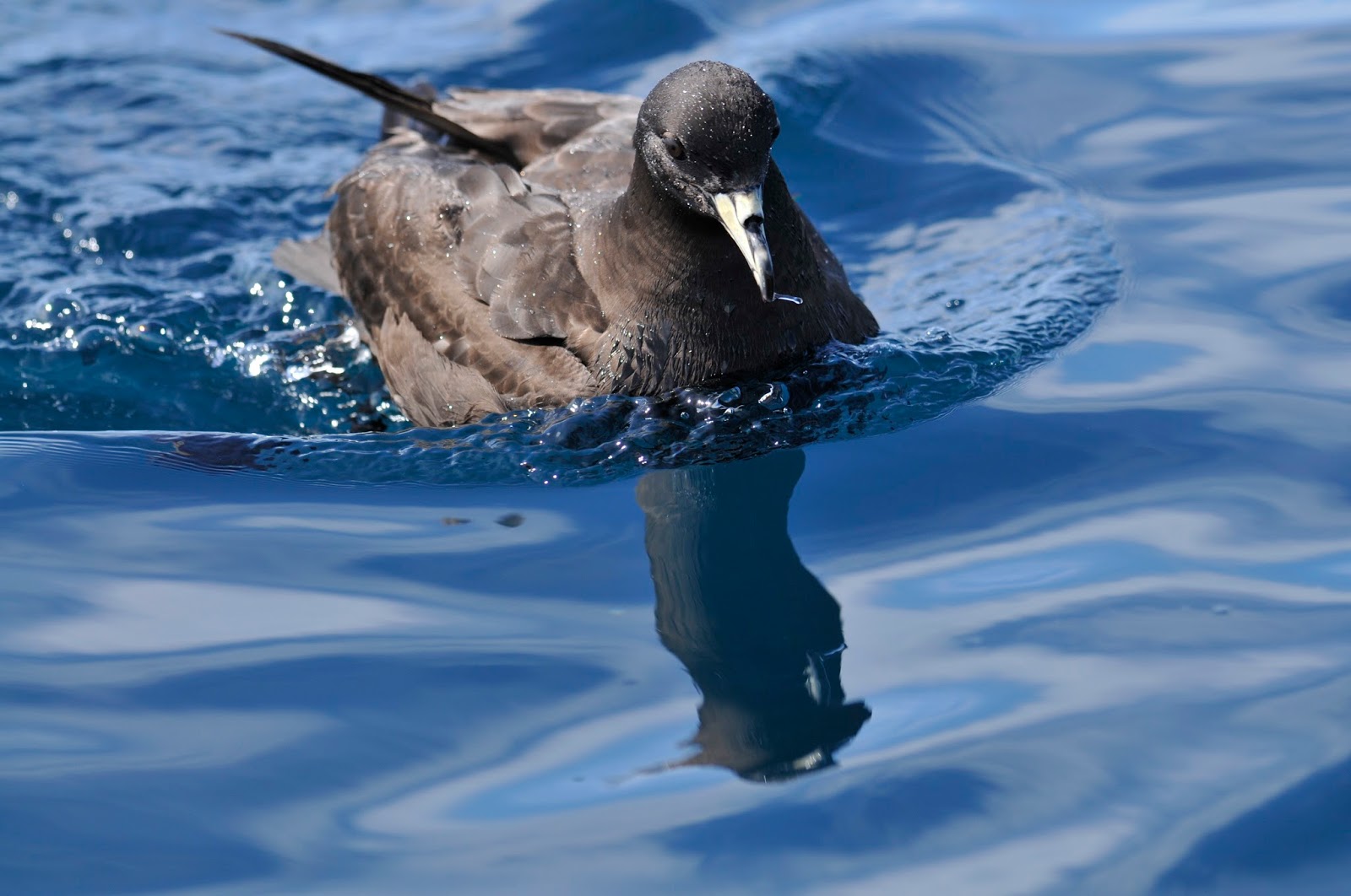
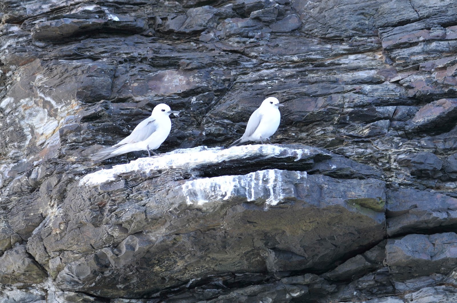
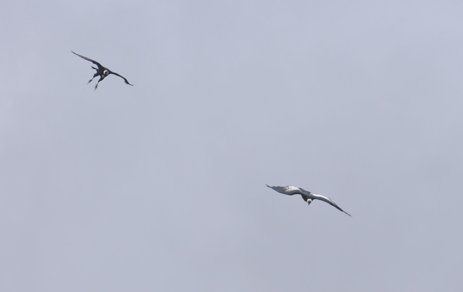
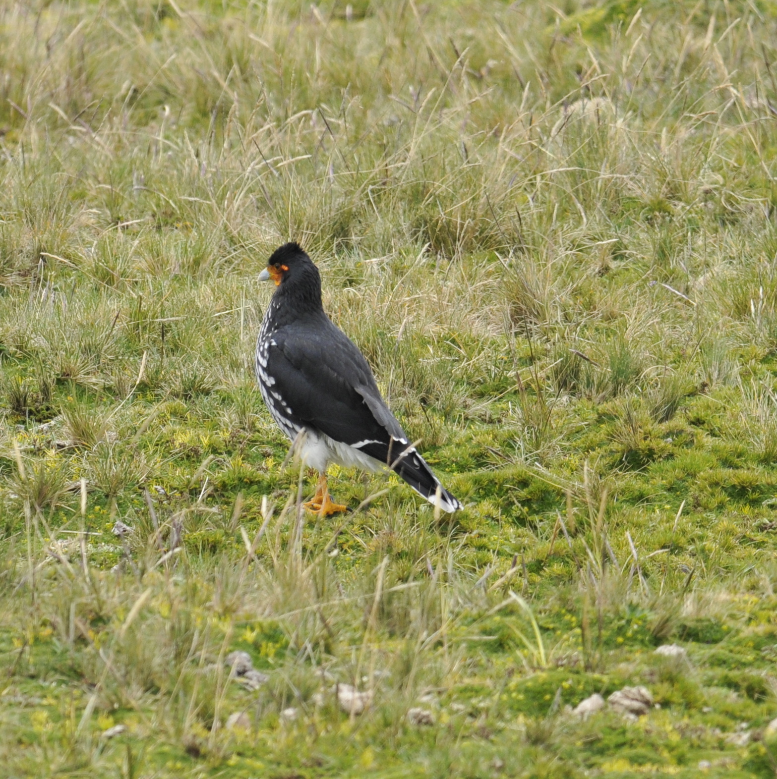
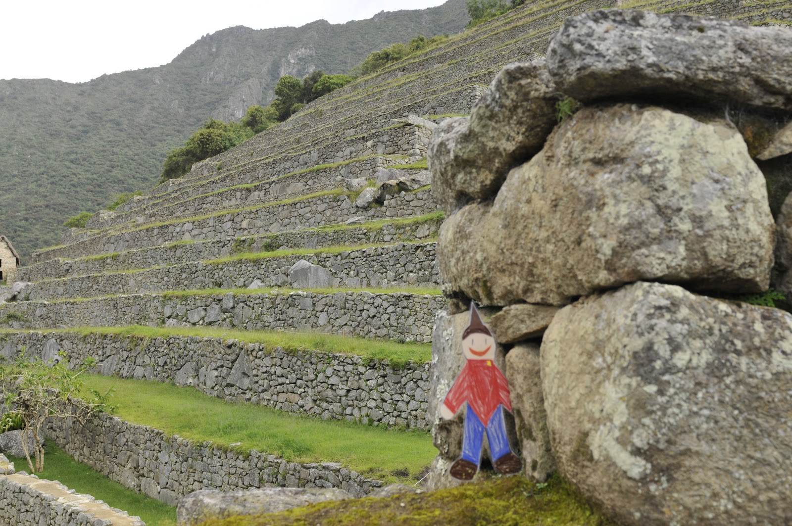
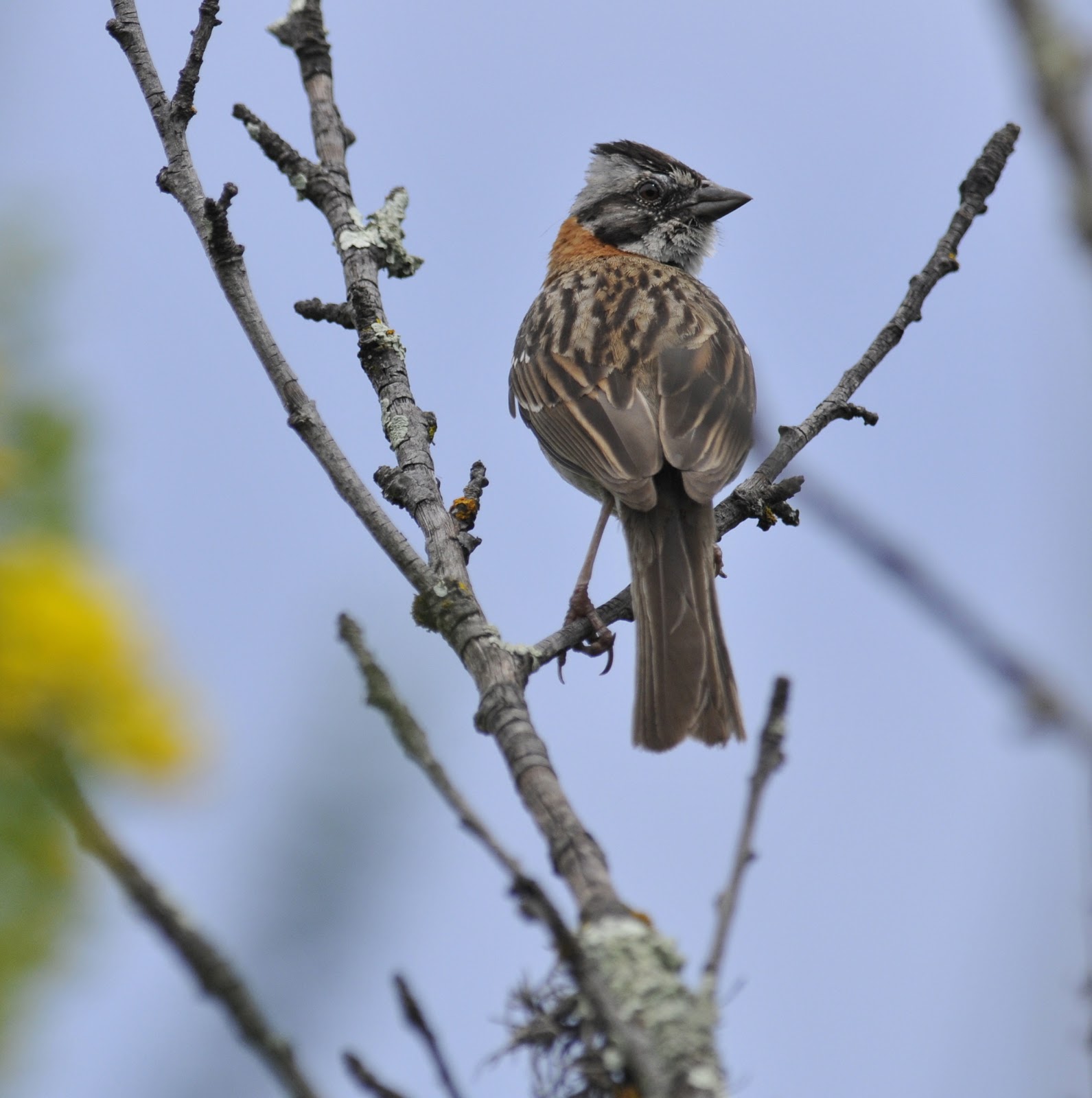
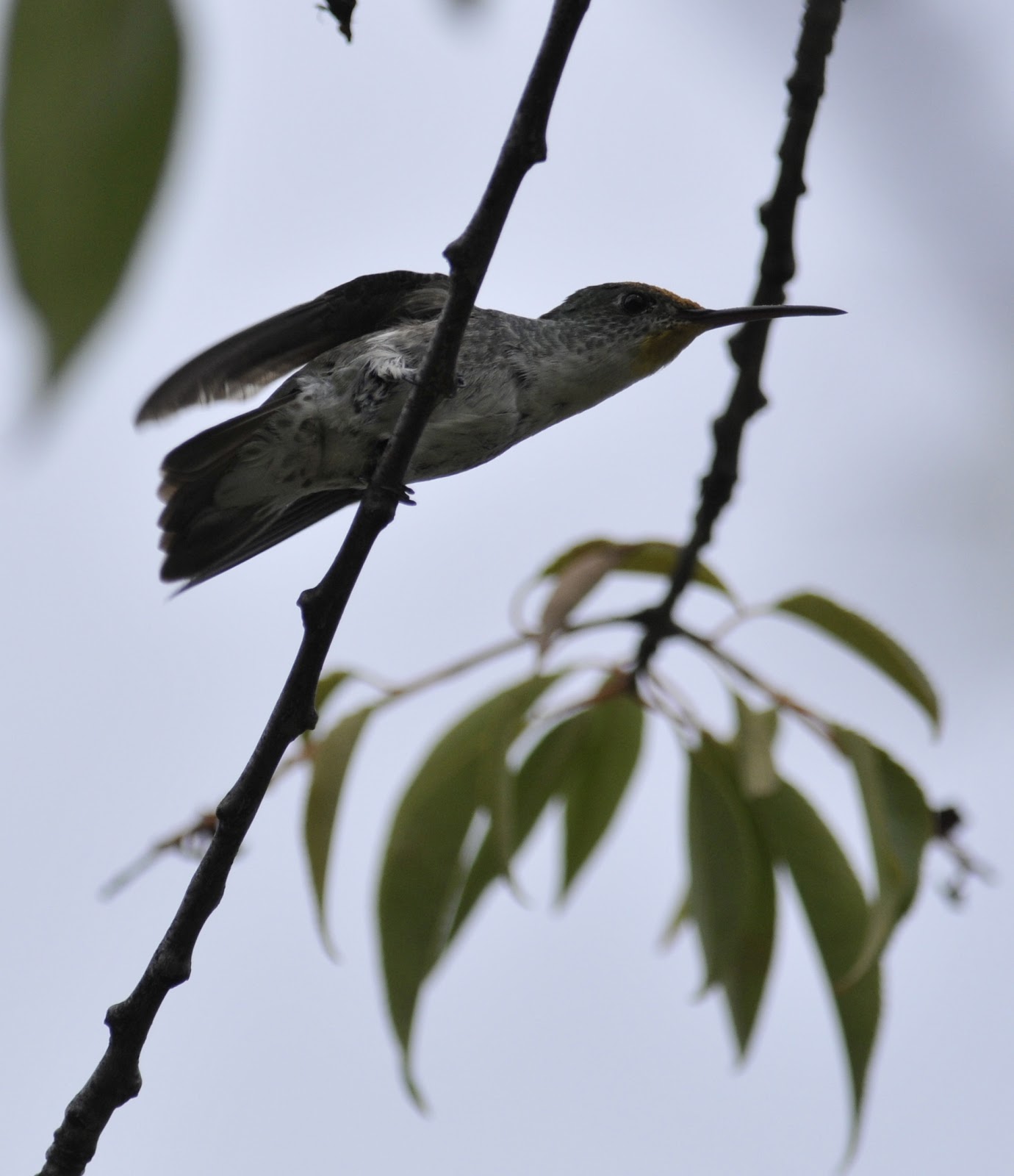
The biodiversity of these mountains is very rich. There are slopes, huge elevation changes, east and west facing aspects (as well as north and south), thin air and thicker air, and micro-climates that afford organisms a diverse array of habitable niches. Thus there are plants and animals of all sorts adapted to rather specific aspects of this convoluted and corrugated landscape. The overall climate at Machu Picchu is quite mild. Only 13 degrees off the equator it is well below the snow line and agriculture involved a great deal of the Incan life here. The agriculture was carried out on terraces held in place by retaining walls. The rocks were cleaved from the quarry sites on the mountain top.  As you look at the pictures think about not how lovely it is but how difficult is was to make. Each stone was hand cut and shaped and then placed and finally polished. Celestial bearings were studied and eventually understood and finally carved in stone. Each aspect is remarkable and in totality it is nearly unbelievable.

Mini Documentary: Andes Geology

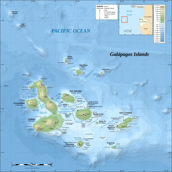
This is a picture (above) from the web that shows the subduction (diving) of the Nazca Plate under the South American Plate (a floating continental land mass). The edge of South America as we know it is a long range created by the Nazca and  and Antarctic Plates as they scrape under and lift and bulldoze debris. The region is not just cold stone mountains but is part of the Pacific Ring of Fire and is studded with volcanoes. These volcanoes and fault collisions continue north along our Pacific coast and around the Alaskan archipelago (the Aleutian Islands) and then southward down the western side of the Pacific Ocean; passing Kamchatka, Japan, Southeast Asia, and terminating just north of western Australia. In the area where Peru, Bolivia, and Chile meet the land mass is moving about 2 inches a year.

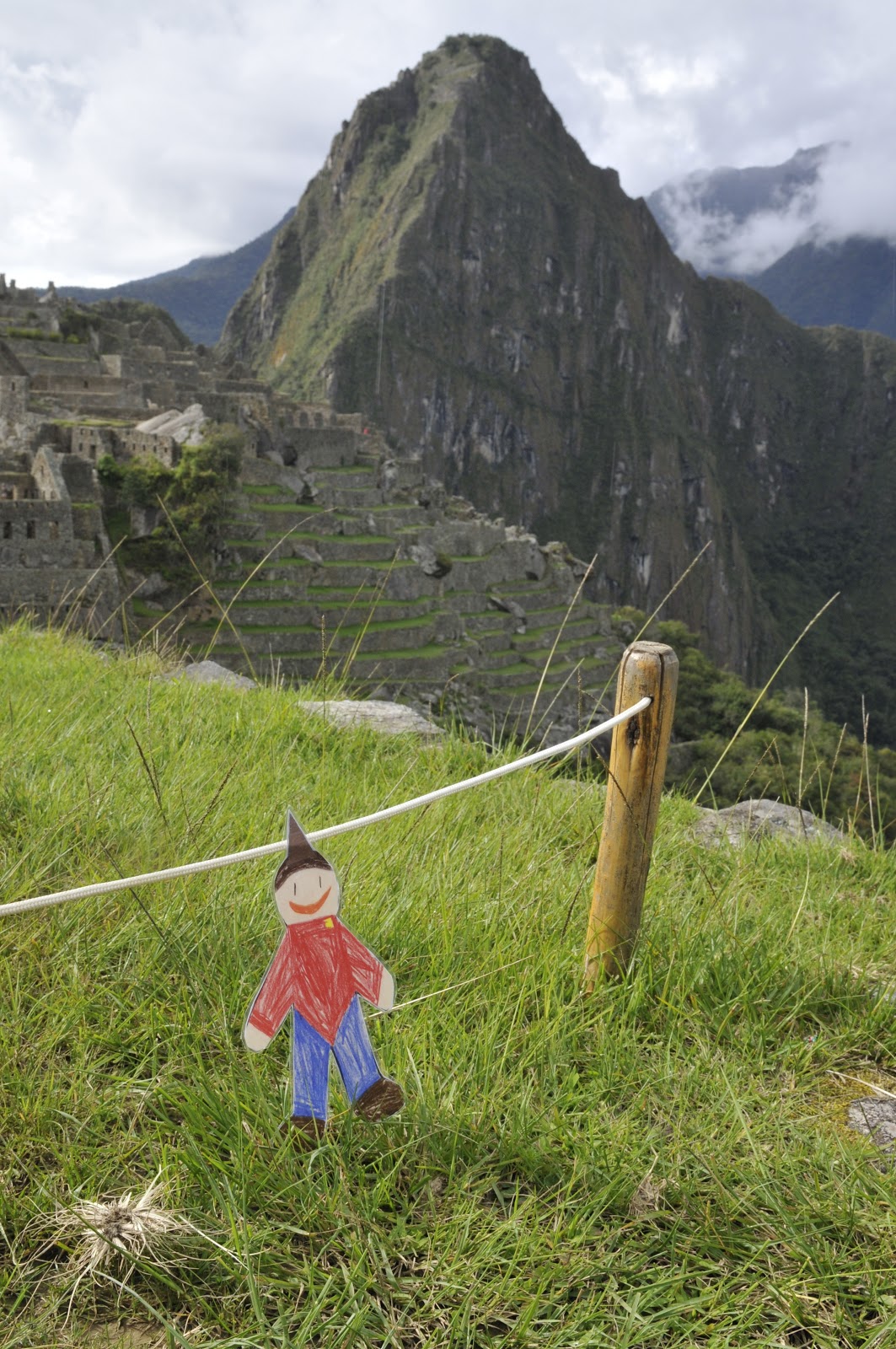
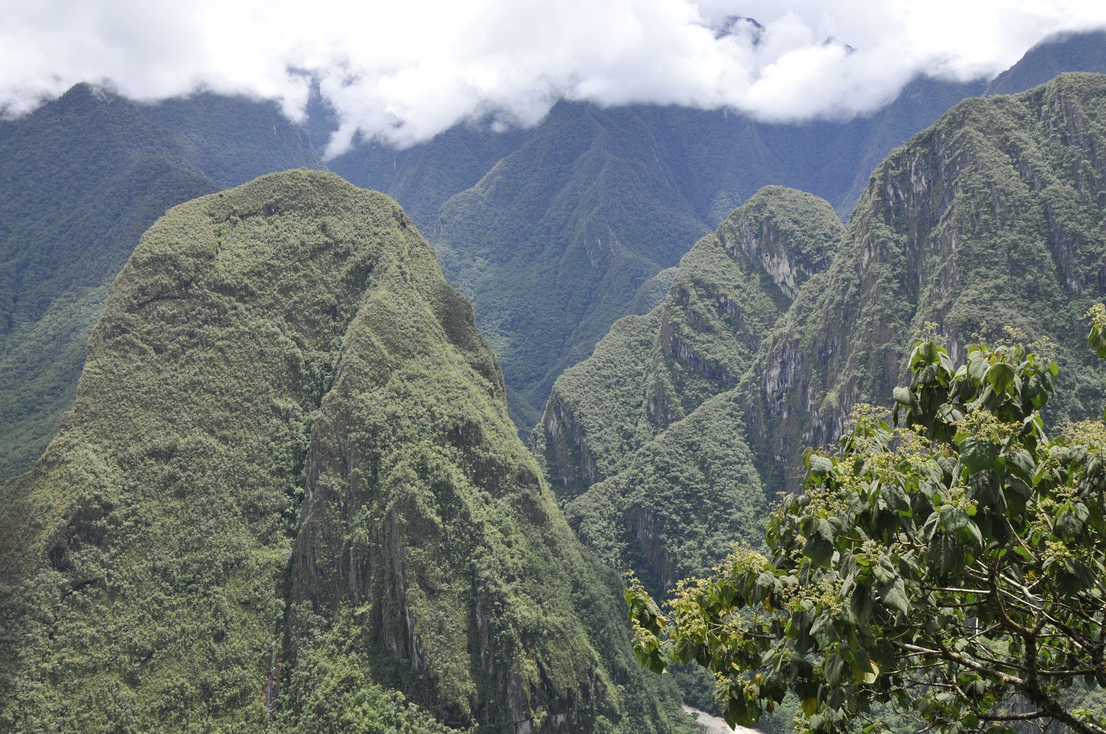
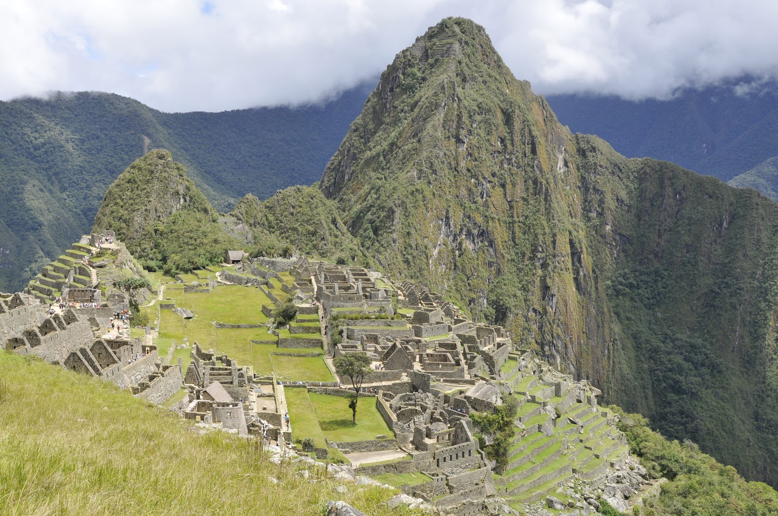
Though the elevation in the area of Machu Picchu is around 8000′ and people lived here for generations, it is not really level. The entrance at the Sun Gate is a hearty climb from the public gates onto the site which are at the level of many of the terraces. The nearby peak, called Huayna Picchu, is another 1000′ or so above Machu Picchu. That is 1000′ of vertical, loose, damp, mountainside. Huayna Picchu is shown in the image below. Notice that there are terraces very near the top of Huayna Picchu.

From the elevation leading to the Sun Gate, where this picture was taken, much of the landscape of the ruins can be seen. There are work shops, residences, religious sites, agricultural terraces, courtyards, and storage areas. Though the buildings, at least the walls, are in rather good condition or have been restored, there are no writings and no Rosetta Stone to allow a real understanding of why the Inca were here and what the city meant to them. Megalithic societies provide quite a conundrum for the archeologists and historians. So much of what they did is obvious and solid but much more of what they were doing is simply guesswork and deduction. 
I often wonder if our culture were to disappear and in 1000 years the ruins of Fenway Park and Yankee Stadium were discovered under a layer of oaks and pines would the 22nd century discoverers assume they were sites of religious activities and perhaps even sacrifice? Perhaps that is the wrong analogy because those two sites may well be sites of religious fervor and sacrifice. Damn Bucky Dent and thank god for the four game sweep – but I digress.
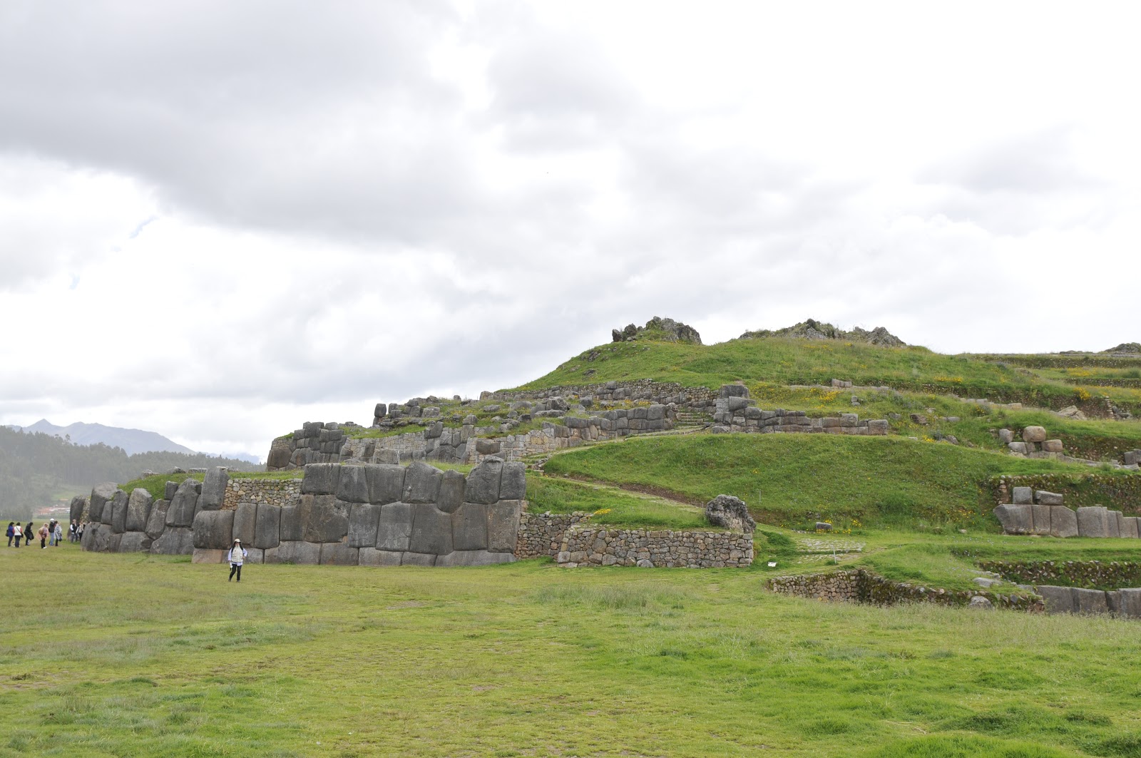
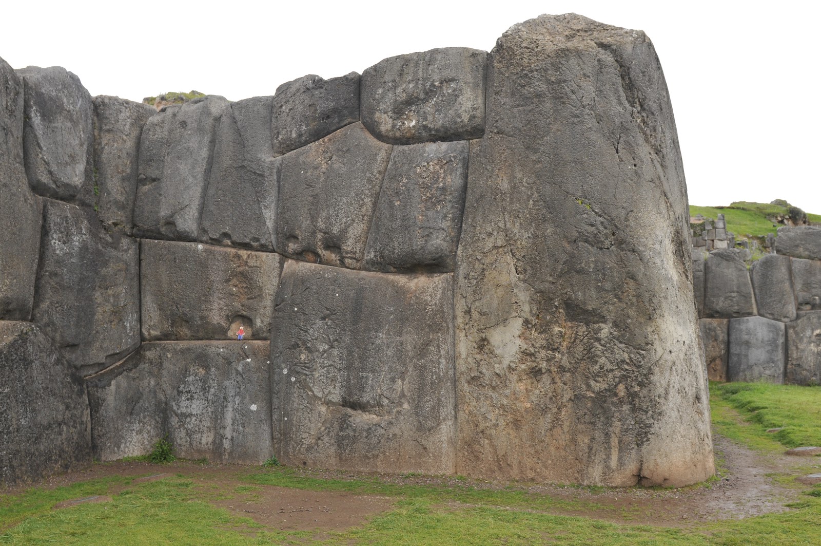
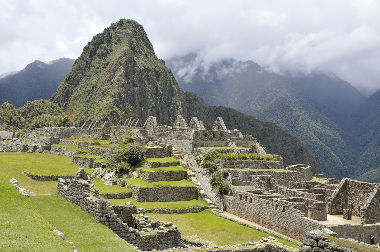
From various angles the complexity of the site opens up. The terraces, plazas, stairways (109 stairways with 3,000 steps), and walls remain in stark display of what was a thriving and active center. However, most researchers feel that Machu Picchu was created as a planned city in the mid-1400’s and lived in for about 80 years; then abandoned. Again, there are no written records with explanations to back this up but also none to dispute it.  The Spanish wrote nothing about this area at this elevation though there are records which probably deal with the lower land in this valley of the Urubamba River.

Retaining walls held everything in place not just the agricultural terraces. The agricultural terraces are located throughout the complex with varying compass aspects. The microclimates that are produced by the various terraces seem to point to a year-round growing season on this mountain ridge.
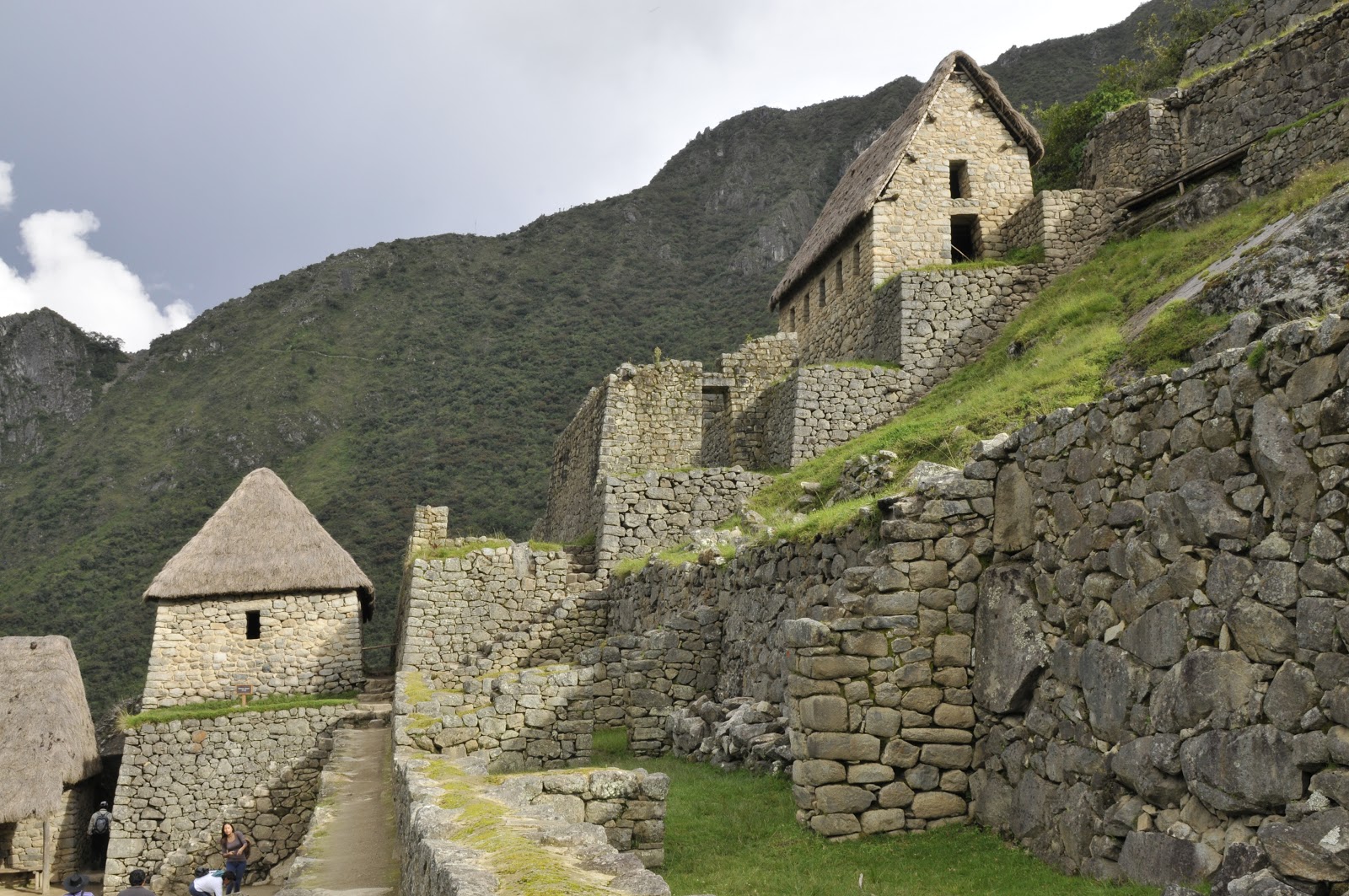
The harvested crops were stored in granaries located along the edge of the garden terraces. There were other storage facilities located throughout the mountains. (See previous blog page.) The need for food was paramount when undertaking a mountain lifestyle. The storage of food was more important than storing gold. It was essential to have food for workers, slaves, and all people who were not agrarian themselves. This was a city with skilled and unskilled workers, religious and political people, as well as families and farmers.

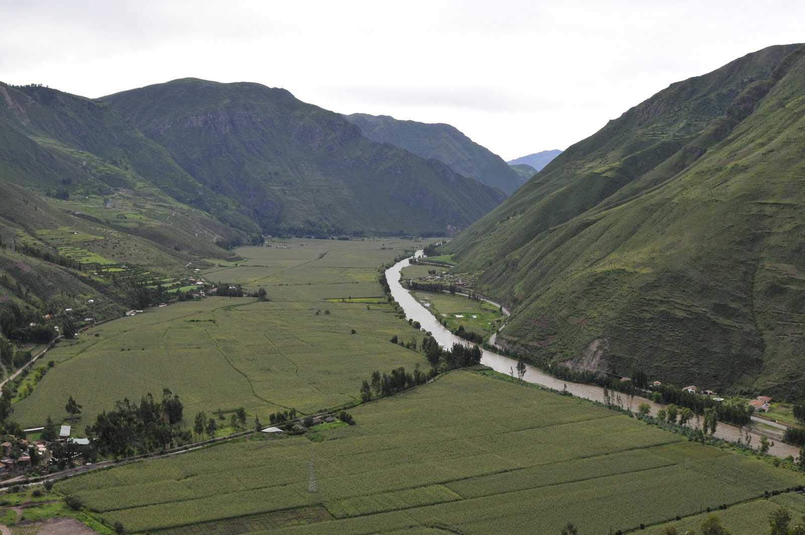
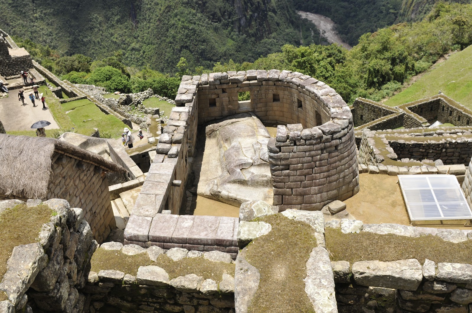
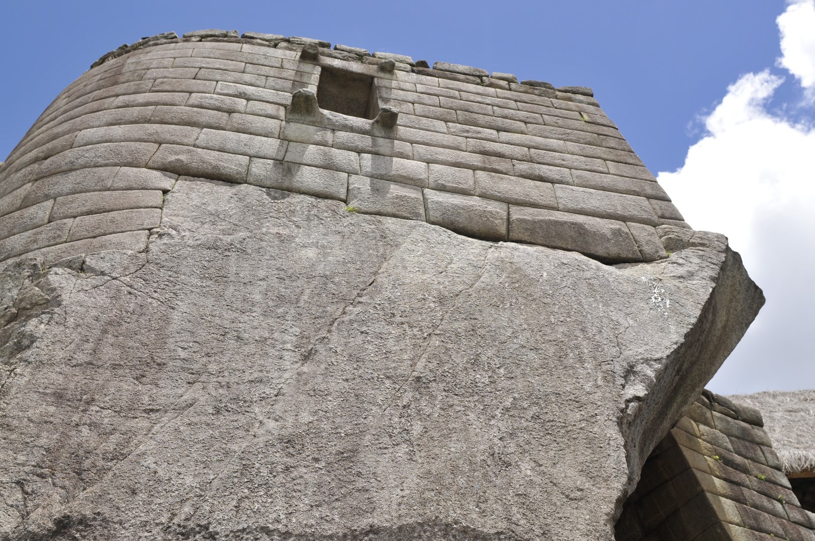
The two images above are of the Sun Temple or Torreon. This city seems to have been rich in celestial and religious significance; though no one knows where one begins and the other ends. The window/door in the upper picture, that looks out over the river valley, lines up the rays of a rising sun on the summer equinox with a carved line in the natural rock rising in the floor of the room. The picture immediately above shows how the Inca used the natural stone where they could and added hand worked stone to create the additional form and space needed. The Urubamba River is down a very precipitous slope of about 1500′ Machu Picchu.
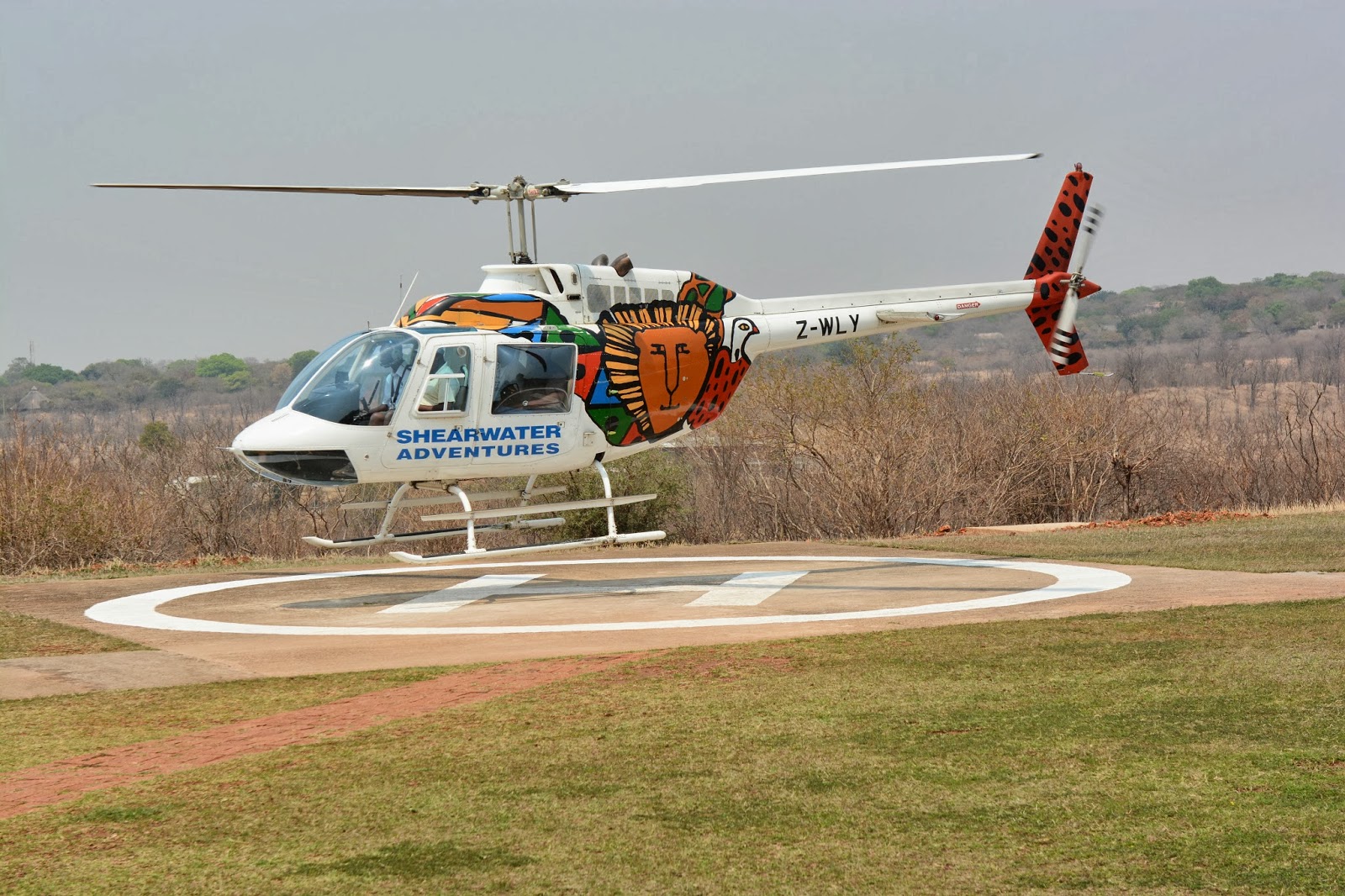
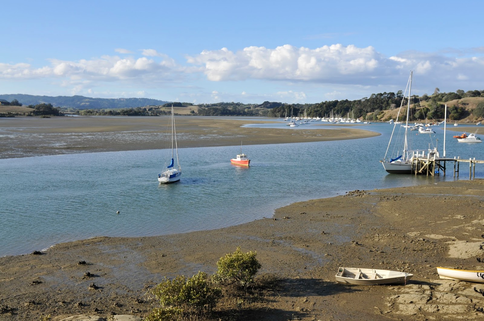
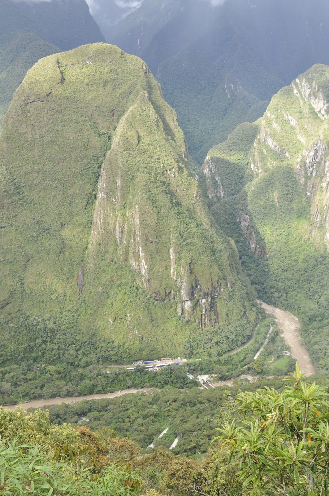
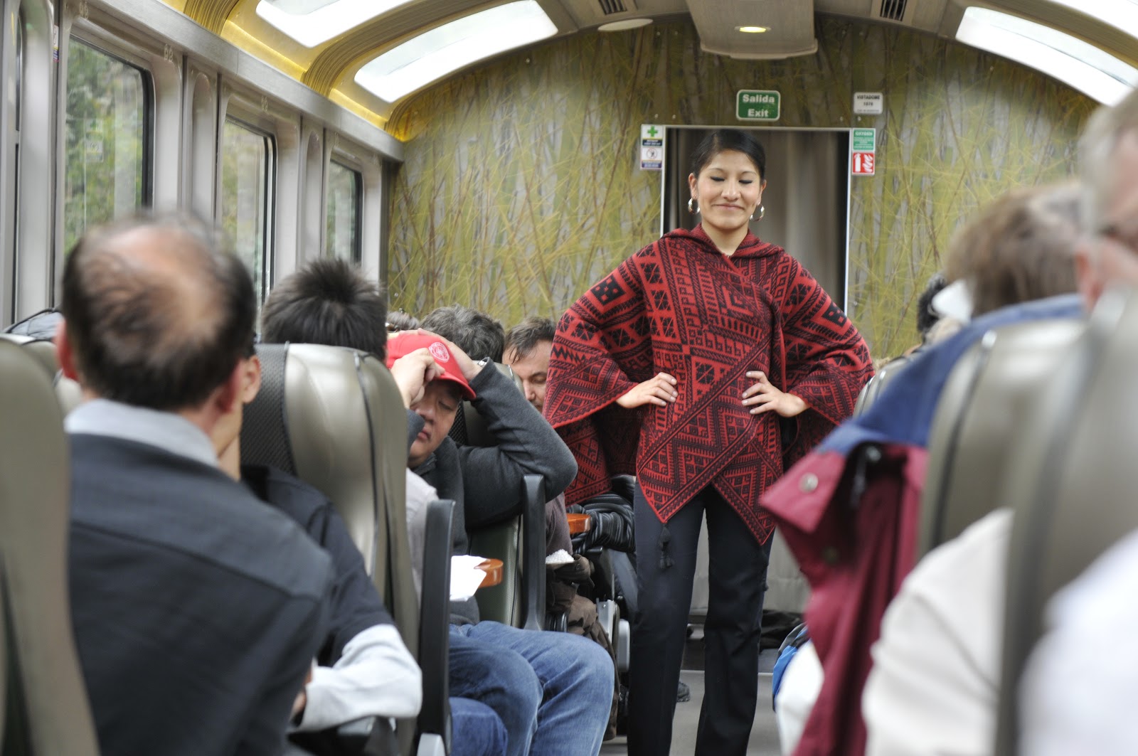
I might mention how one does access this location. The city of Cusco is about 1000 meters (3300′ or so) higher than Machu Picchu and is the starting point for getting to the 70,000 acre Historical Sanctuary. The most direct route is by noisy and intrusive helicopters – don’t use them. The best way is by train from Cusco or from the Sacred Valley at Ollantaytambo. This ride is rich in vistas and provides a nice transition from the city to the remote mountain vastness. Once in the town of Aguas Calientes and established in your lodging you proceed to the main corner in town and hop a bus up a switch-back filled road (at least 16 hairpin turns) which deposits you at the main entrance to the sanctuary. You can do the trip in one day from Cusco but for better vistas, mountain birding, and a chance to drink in the area’s majesty and overnight stay is the better option. The staff aboard the train will provide snacks and drinks and then a fashion show with a chance to purchase local garments made from llama, vicuna, and alpaca yarn. 
The next page will add to the Inca story with more images from Machu Picchu and other sites near Cusco.