The Zambezi River, in the area of Victoria Falls, separates Zimbabwe and Zambia. The river also flows through Namibia, Mozambique, Angola and Botswana. It is the fourth longest river on the African continent behind the Nile, Congo, and Niger. At present the Victoria Falls area is a significant tourist destination. The demands of maintaining a modern infrastructure does not always keep up with the rush of economic opportunities. Trash, sewage, road maintenance, clean drinking water, protected vistas, and forest management (trees are cut for wooden curios) are all areas of significant long term concern.
But, it is a great scene, in a wonderful spot, still adorned with birds and wildlife – and the largest sheet of falling water in the world.
The geologic history explains everything; as it often does. In this case a great expanse of southern Africa was covered with basaltic lava that oozed from the earth and formed a sheet or layer over the land. It was not a downward lava flow as from a volcano and, thus, the result was a flat terrain. As the lava cooled there were many east-west cooling cracks that formed. This was about 200,000,000 years ago. In the following 100,000,000 years there was some uplifting and settling that took place. These movements created north-south cracks that often went from one east-west crack to another. Picture a shallow, muddy pond drying out and you have the general sense of what was happening.
All of this later activity happened as (and after) the cracks were filling with sands from the Kalahari and limestone-like materials from flooding. Over the next one hundred million years the basalt was covered by materials from erosion and deposition. These fissures and the materials in the cracks set the scene for the formation of the many (yes many) Victoria Falls’ that have now occurred. It is sort of like a row of dominos or pieces of bread in a loaf that get covered with sand and dust. If you were to run water over the dominoes (or water-resistant bread) the sand would erode away leaving a scattered series of dominoes behind. Ta-dah – that is what has happened here.
The Batoka Gorge was first started about fifty miles downstream from the current Victoria Falls. The Zambezi River has an interesting history on its own but we will just look at its modern route and actions. The river flowed over this old basaltic plate and eventually found a weakness in the east-west cracks and began to erode away the sands and limestones that had settled into the fissures. Soon the water was pouring over the lip of basalt into the eroded crack – the first waterfall. Eventually the water found a north-south weakness and worked at that for a while until the river stopped spreading and flowing over the edge but drained into the cleft and flowed hard until the upstream water starts to erode along another east-west crack and a new lip to the falls developed. In geologic terms this is happening very quickly. The erosion rate of the falls is about seven centimeters a year (three inches). One hundred years will average a northward creep of about twenty-five feet. A thousands years; two hundred and fifty feet and so on.
The modern falls is the eighth location and is about five miles up from the first lip. There are three gorges just below the current falls. The captions of the images below will summarize and depict some of the recent geologic history.
 |
| The land surrounding that falls is quite flat. There are no volcanic mountains in the area. The great lava shield that forms the overall contour was oozed from cracks in the earth not from volcanic eruptions giving the area a rather level feel. |
 |
| The levelness of the area allows the river to flow around obstructions and to seek the easiest way across the countryside. In a softer setting the river would meander and form oxbows. Here it meets obstructions and rather gently flows around them widening and narrowing as required. |
 |
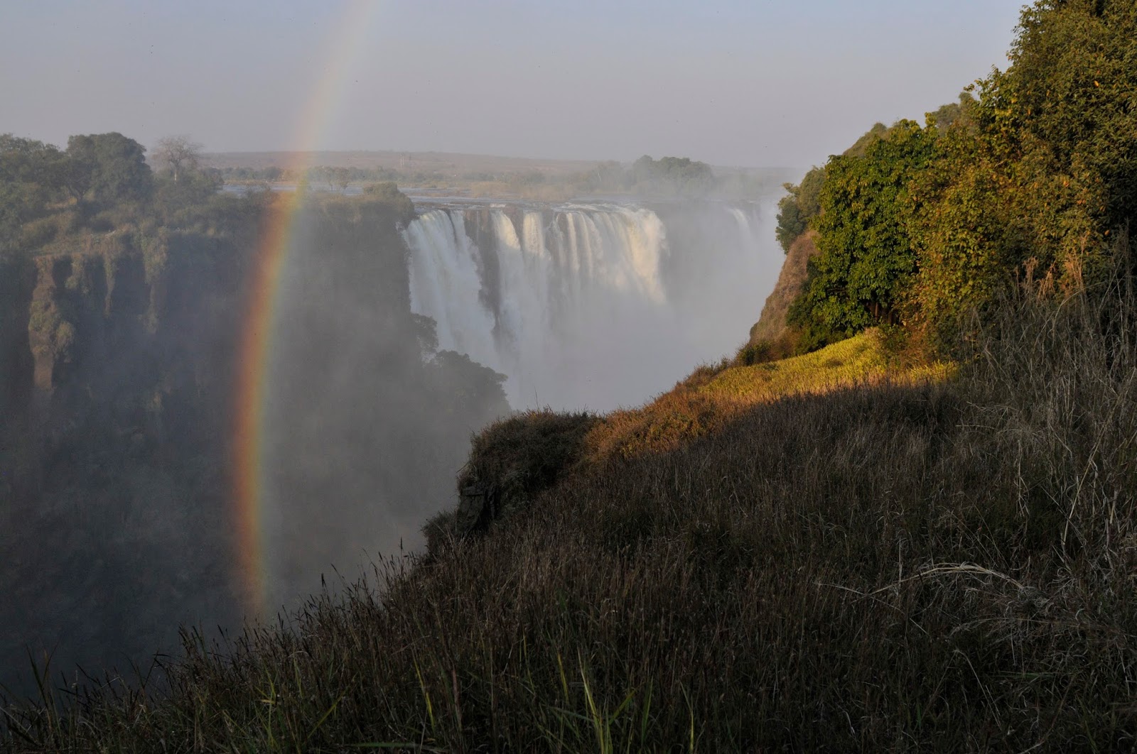
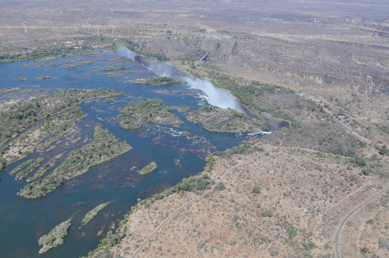
| The river splays out to about a mile in width just above the falls. The lip at the current falls is a few hundred feet wider than one mile. Water flow at the falls is quite variable and the entire edge is rarely flowing with water at the same time. There is a rainy season upriver from November through March. This water reaches the falls from February through May, with the greatest volume of water in April. The variation is significant with the October-November flow being about 10% of the April flow. |
 |
| There are always rain-bows and on a full moon night there will be moon-bows as well. It is possible to walk to or view the falls from both Zimbabwe and Zambia. The bridge over the river, between the last gorge and the falls, can be walked in a few minutes. Walking is the best and easiest way to get from side to side. It requires no paperwork at the borders (except a visa stamp for a few dollars) whereas taking an auto over can beget a tedious process.
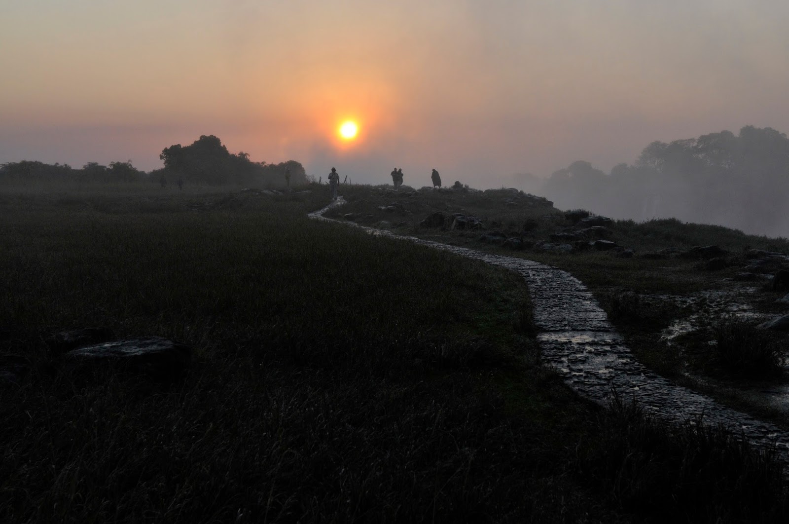
There are paved trails on the Zimbabwe side that take you through a rain forest and along the front edge of the falls. It rains here every day all day. The force of the falls creates a wet cloud that often rises a thousand feet above ground. This moisture consists of large droplets and the mist is perpetual. Cover your cameras! There is a pathway from the Victorias Falls Hotel that allows for a walk through a mopane woodland to the rain forest parking lot. Check out the woodland as the dry habitat is really the dominant feature of the landscape. |
 |
| The mist at the top of the falls creates a rather moist Scottish landscape. |
 |
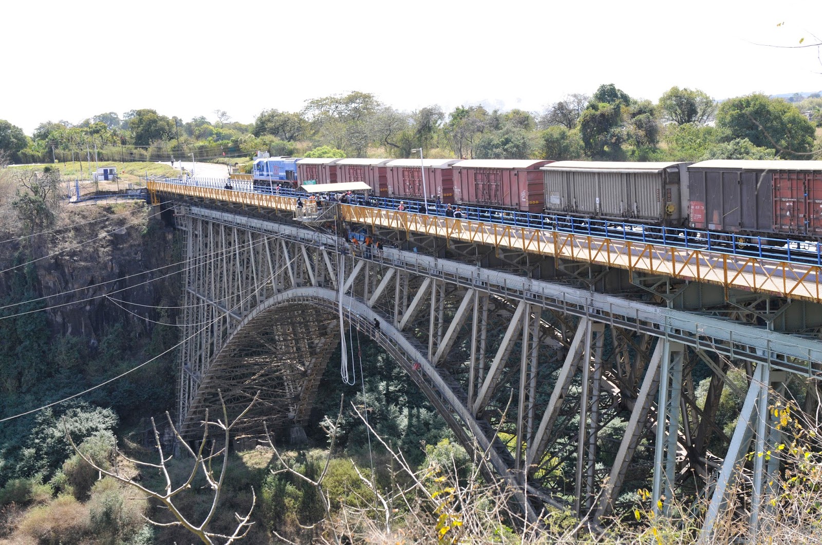
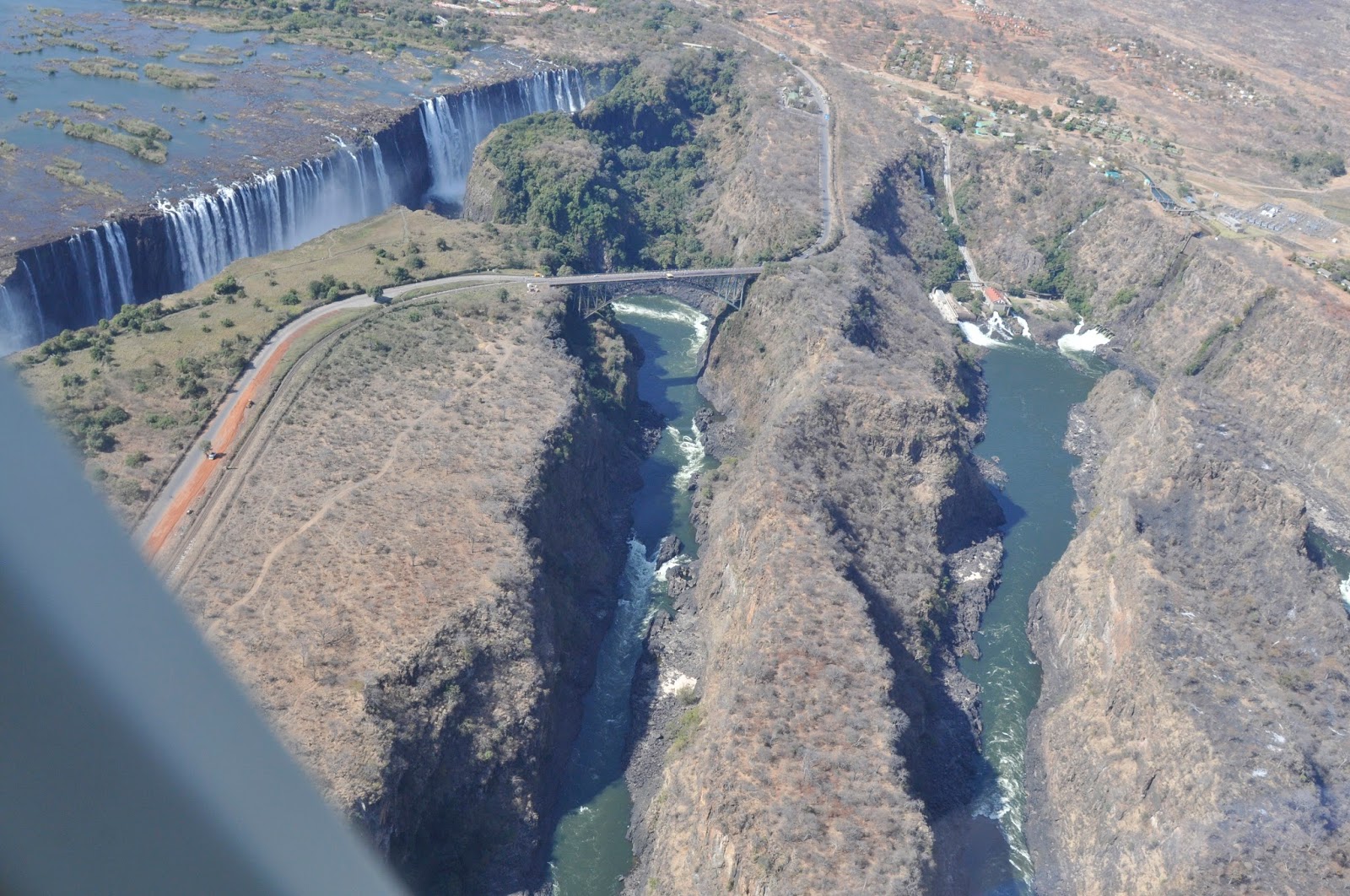
| The bridge across the river is over 100 years old. It was the brainchild of Cecil Rhodes the man behind the colonial (British) development of what was called Southern Rhodesia. The use of Rhodesia replaced “South Zambezia” in 1895 and the modifier “Southern” was added in 1901. It was in 1980 that Zimbabwe became the official name. British colonial rule terminated in 1965. The name Zimbabwe Rhodesia was used for a short period after the British influence ceased. The bridge was built close to the falls as Rhodes wanted the cars to be wet with spray. It was finished after his death.
The bridge is currently an adrenaline-hotspot. There are bungy jumps, zip lines, giant swings, and white water opportunities here. |
 |
| The first European to reach this area was David Livingstone a Scottish missionary sent to the region by the London Missionary Society. He intended to set up a mission but the prevalence of malaria forced him to drop that idea. Instead he hoped to use the Zambezi River as a passageway to open up south central Africa. He explored the river, became (probably) the first European to see (and hear) the falls, and named it for Queen Victoria in November of 1855. Though we, with our European heritage, write of Livingstone as the founder of the falls it is certain that the area was inhabited for about 15,000 before Livingstone arrived and the name used by the local people may not be Tonga in origin, but Arabic. So much is lost in the mists of the great falls. |
 |
The falls can be viewed from a myriad of angles. The pathways offer moist close-up looks at the torrent. The rain forest has bushbuck and turacos and many moisture-dependent plants. Be sure to walk the main trails.
However, it is really nice to see the spectacle from the air. The bridge provides a look into the next gorge but a helicopter ride is worth the money. In many locations tourist flights are unnecessary and do little to enhance an outing – but in this case it is pretty cool and very informative
The following images take you down the west side of the river, across the front face of the falls and over to the western edge. From the helicopter I saw quite a few elephants and a crocodile farm as well as the river, bridge, and falls. |
 |
| The broad river flows gently toward the edge. The cloud-like appearance is from the moisture sent up from the falling water. |
 |
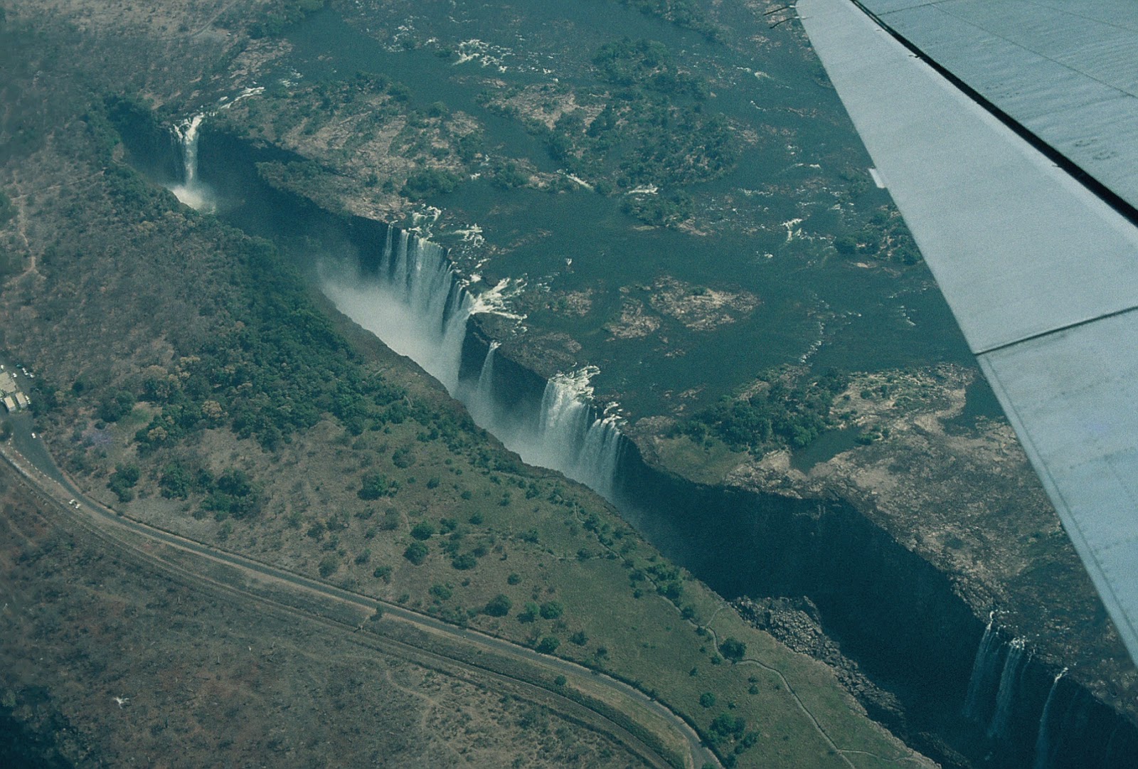
| As you swing across the face of the falls the flow become apparent. The width of the lip exceeds a mile; all water in full flow, though rather patchy when water is low. At the very lower left of the photograph there is a separate flow that is referred to as the Devil’s Cataract. This area is now cut several feet deeper into the face than the rest of the falls. It is likely to be the spot where the river starts to unify and cut back to the north. Eventually this will be a powerful rock-eroding flow that will take all the water and give off all the energy from the river. The flow northward will continue until an east-west fissure is found and then the erosion will begin to form the lip of another falls.
I can remember that as a kid I would allow the water in the tub to run while I held a bar of soap at the bottom of the stream. Slowly a hole would be worn into the soap. That’s what this is on a grander scale. Water is the (or has the) power as the Taoists say. |
 |
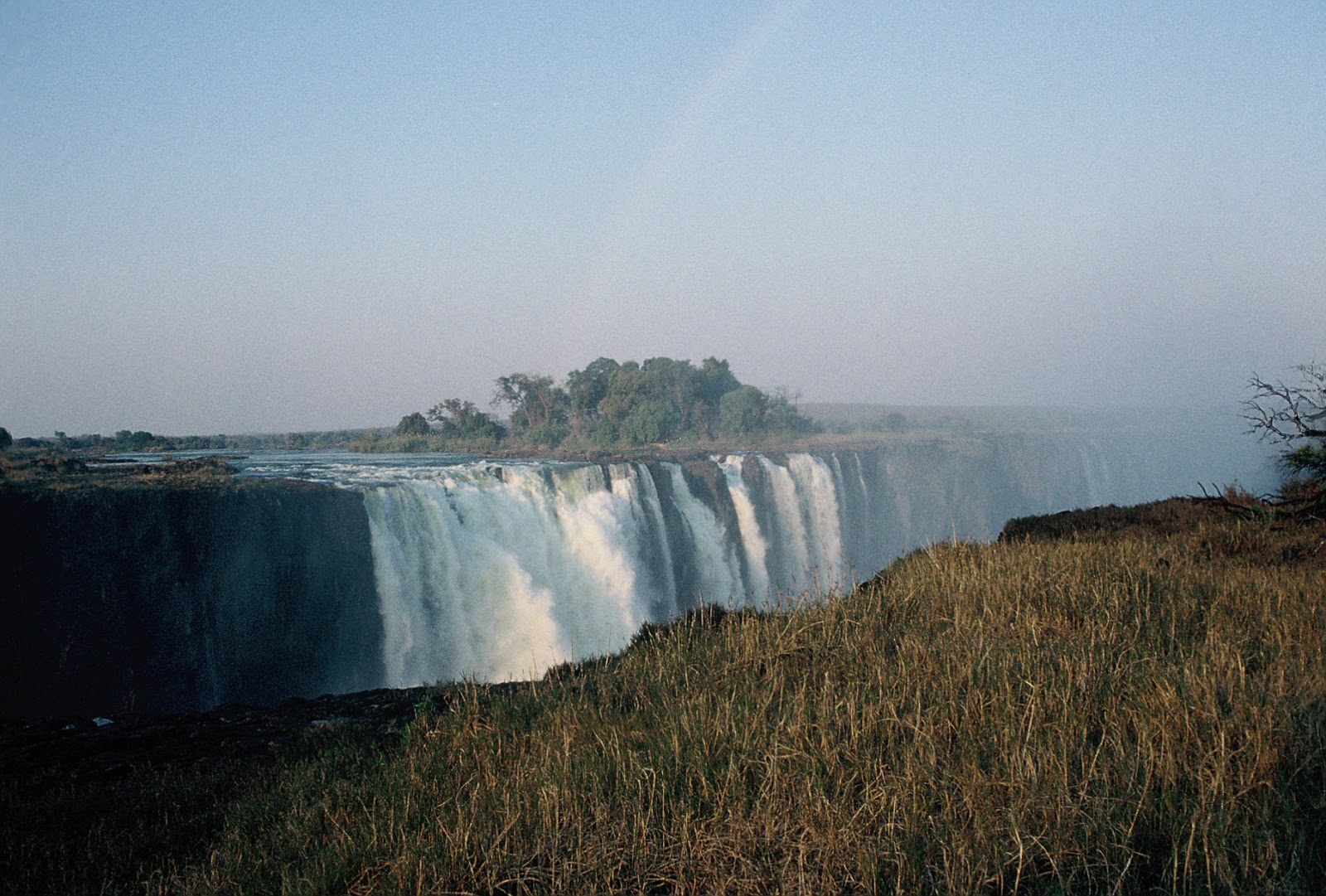
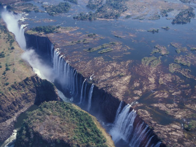
| This is a similar view showing the extent of the lip – and the modest extent of the flow in mid-August. |
 |
| The next three images are from the down-river face of the falls. In these the previous edges of the waterfall are evident. These gorges were once the terminus of the river’s easy flow and the water cascaded over the edge into the river below. The current falls is starting to retreat at the Devil’s Cataract. |
 |
| Though the area seems quite undeveloped from the air there is a beehive of activity on the ground. You can see the access road into the bend in the river at the start of the Third Gorge in the right upper part of this image. Hiking, bridge-walking, safaris, birding, and other opportunities abound. Both Zambia and Zimbabwe have natural history opportunities. There are national parks where safari tours can be taken, bird guides for birding, and plenty of opportunities for accumulating trinkets.
Hotels and lodges are here in many price ranges. None are directly on the river in sight of the falls. |