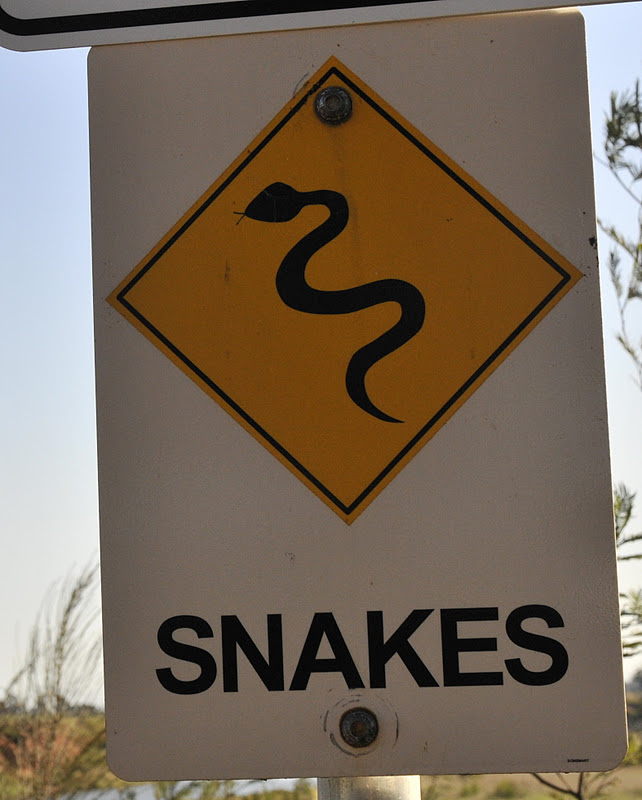
We have long been home from our trip to Australia but I had one of the “fevers” that seem to be a feature of the island continent, at least there are lots of scary illnesses to read about. My illness was characterized by a modest fever, an encephalitis (a symptom, not a disease), and a prolonged desire to just stay in bed. As with all viruses sooner or later you die or get better and fortunately it was the latter for me.
So I will now start on the blog pages that, I hope, will give a sense of this gorgeous place. Over several blog pages I will show where we went (and what we saw) as we traveled. We landed in Melbourne after a lifetime on an aircraft (but not as bad as the return trip) and took the SkyBus from the airport into the city. We were headed for a town on the southern edge of the city (Port Melbourne) and decided to get our one look at big buildings as we headed in from the airport. From the CBD (central business district, a phrase used in most towns) we caught a taxi to our home for the next three nights and made arrangements with the driver to return to deliver us back to the airport for our flight to Tasmania. But in the meantime we had the Melbourne area to look over.
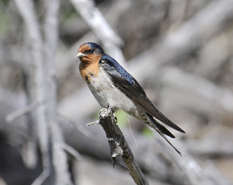
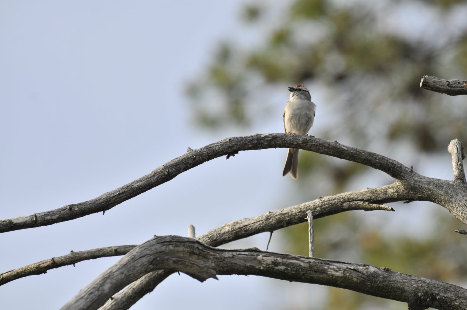
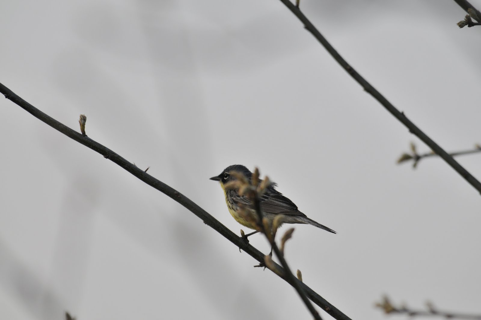
As our hosts had left us a key we entered the beachside house, found our room, left our gear, washed our faces, grabbed our binoculars and went for a walk. We walked along the beach and then cut up a walking path (paved and signed) along some ponds and shrubby growth. We had twenty or so species of birds, no mammals, and a chance to get some fresh air. Our host returned from work at about 2:00pm and we headed out for an afternoon of local birding. Australia is developed in a nice way; there are residential blocks, cities, and a lot of parkland and countryside. We went into the countryside and had a great time, got the lay of the land, and forty-seven species of Australian birds.
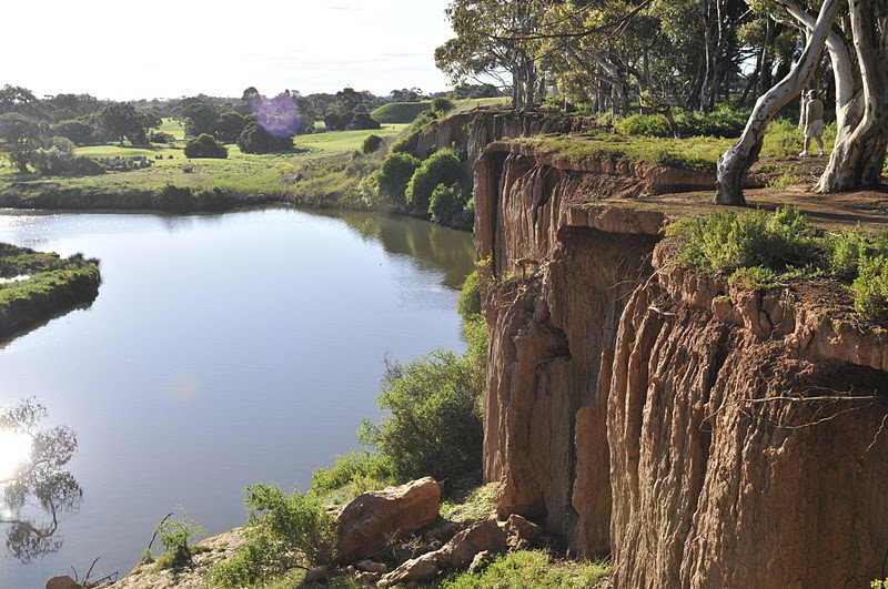
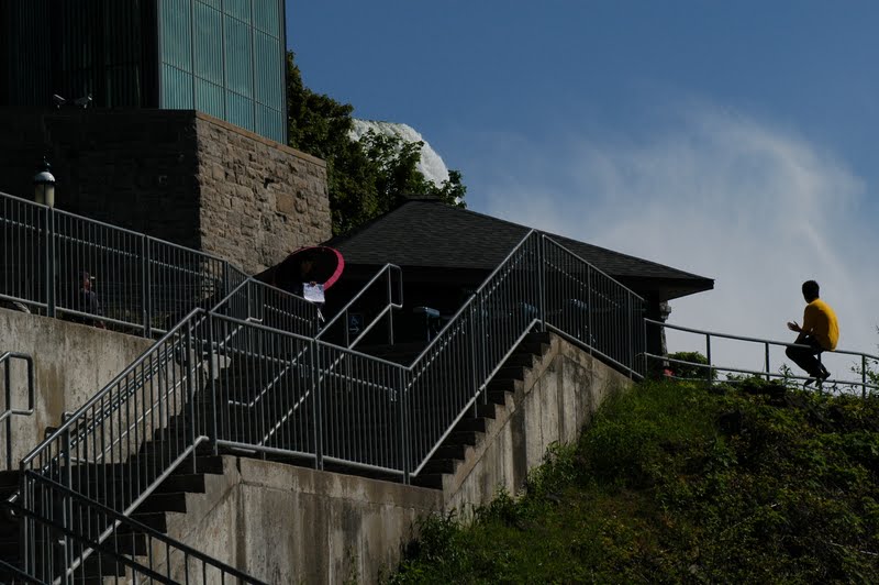
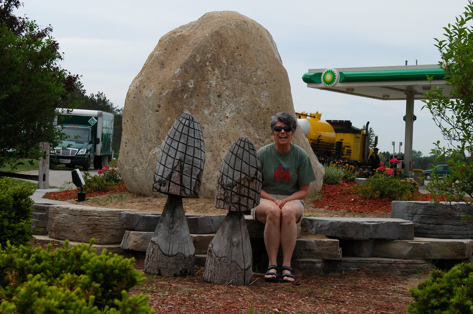
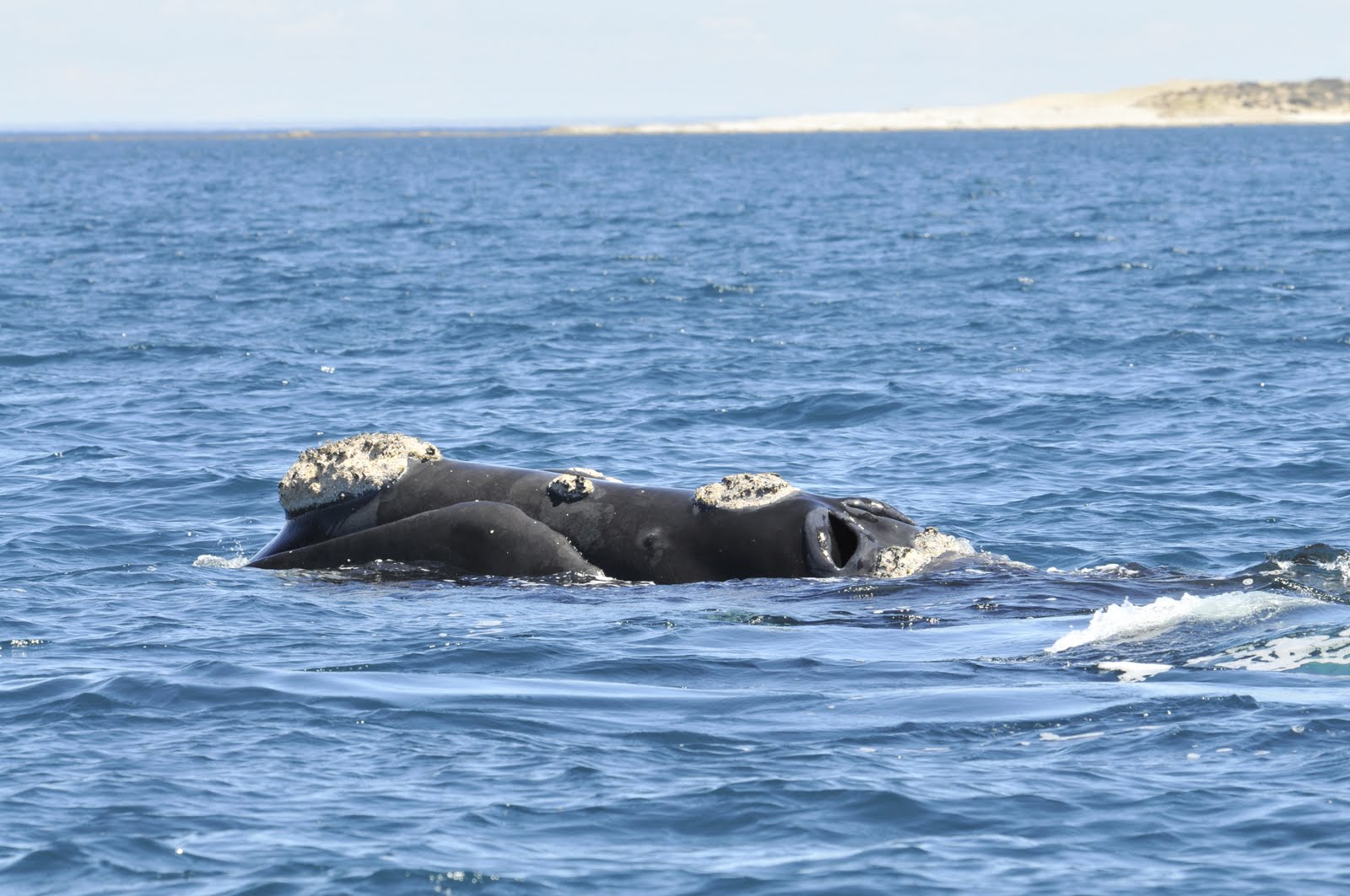
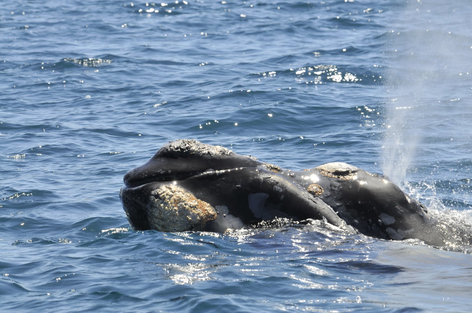
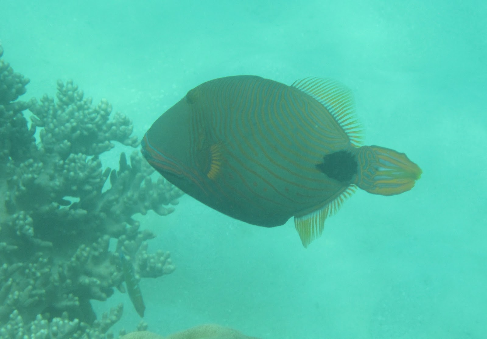
We used our heads and did not join our hosts for an evening out and as a matter of fact did the same the next night. We were very tired and out of sync with the moon, stars, and daylight. So we went to bed early and spent the whole of the next day out birding. We started with a few local stops and then went to the You Yangs and from there to the Werribee Treatment Plant. Though there is a great deal to say and write about I will try to insert images from here on and use the captions as dumping grounds for ideas and memories.
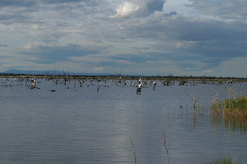
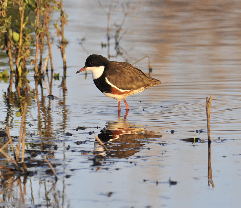
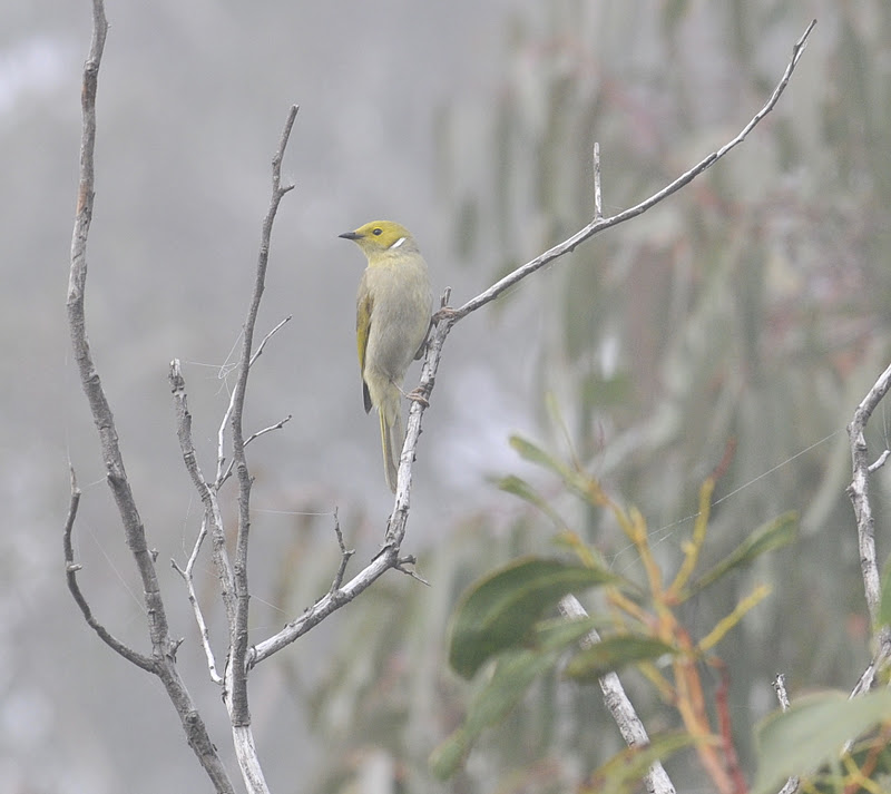
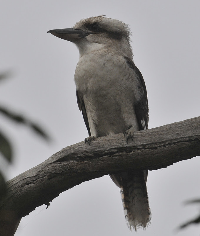
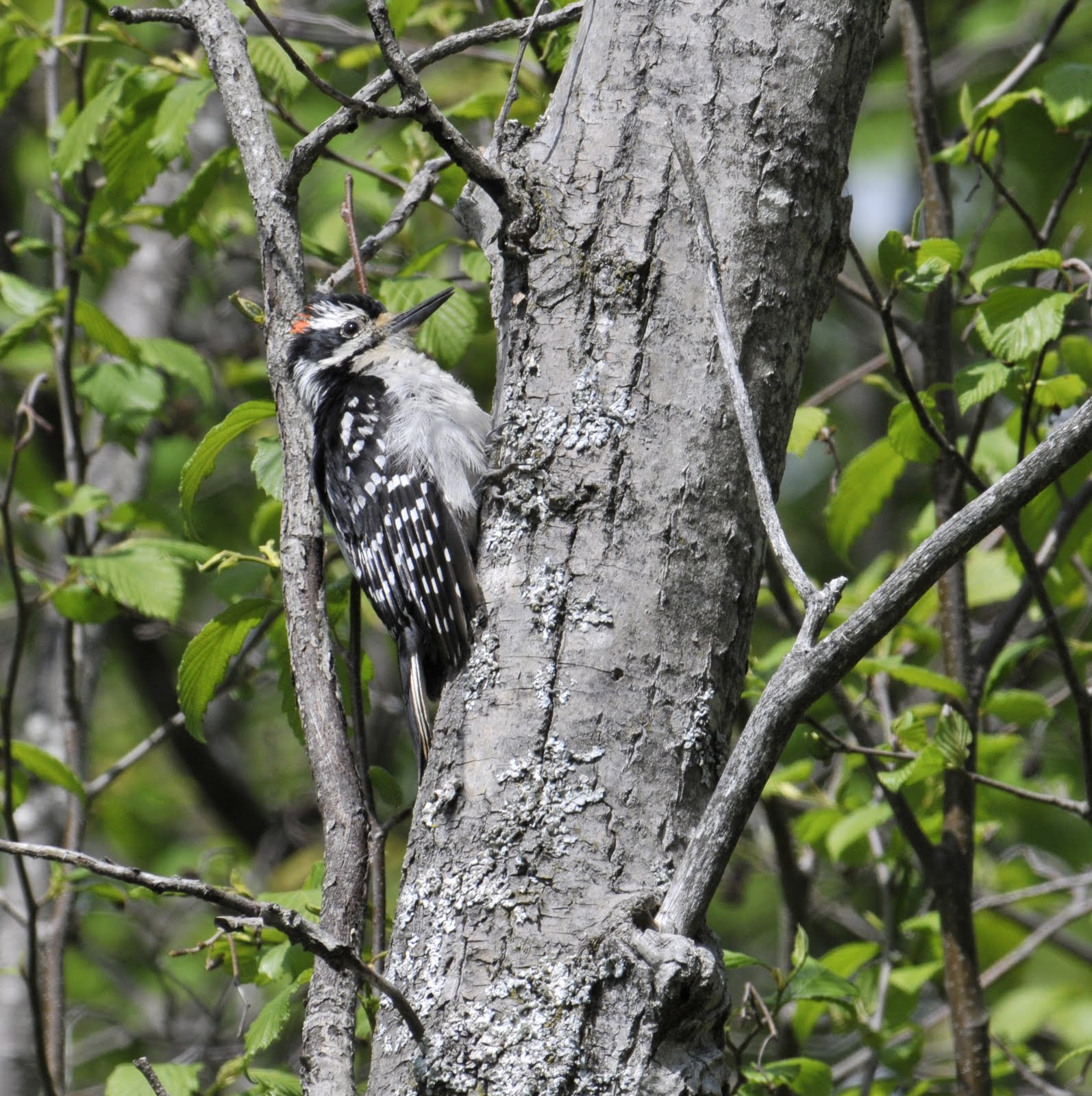
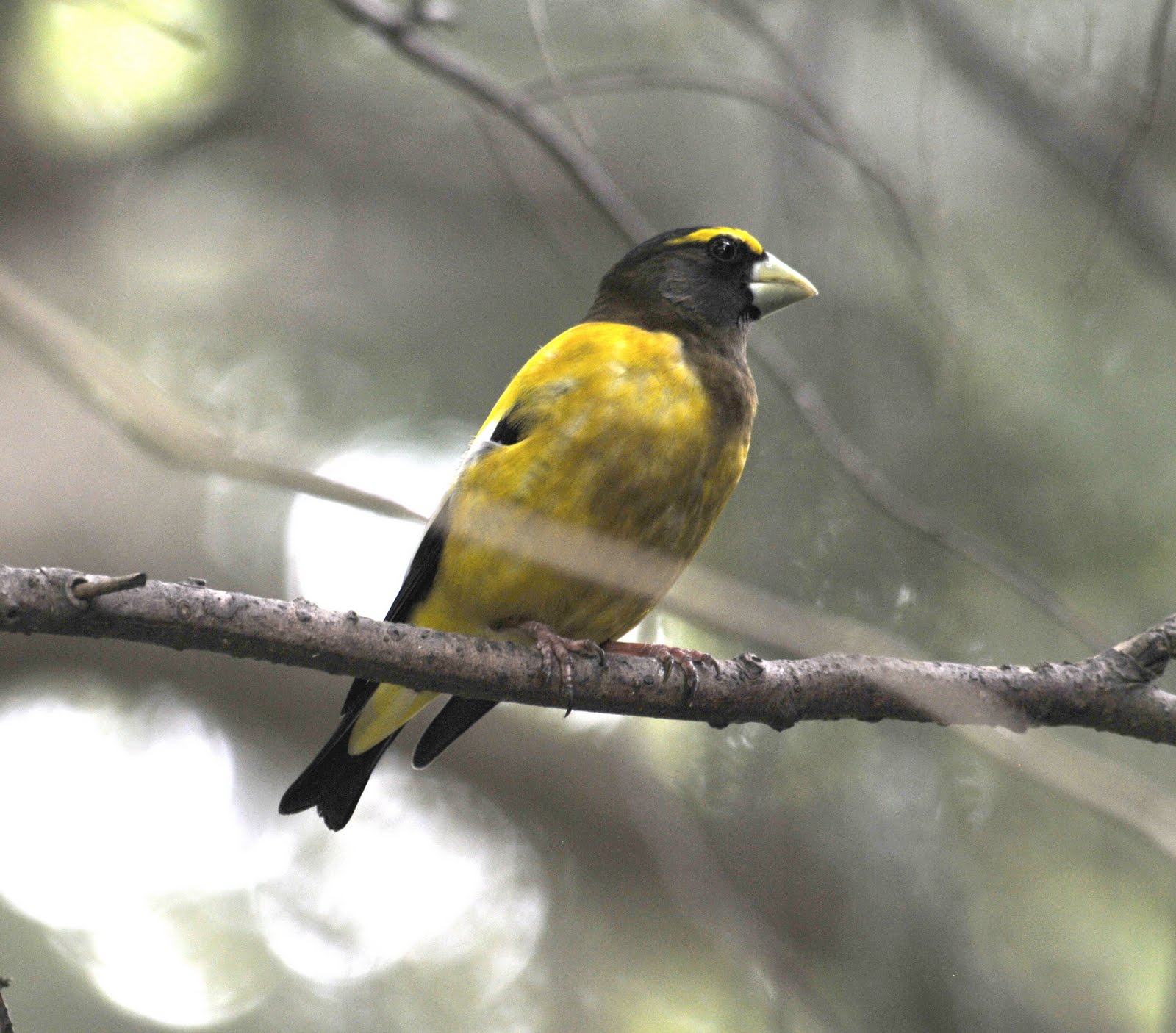
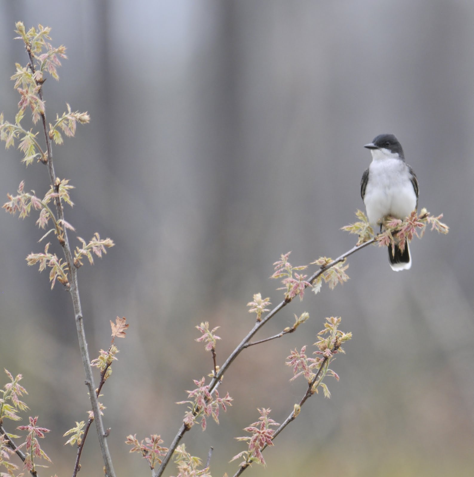
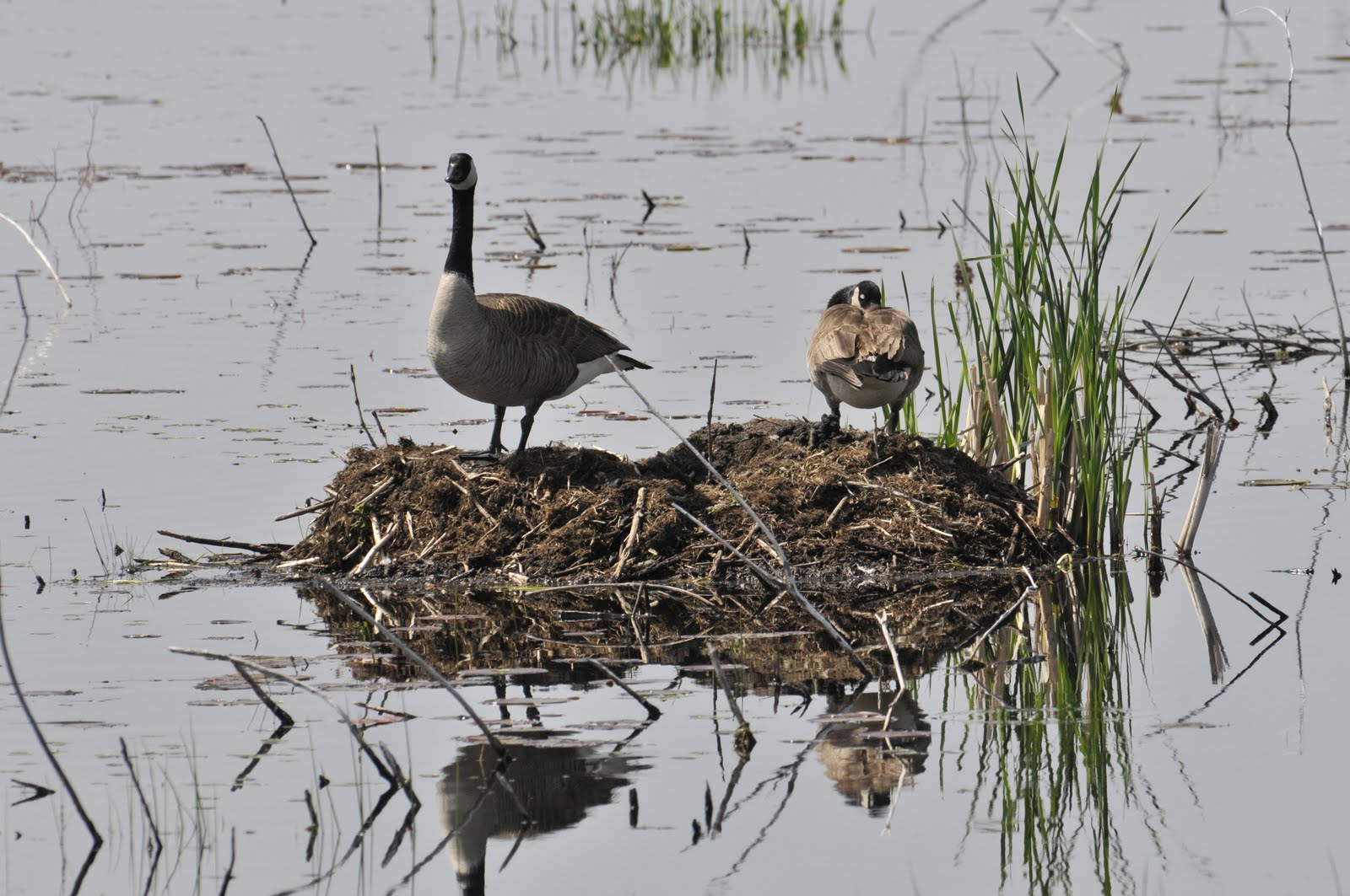
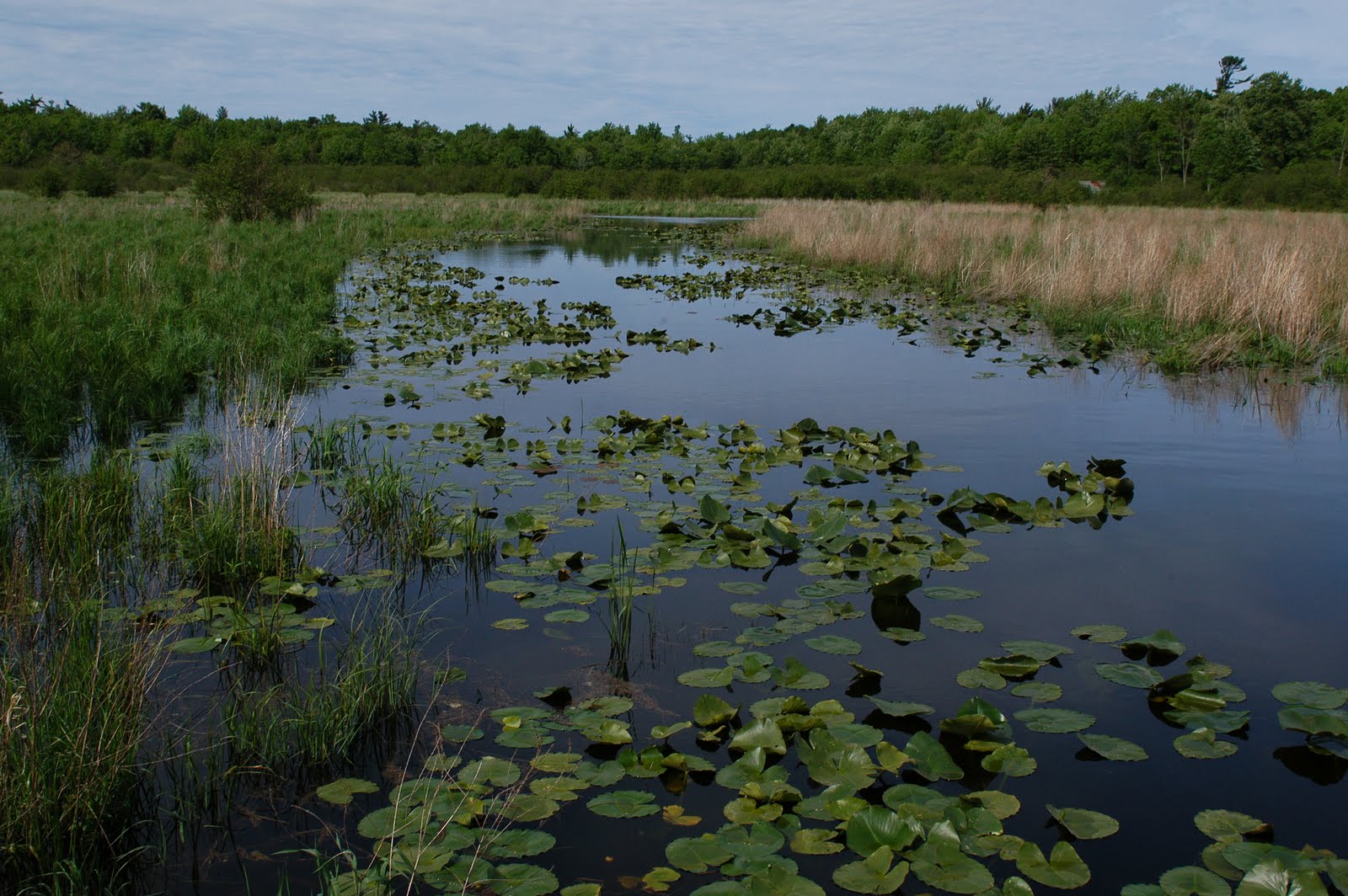
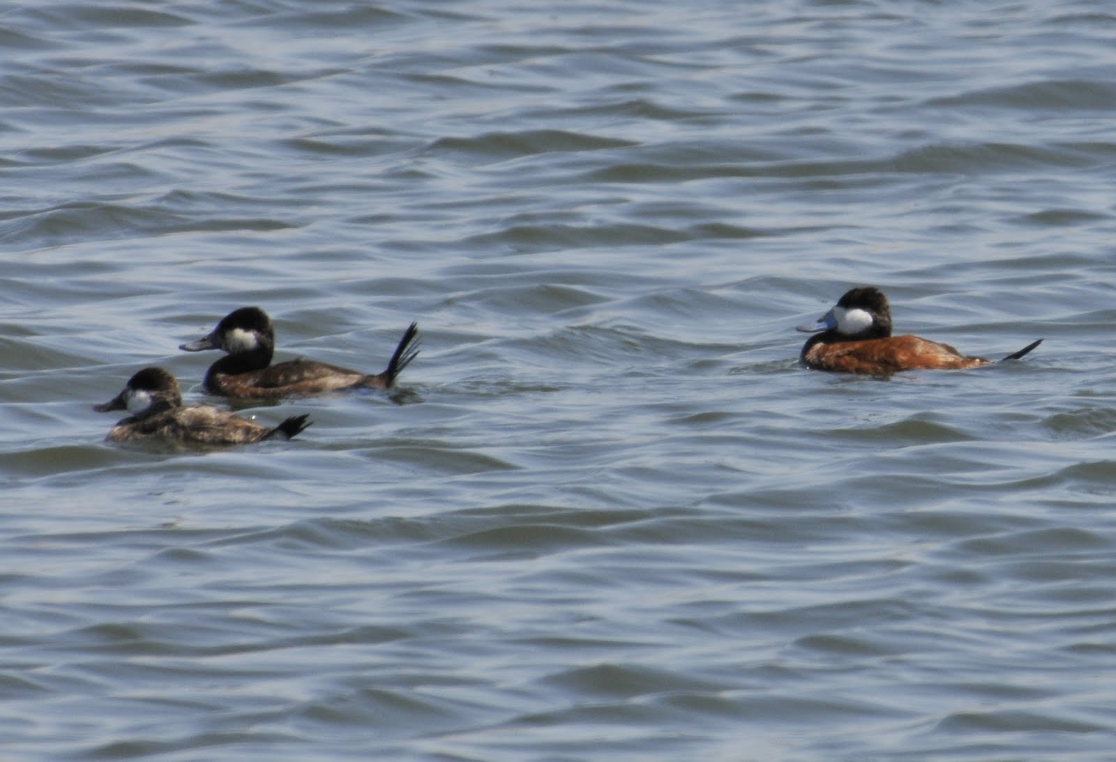
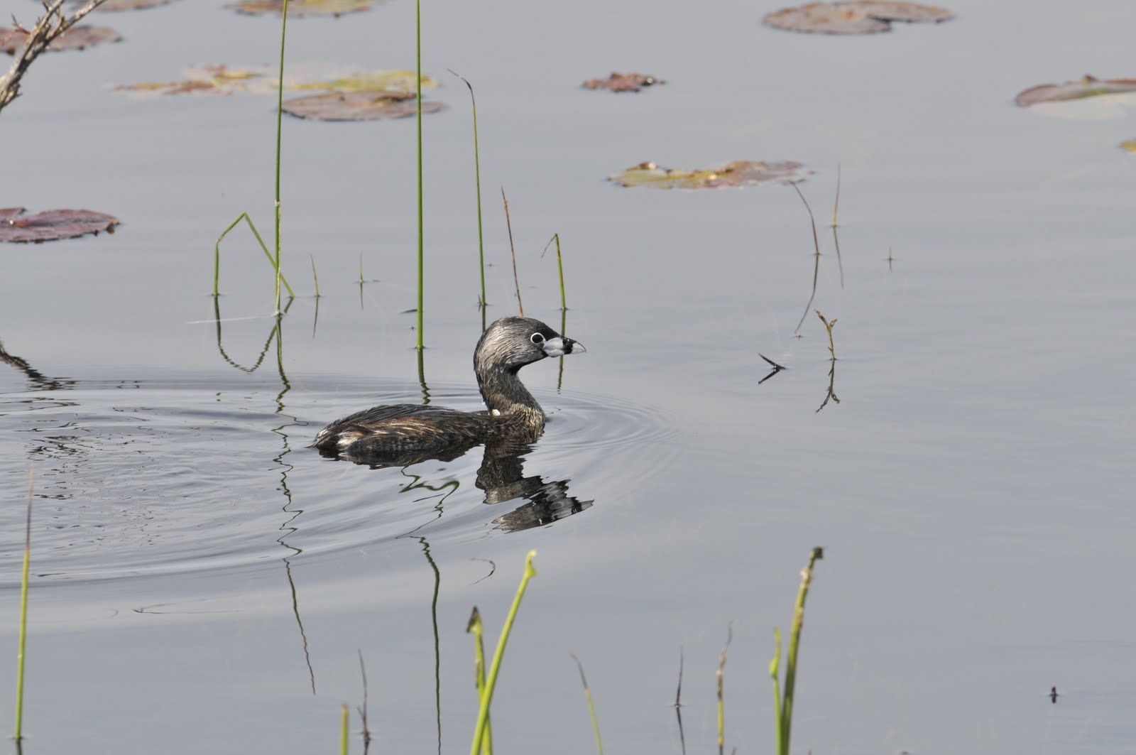
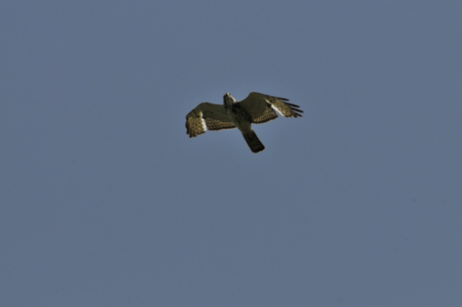
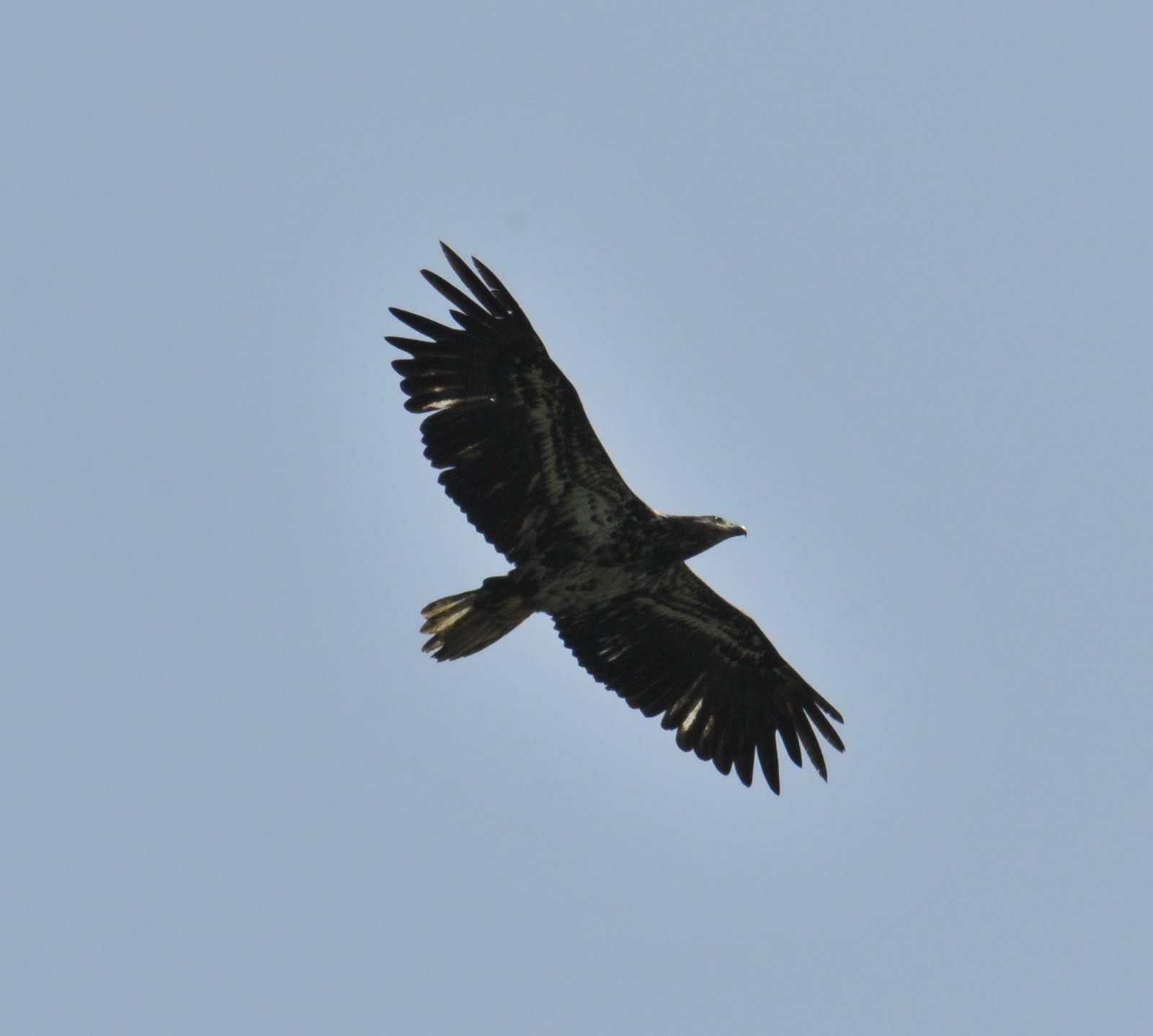
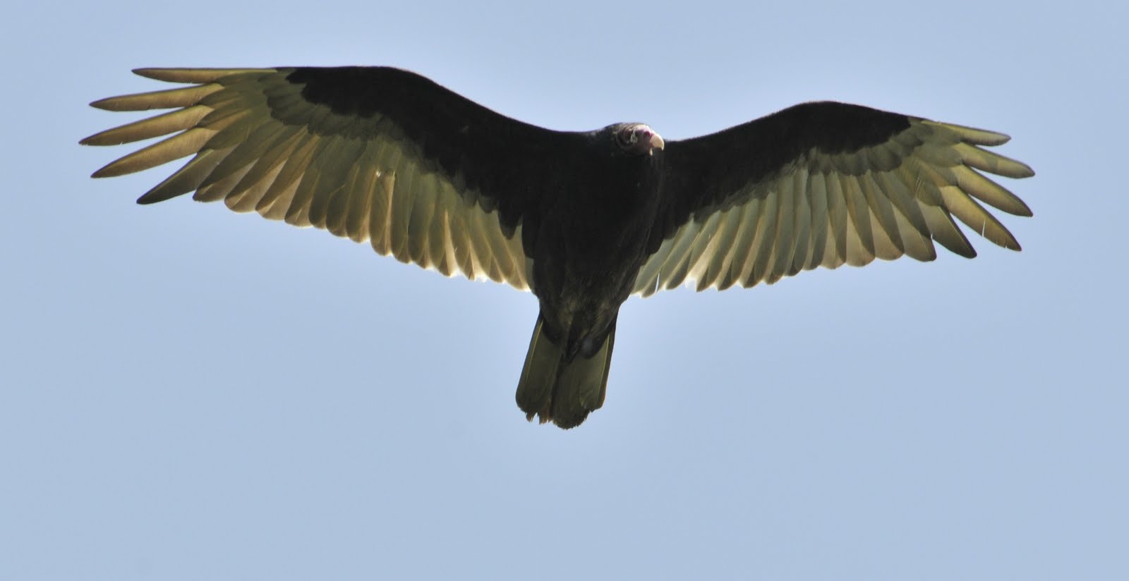
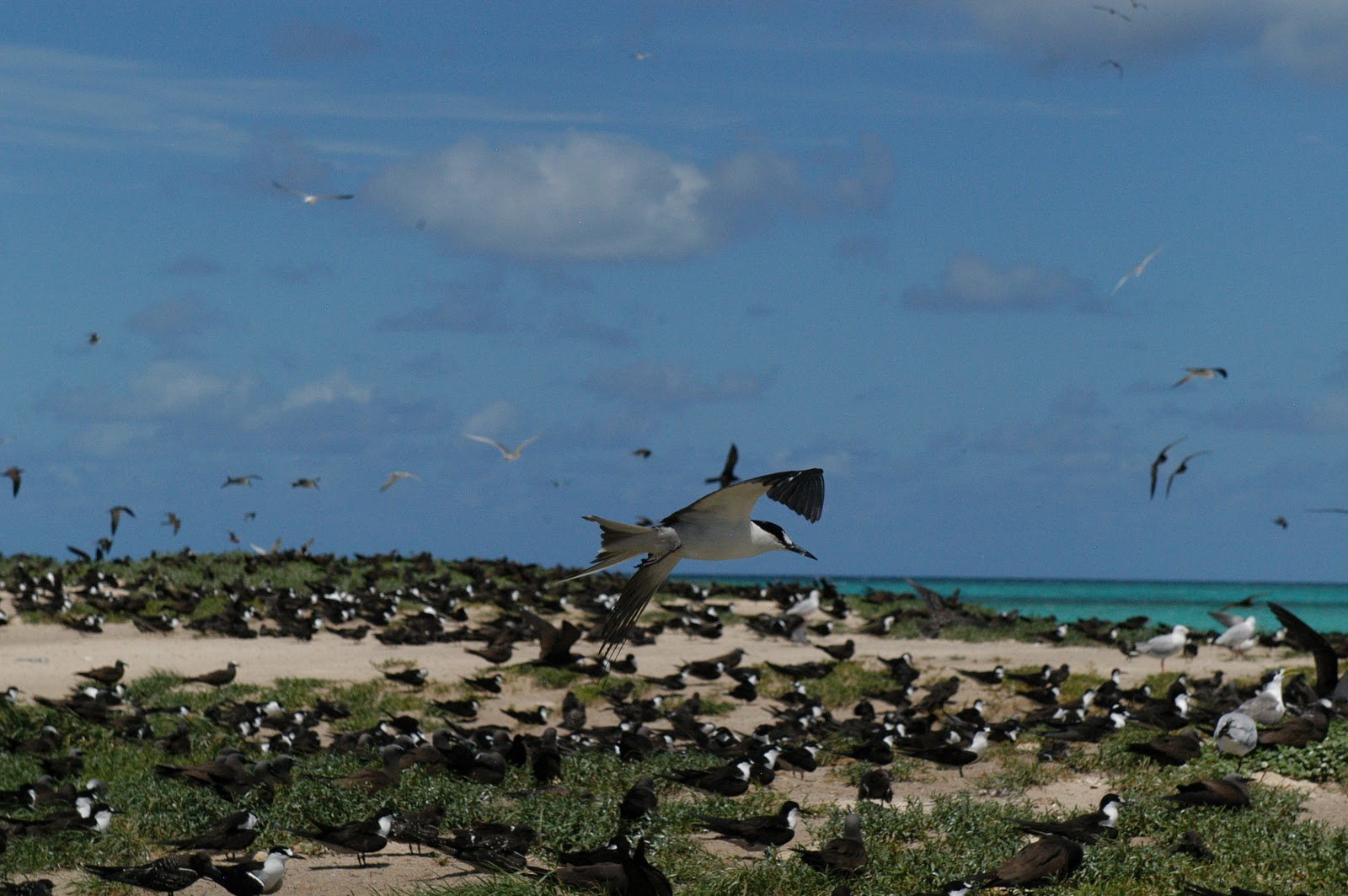
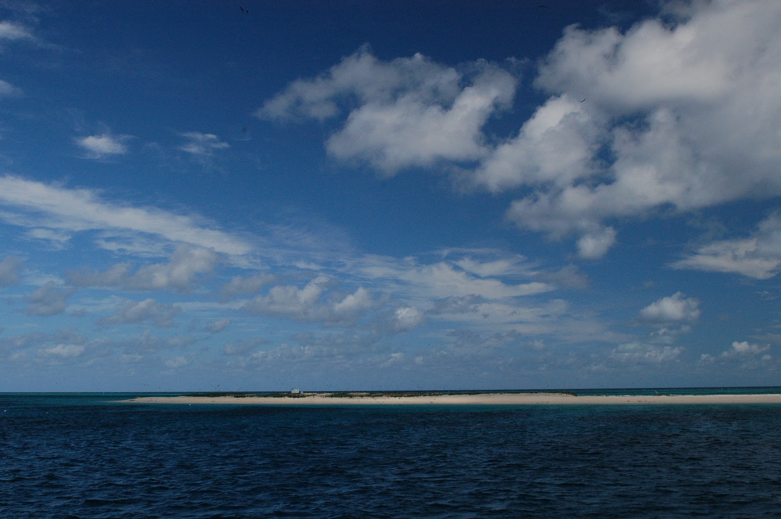
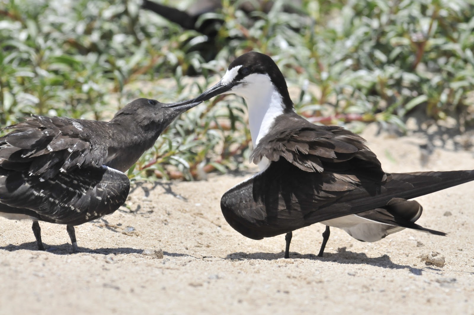
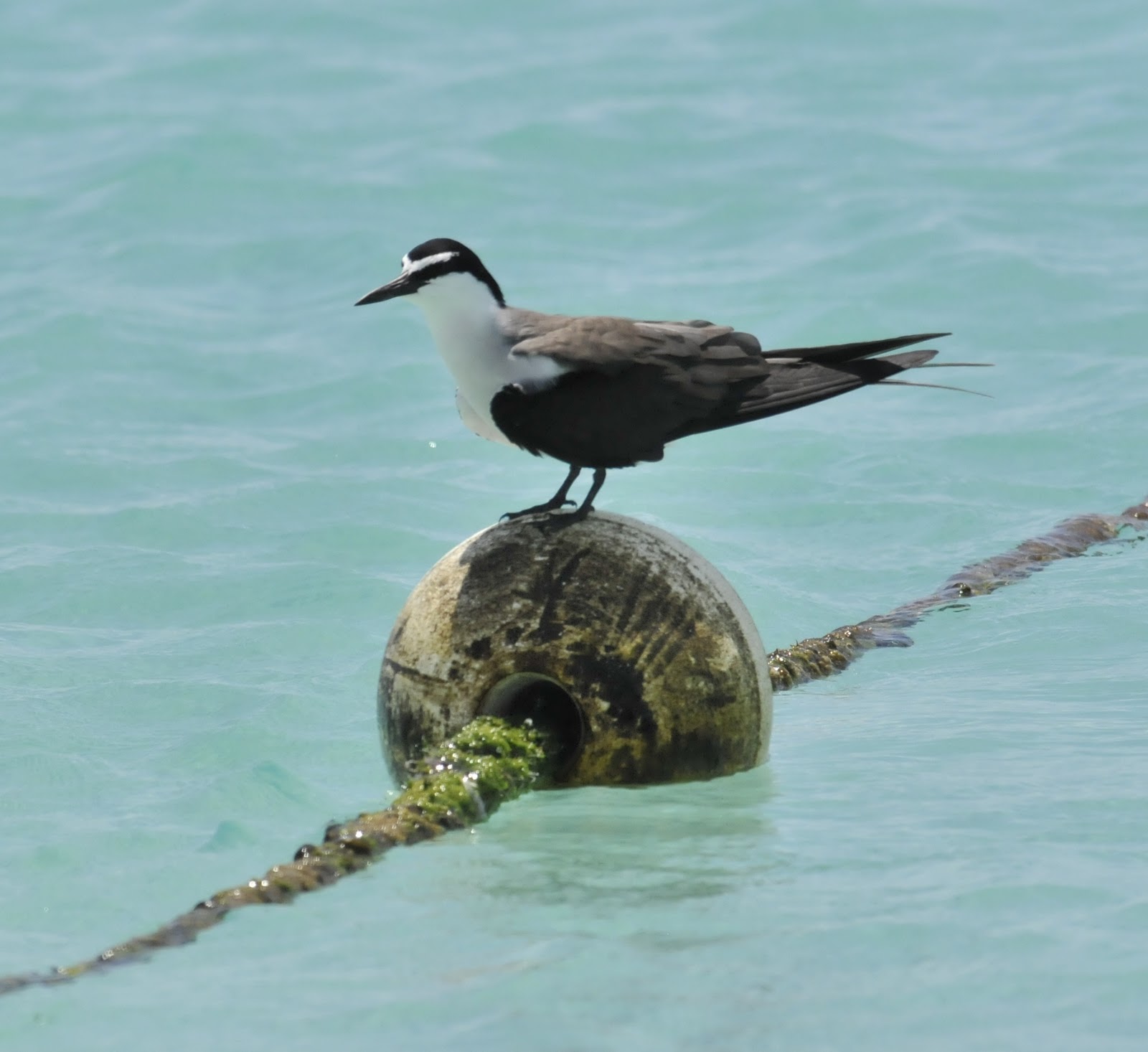
Niagara Falls; Volume and Width
I know that tourism, especially local tourism, can be both hokey and important. Niagara Falls meets both sides of that description. The town is not too attractive, the roads are poorly maintained, the hotels are average, yet the state park and the falls are compelling. The Niagara River is short but powerful.
About 18% of the world’s fresh water is in the Great Lakes System. The water in the Great Lakes System would cover the lower 48 states to a depth of 3.5 feet if it were allowed. The falls have about 6,000,000 cubic feet of water per minute pass over the (two) edges. The Niagara River connects Lakes Erie and Ontario. The Canadian side has about 2200 linear feet of falling water. The US side has about 850 feet. There are about 500 higher waterfalls around the world but few have the combination volume and elevation seen at Niagara.
There are many Maid of the Mist boats that take you into the spray near the turmoil at the base of the falls. They ride is about 35 minutes, very wet, and reasonable in cost at $13.50 per person.The Michigan Woods, etc.
Though the Kirtland’s Warbler was the target of the trip there was a great deal to see and enjoy. The following images are a representation (and annotation of the outing).
We were impressed with the huge lilacs that were all over central Michigan. We found that central Michigan, like many rural areas, places landscaping rather low on the list of urgent things to do. We saw more old 4x4s and snow machines than we saw mowed lawns. But the lilacs were great!
The birds below are Cedar Waxwings. A soft-plumaged species found throughout North America.
Michigan’s Rare Bird – Kirtland’s Warbler
There are fewer than 1800 male Kirtland’s Warblers in the world. Hopefully, there are about that number of females as well. There have been more than 1600 males for the past three years and the number was as low as 200 males in the 1970’s. This bird is limited to central Michigan’s Jack Pine woodlands for nesting. It has absurdly specific requirements.
Grayling is one of the two towns where Kirtland’s Warblers are pretty much guaranteed. They are a very rare species; breeding almost entirely in the Jack Pines of central Michigan and wintering in the Bahamas. Though that sounds pretty cushy it is a bit of a challenge on the ground. The Jack Pine habitat was managed by natural fires historically and natural fires are frowned on these days. The use of controlled burns is a bit iffy as well, as control and loss-of-control are often only a gust of wind apart. There was a 24,000-acre fire several years ago that changed the management techniques for Jack Pine woodlands. After the Mack Lake Fire the use of mechanical planting has pretty much replaced managed fire as the prime tool for Jack Pine reforestation and management.
The birds use young Jack Pine (5-20 years old) for nesting and then abandon the area. They then look for an area that was burned a few years previously and nest there until it grows up. Once the fires stop and the habitat ages the birds are in trouble. This is an easy bird to manage for, however; as long as there is acreage of young pines the birds seem to do fine. The wintering habitat seems to be adequate and the numbers returning each spring seem to be solid. So, if fires are too risky how do they manage the land? It is farmed – tree farmed in a real sense. Mechanical planters insert thousands of small trees in an area and then you wait. It seems to be working quite well.
The US Forest Service, US Fish & Wildlife Service, and the Michigan Audubon Society work together to provide free or inexpensive tours intended to show visitors this bird. The tours are available in either Grayling or Mio. Tours during the four weeks from May 15 to June 15 are pretty much guaranteed to see the birds. Later tours are less likely to see them. The warblers are headed south in late August and by mid-September they have all gone home to the islands.
The towns in this part of the state are aware of the visitation by birders and naturalists and accommodate people well. The hotels are pretty average and there are few restaurants but all in all it is a nice place for a birder to stay a few days.
There is a previous blog-page on Michigan’s wetlands and there is a following page on the other natural history of Michigan – as usual, mostly bird related.
Michigan’s Wetlands
We just had a week in the Lower Peninsula of Michigan. There are Great Lakes all around Michigan; Lakes Erie, Huron, and Michigan wash the Lower Peninsula with Lake Superior looming above the Upper Peninsula (which is attached to Wisconsin and never touches the Lower Peninsula). In addition, there are many streams, rivers, lakes, marshes, and bogs. It is just great for mosquitoes, black flies, and birds. The area is a haven for birders (a few), fishermen (a whole lot), hunters (lots in season) and, in the winter, snow-mobilers (again, lots). We were impressed (wrong word?) with the number of road-killed deer we saw; the insurance companies must really dislike deer.
Our trip took us from eastern Massachusetts, out through New York state and into Canada at Niagara Falls (there will be a blog page on this area coming soon) and then across southern Ontario and back into the US at Sarnia/Port Huron. We then headed west and north reaching Grayling, Michigan where we stayed a few days. From there we headed west to the bustling vacation town of Traverse City and then south along Lake Michigan to Grand Haven. From there we headed east by the same roads with stops at Niagara Falls and the Baseball Hall of Fame in Cooperstown, NY. It was a trip of 2667 miles with lots of dollars spent of petrol – $4.19 a gallon in Michigan and $3.83 in Massachusetts.
Grayling is one of the two towns where Kirtland’s Warblers are pretty much guaranteed. They are a very rare species; breeding in the Jack Pine of central Michigan and wintering in the Bahamas. Though that sounds pretty cushy it is a bit of a challenge on the ground. The Jack Pine habitat was managed by natural fires historically and natural fires are frowned on these days. The use of controlled burns is a bit iffy as well as control and loss-of-control are often only a gust of apart. There was a 24,000 acre fire year ago that changed the management techniques for Jack Pine woodlands. After the Mack Lake Fire the use of mechanical planting has pretty much totally replaced fire as the prime tool for Jack Pine reforestation projects. (There will be a blog page on this area following this page on wetlands.)
In an area that is largely remote and often wet, as is most of rural Michigan, it is nice to see all the grebes, mergansers, ducks, and geese that live there. It is not unusual to see Canada Geese most anywhere in the US these days but there are impressive numbers in Michigan. There are large marshes that hold Bitterns, Pied-billed Grebes, lots of diving and puddle ducks, and an abundance of Great Blue Herons. In addition there are swallows, Black Terns, the occasional Caspian Tern, and a huge biomass of Common Grackles and Red-winged Blackbirds.
While traveling north of Traverse City on the Leelanau Peninsula we bumped in to a large number of migrating birds of prey. There had been no southern air moving north for quite a while and this warm and breezy day was just what they needed. The adult birds had pushed through the early weather but the non-breeding younger birds seemed to have lazed along and were all bunched up mulling over the water-crossing that was ahead of them. We had several hundred Broad-winged Hawks, Bald Eagle, accipiters, and Turkey Vultures soaring above the cherry orchards of the northern part of this peninsula. It was pretty nice. The blurry images below show the crescents in the wings and the split tails on many of the Broad-wings. Young eagles are very dark. The Turkey Vultures were not all young as might be seen by the reddish heads.
Northern Right Whales around Cape Cod
As winter wanes in New England the right whales appear*. They are here coincidentally with a bloom of zooplankton that seems unbothered by the still-cold waters. The whales (and the zooplankton) usually appear in March and move on by mid-April. This year there have been a great many Atlantic Right Whales (more than 200 – almost half the world’s population) and they have been very close to shore. The images that I show below are from 22 April. On this outing we had whales right at the Provincetown breakwater and about 65 whales without getting more than half-a-mile from the beach.
The Right Whale is not as showy or active as the Humpbacks that will soon arrive. So, most of the images will be of modest chunks of whale in a dark gray-green ocean.
Underwater In Australia
There is some redundancy with a late October post about Cairns and the Great Barrier – but this speaks a bit more about the reef and its wildlife.
The Great Barrier Reef is touted as one of the few landmarks on earth that can be seen from space. In fact this remarkable array of atolls, islands, reefs, shoals, and mangroves can be seen from space. The reef consists of more than 2500 islets and reef parts that stretch from New Guinea to the coast off south-central Australia. if you have spent a week diving on the reef you have seen but a tiny fraction of it. The corals, fish, mollusks, and birds make for a most exciting array of life in the warm seas just off shore.
The reef is about 1600 miles long and has as many as 2,900 reefs and 900 islands associated with it. The reef is in the Coral Sea (appropriately enough) and reaches all the way to Papua, New Guinea. It is a structure that is covered with billions of living architects; each building on the foundations laid by their predecessors. Though the reef has been around for about 25 million years there have been many starts and stops as the continental plate upon which the shallows ride has moved considerably – sometimes to a place favorable to coral growth and sometimes to place not favorable. The current reef creatures probably have an ancestry dating back about 20,000 years though they are building on a previous reef from about 600,000 years ago. The sea has risen almost 400 feet in the that time and the coral has grown with it. Coral reefs can grow upward about 10 inches a year if circumstances demand it.
Reptiles of the Galapagos
![]() |
| Male tortoise are much larger than females. Though they are usually silent and occasionally hiss, during mating the male can be heard at some distance. |
The Galapagos Islands – #1
This was to the first blog – but I finished the oceanic-bird page first – so this is second.
Over the next ten days I will be posting blogs from several islands in the Galapagos chain. This posting will set the geologic tone for the rest of the posts. The Galapagos are not lush and green like most equatorial sites. They are often bare and rocky, sparsely vegetated, and surfaced by what look like fresh lava flows. The plants and animals of the Galapagos are actually quite limited in diversity and many of the organisms have adapted to the archipelago or to an individual island.
Charles Darwin was here in the Galapagos Islands aboard the HMS Beagle in 1835. He was ashore for short bits of time while the Beagle crew surveyed and charted the islands as part of their mission. The ship was in the islands for only thirty days and Darwin was ashore for barely one-third of that time. The most surprising tidbit about Darwin’s time in the Galapagos is that he arrived here in the 45th month of the voyage. This was by no means a trip to the Galapagos, nor were the islands a real feature of the Beagle’s itinerary.
Though the Galapagos and Darwin are knitted together in today’s thinking, there are many other factors that stimulated Darwin regarding the development of species and many other places that had a more significant impact than did these remote islands. He had already seen fossils that looked like creatures he was familiar with and experienced and earthquake that lifted the city of Concepcion, Chile about nine feet. These observations had opened his mind to the possibility that the earth was changeable and had changed in the past. However the continued work of David Lack and Peter & Rosemary Grant and their studies of the wonderful biologic array presented by the finches of the Galapagos have elevated the islands to an iconic evolutionary position.
If Darwin had realized what the Galapagos really had to offer he most likely would have focused on the variation between similar animals that obviously share ancestry. There are land snails that speak better to the development of species than do the finches. The mockingbirds do the same; as do lava lizards and many other creatures. He was aware of, but did not study, the shell-shape differences that can be seen in tortoises from different islands. As a matter of fact the Beagle took about 50 tortoises on board for food and ate them all as they traveled and Darwin did not save a single shell. He thought (regretfully) about the finches and tortoises on many occasions after returning to England.
Geologically the islands are a continuing cycle of creation and destruction. The lava builds upward and eventually rises above the surface of the Pacific from a hot-spot deep in the earth. The tectonic plate moves to the east a few inches a year, slowly-but-surely leaving the hot-spot behind. Over time the islands cease building and the ocean begins to erode the islands until they disappear below the sea. The oldest island that we see here is about four million years old and the youngest about 700,000 years.
However, the islands have been building and eroding here for about seventy million years; hence there are dozens of old islands beneath the sea to the east of the existing archipelago. The young islands are often barren lava-covered specks in the sea. However, if the islands build high enough they can collect clouds and soon become moist. The plants move in faster in the higher moister areas and soon pockets of soil develop and these larger islands become vegetated. Those islands in rain-shadows or without elevation usually remain dry and rocky – sometimes for tens of thousands of years.
The earth’s crust as we see it is a series of floating plates that are buoyed up by the hot magma of the inner earth. These plates often move; creating trenches, undersea volcanic troughs, and mountain ranges where they collide with another plates (like the Andes to the east of the Galapagos). The older islands have eroded and traveled with the plate eastward. Volcanic activity still occurs in the islands; in the region of a “hot spot”. This spot is a plume of magma that extends upward from the earth with such heat that it continually melts through the plate at the same spot. The plate moves and the islands form in a row like the (inverse) of dripping pancake batter from a spoon on the way to the griddle.
There are layers of ash, tuff, and lava all over the Galapagos. They are young and the geology is like an open book. There are places where lava flowed over land and where it exploded from under the sea. Scoria, lava tubes, tuff, calderas, cinder cones, pit craters and aa and pahoehoe flows, are all there to be seen and understood. It is a remarkable place for its geology as much as for its animal forms.


