Ayers Rock Is now Uluru

Ayer’s Rock and the Olgas or Uluru and Kata Tjuta

The ride from Alice to Yalara, where Ayers Rock is located, takes a solid five hours; longer with stops. I think it is a great ride and today was very special. The road south from Alice is the Stuart Highway and the road west to the rock is the Lasseter Highway. There were two right hand turns during the six hour ride. 


The rains have everything in the desert green and flowering. There are green leaves and flowering stalks everywhere. It is pasture-like and very pleasant on the eye. Of course this is balanced out by the small, narrow, spiny leaves of desert plants. They don’t just become oak-like because it rained – but anyway it is very pretty.


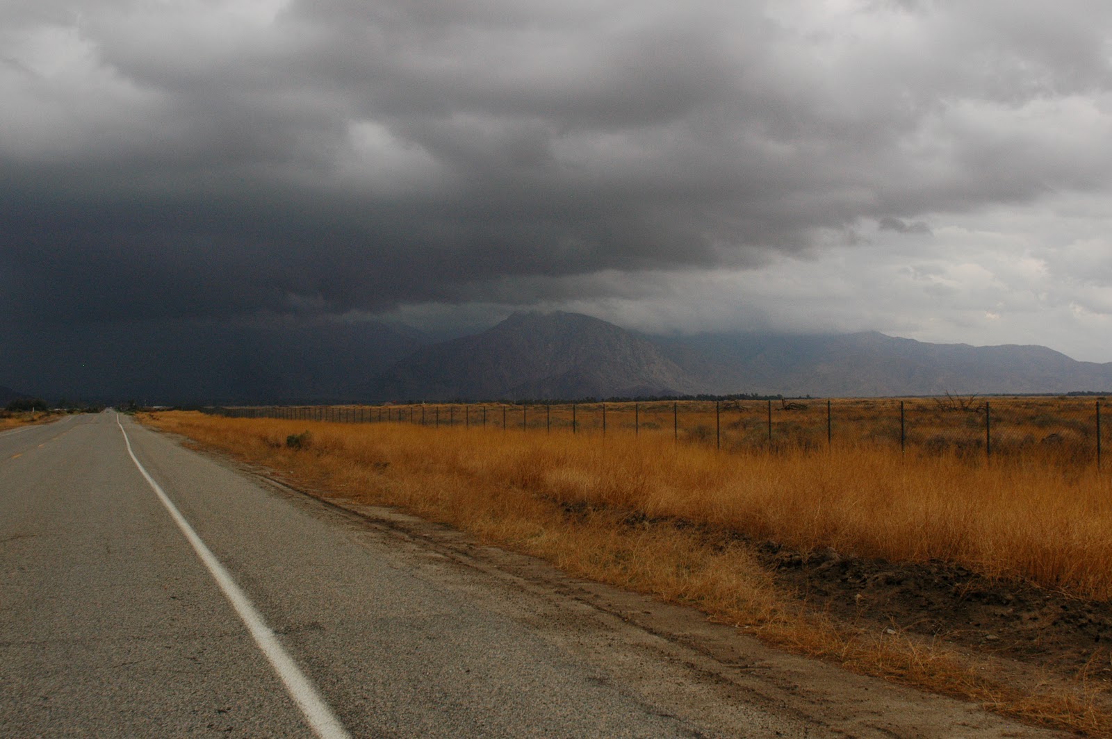
There was water in most of the dry rivers and the lake system near Mount Connor, called Lake Amadeus, had many of its salt flats covered with shallow water. On the way to Sydney we will fly over Lake Eyre, a great salt flat in central Australia, that gets water in it maybe once a century. It is now partially wet and likely to become full within a couple months. The image below shows a thin stripe of blue in the center – that is the rare Outback sheet of water. Incidentally, Mount Connor looks like a toothbrush lying (for a couple miles) across the desert. The handle is a long low ridge and the mesa forms the brush end. Mount Connor is on the Curtin Springs Station (ranch) and is not reachable unless you are on the ranch land. Oh yes, the ranches here are huge – one is the size of Florida and they are all measured in hundreds and even thousands of square kilometers!


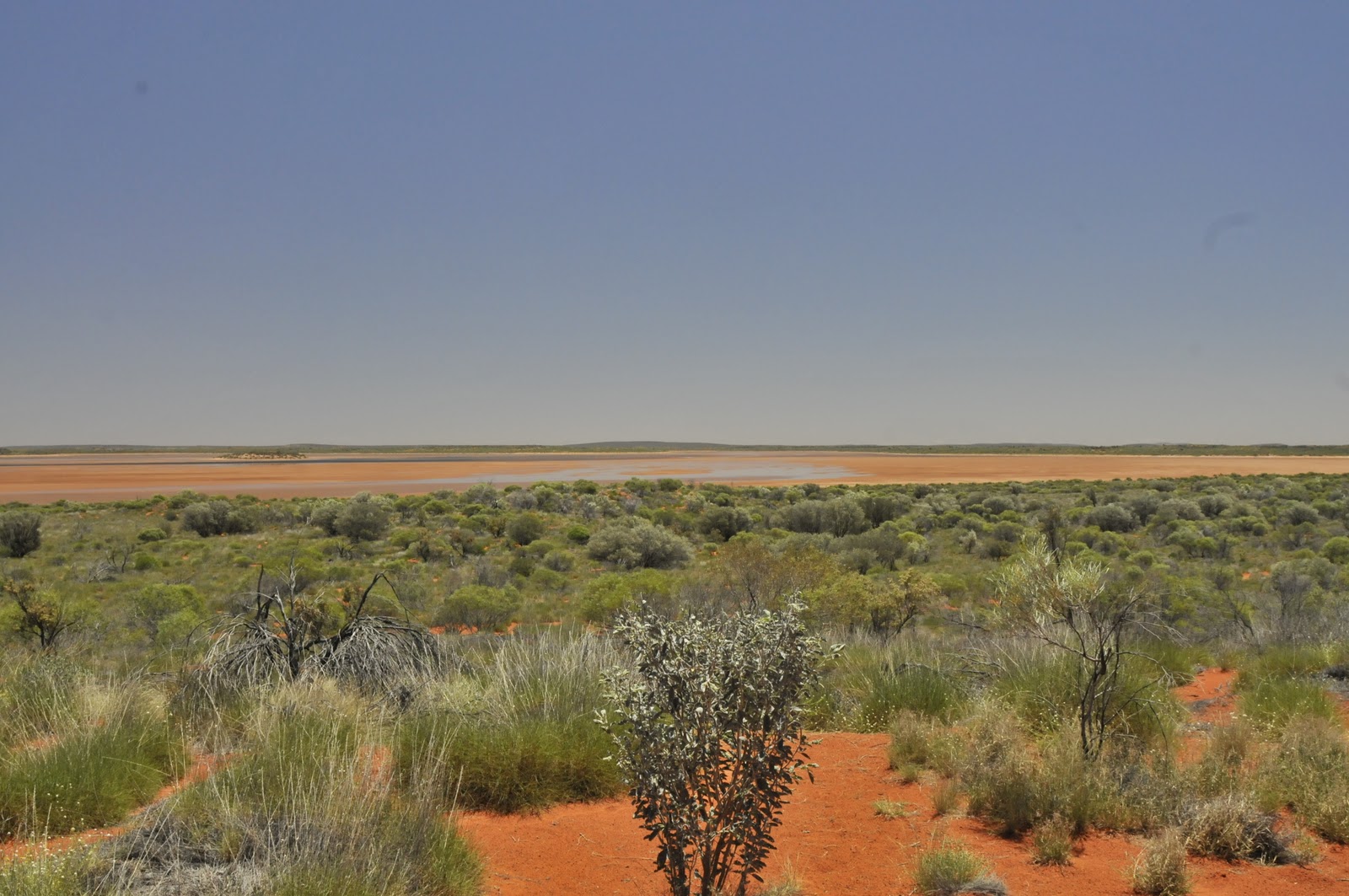
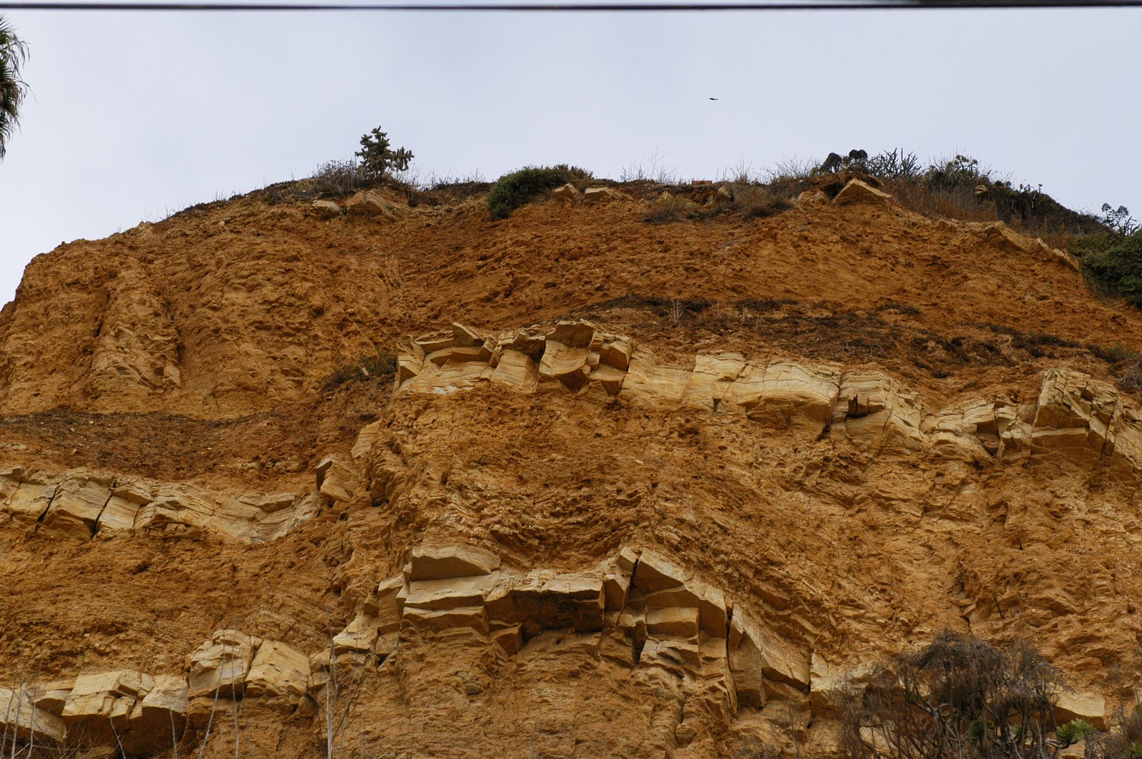
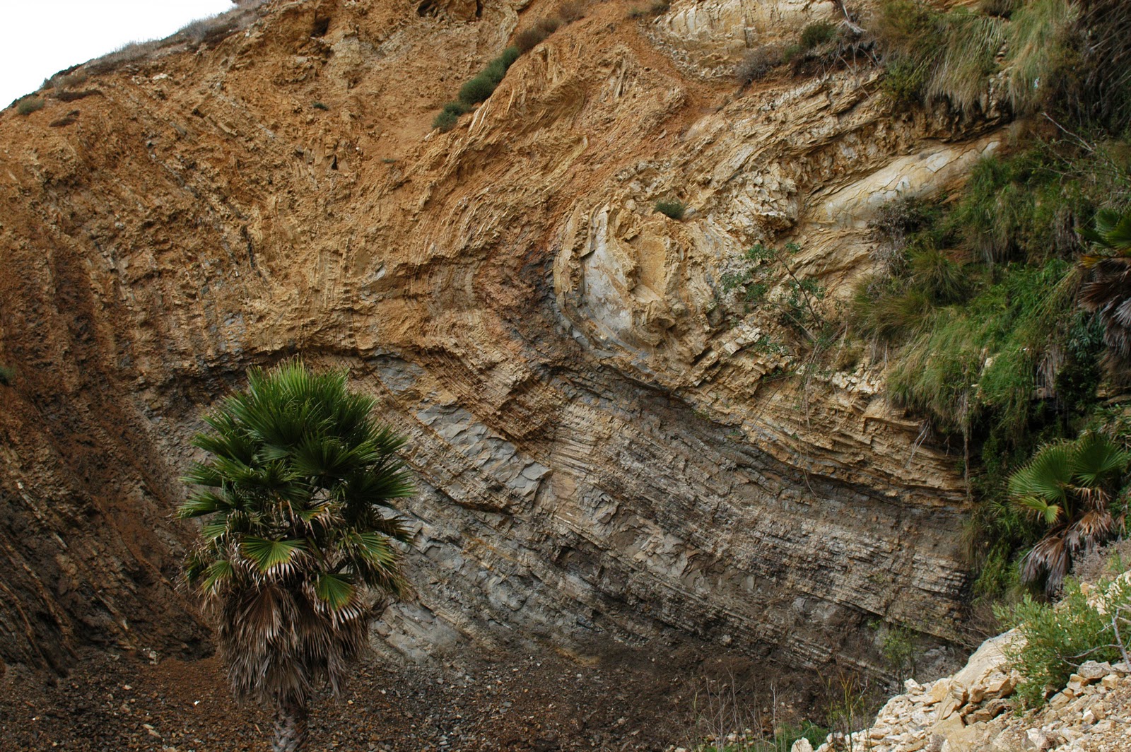
The above image was taken along the Lasseter Highway about 40 miles out of Yalara (the official name of the town where  Ayers Rock resides) and shows a thin line of blue in the center where water was in the shallow salt pannes. The Lasseter Highway is bounded on both sides for mile after mile of what were once shallow lakes. There is rarely water anywhere along this road. During the low waters of the ice age just passed this whole area was dry but during ther high waters before the ice age the sea reached into this shallow basin many times. This is similar to how the sea reached into southern California at the mouth of the Colorado River – for instance the Salton Sea was part of the Sea of Cortez at one time.
The sunset at Uluru was very pretty what with clean air and a clean rock. There was no haze and no dust, and no rain – just the usual 1000 tourists lined up enjoying the end of the day. Tonight it was very cold and windy at sunset.
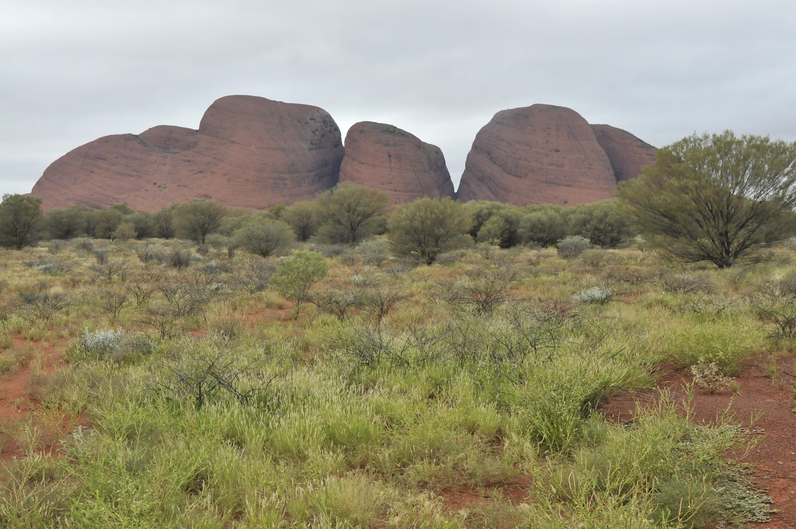
About 12 miles from Uluru is Kata Tjuta or the Olgas. These are huge conglomerate rock heads towering over the desert plain, there are about 36 in all, sitting in a jumble like a pile of discarded billiard balls. They are very sacred to the local Aborigines and the 36+ mile ride to get here is because we have to go around so many sacred sites. The stories of these sites is not known to any white people – even today – as they are culturally important and integral stories known only to the older aboriginal men. 


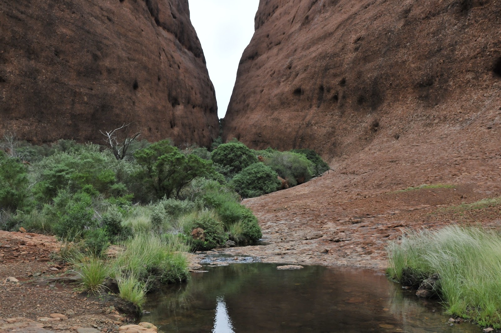
There is a walk between two of the larger rocks that offers a sense of the place. The wind whistles and the bare rock rises over you as you walk across the welded conglomerate pavement. There is a wettish seam that runs down the crease between the rocks and these are treed with tall gums. The look like bonsai against the enormity of the rocks. 
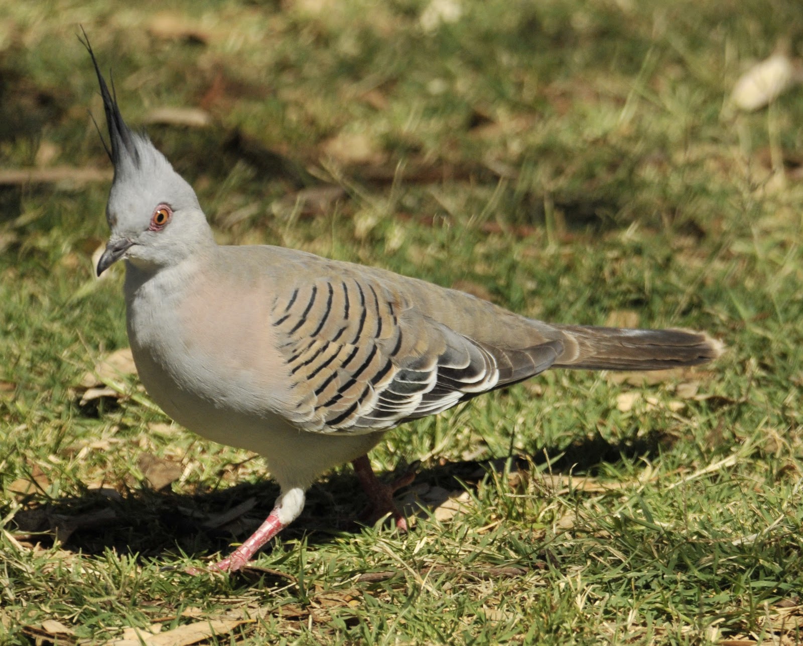
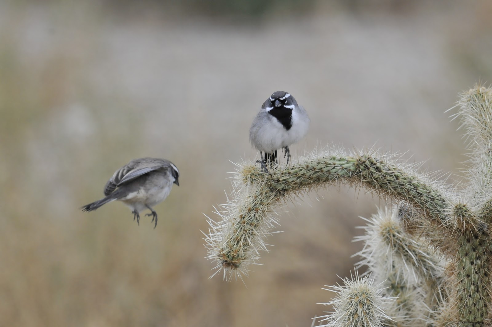
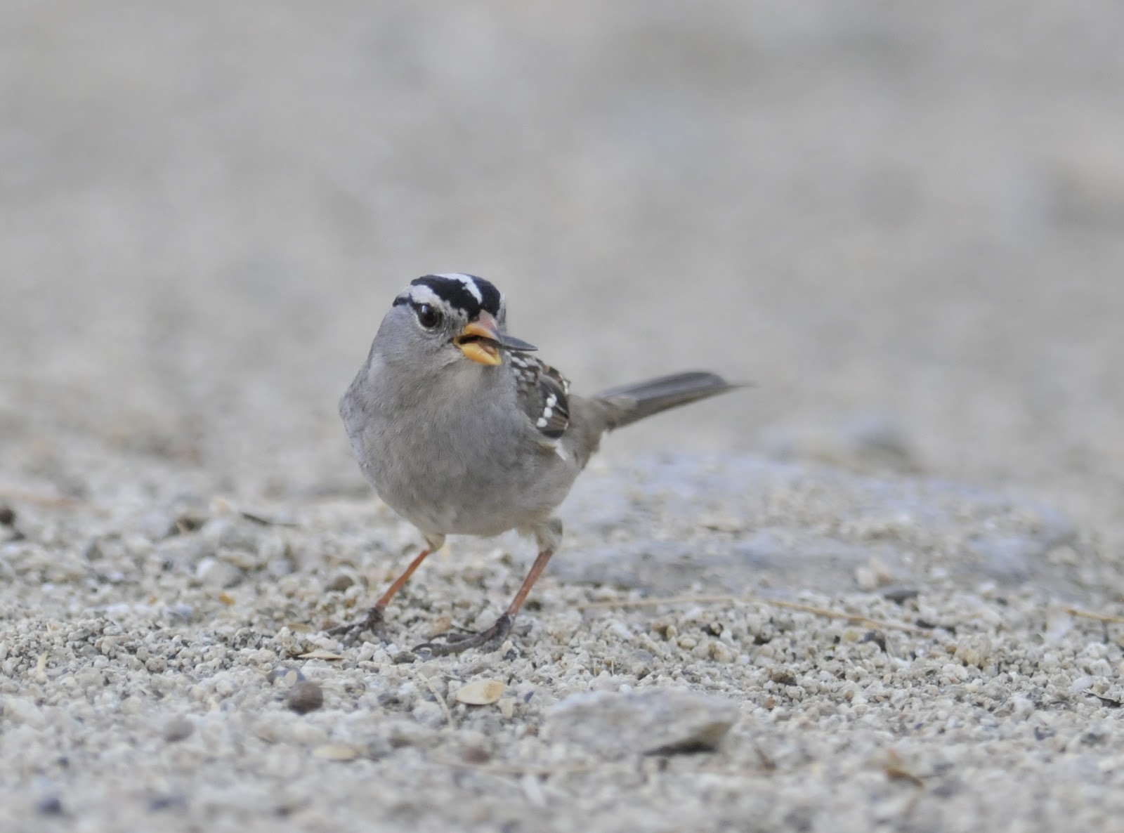
The desert is quite empty of wildlife; especially if you don’t count the birds (a few) and the flies (a lot). The flies are creatures of the warm summer days and can be very thick. They don’t bite or land on your food but seem to be seeking moisture from the skin. They are very found of your eyes and the corners of your mouth. It is very likely that a day outdoors in fly-season will allow you the chance to swallow one or two. The most rain ever measured in a month here was last month. There are freshets, pools, and wet river beds. The wettest weather of the year is supposed to be in the next three months so maybe the rivers will really flow at some point. We have had flowers, shrubs, and trees in bloom. There are birds feeding young all around. It will be a good year for raising young. If next year is dry only the fittest will survive.

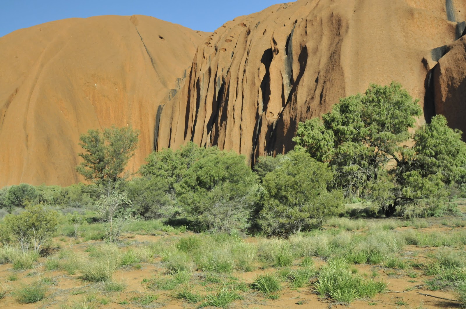
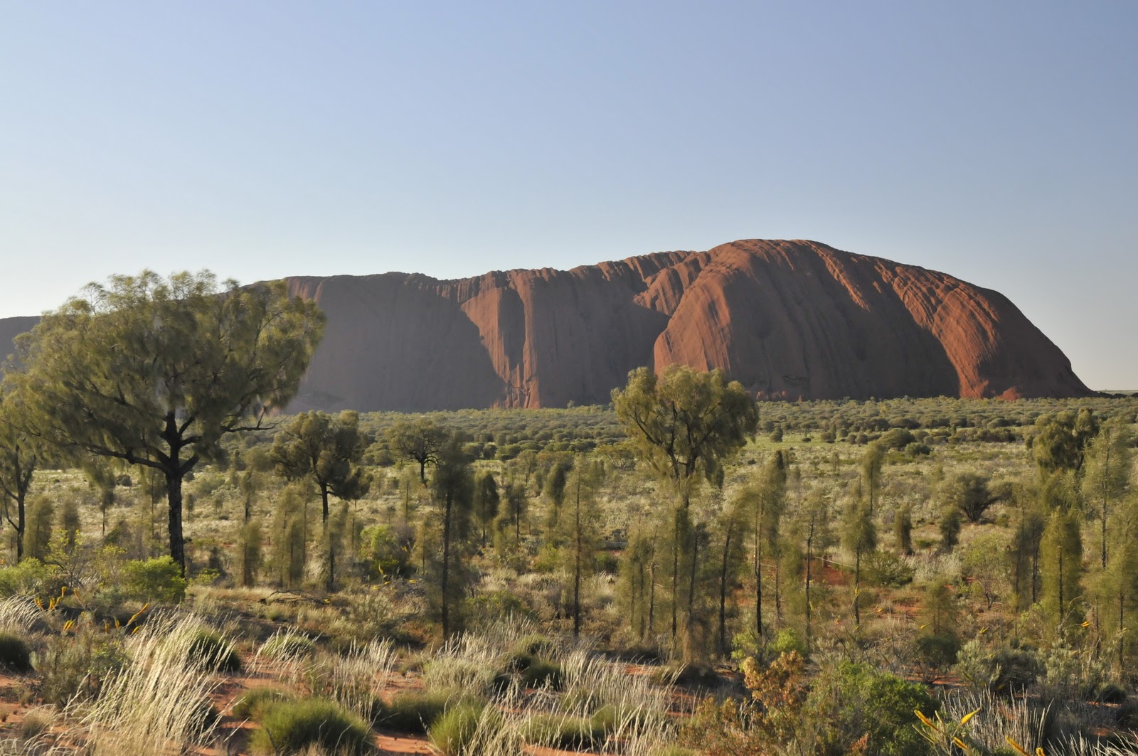
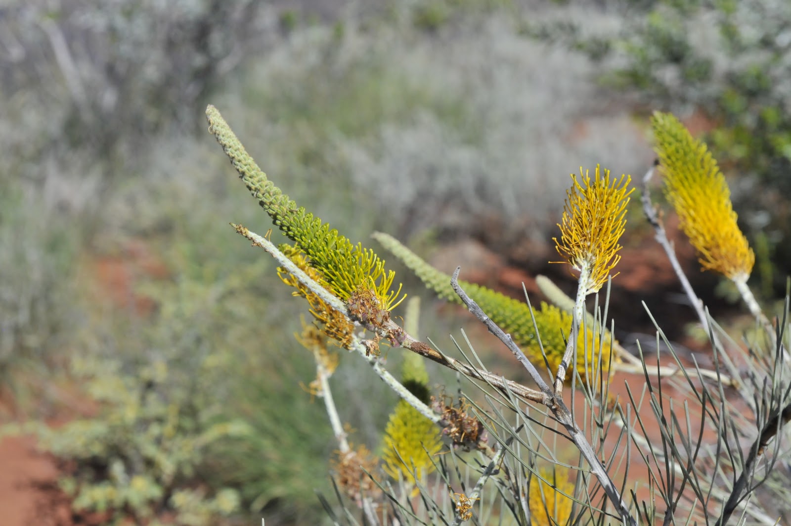
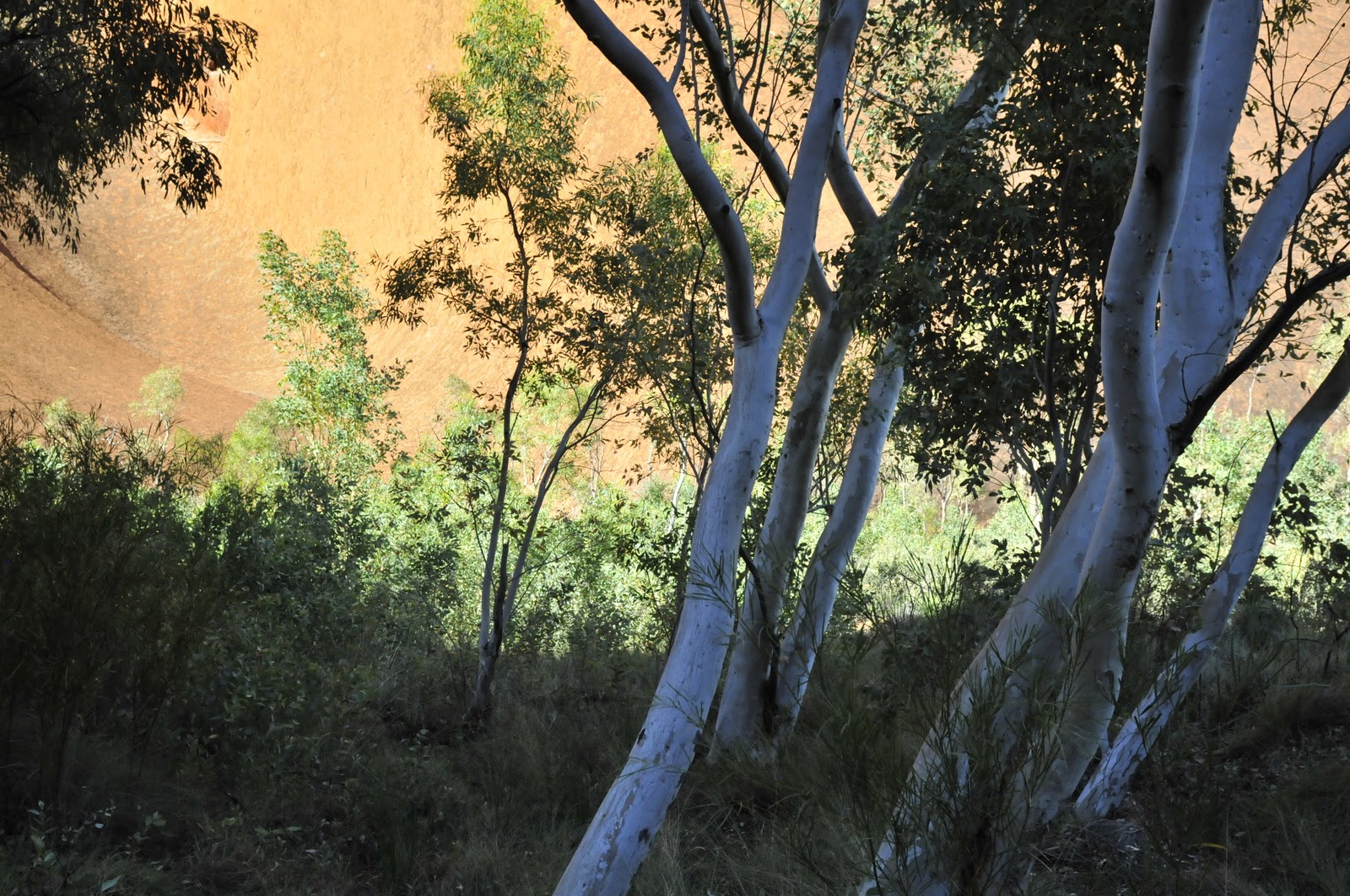
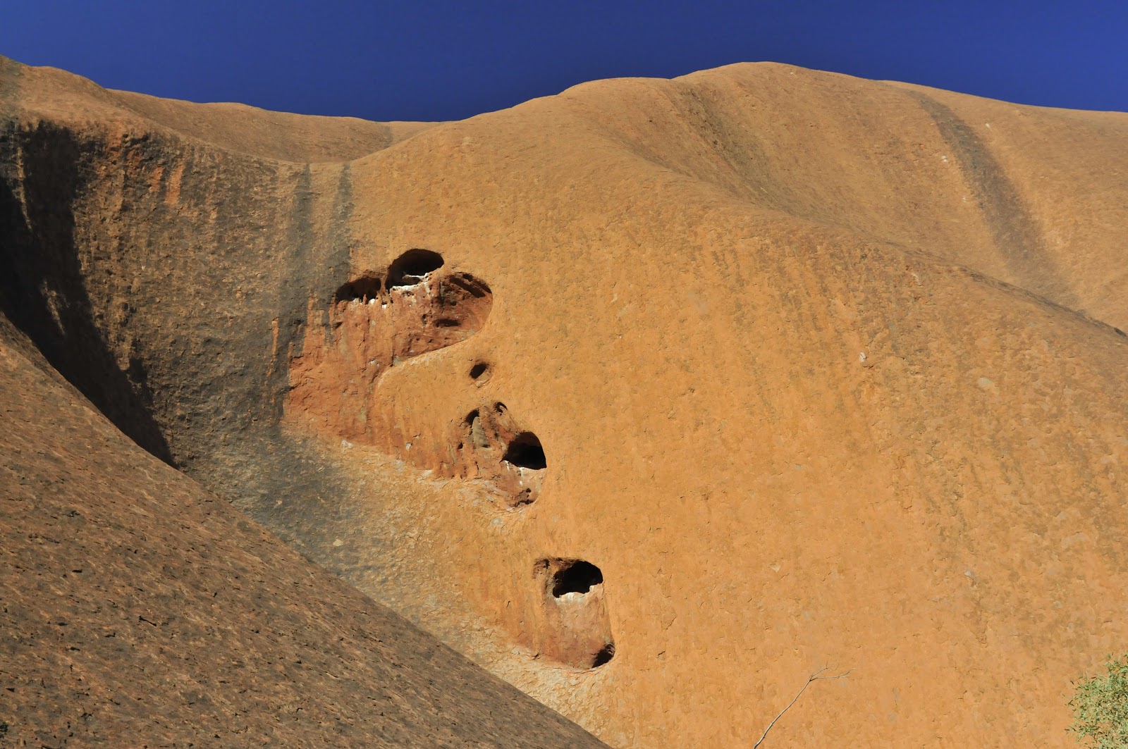
The three images above are of Ayers Rock at different times. Though the sandstone was laid down in layers (up to 900,000,000 years ago) the layers are not very distinct in the now twisted exposures. The layers are vertical today. The rock is about 2.2 miles long, 1.4 miles wide, and 1140′ high. It is huge and there is no way to show that…..

The three images above show: 
top- one of the flowering shrubs, with a rather usual flower form for Australia. This is something like the Banksia (bottle-brush) flowers; each with many many florets. These flowers and their rich nectar production has resulted in the evolution of dozens of nectar-eating birds down here.
middle- A small group of Eucalypts (ghost gums) against the backdrop of Ayers Rock.
bottom- One small section of the rock with modest erosion in the sandstone.
As for Kata Tjuta images – I will insert a couple. The size of these rock (1100′ high at places) cannot be sensed from these photos. The rock are pudding-stone, a conglomerate. They are welded together by muds and consist of large stones as well as smaller ones. the large stones are the size of bushel-baskets and basketballs.

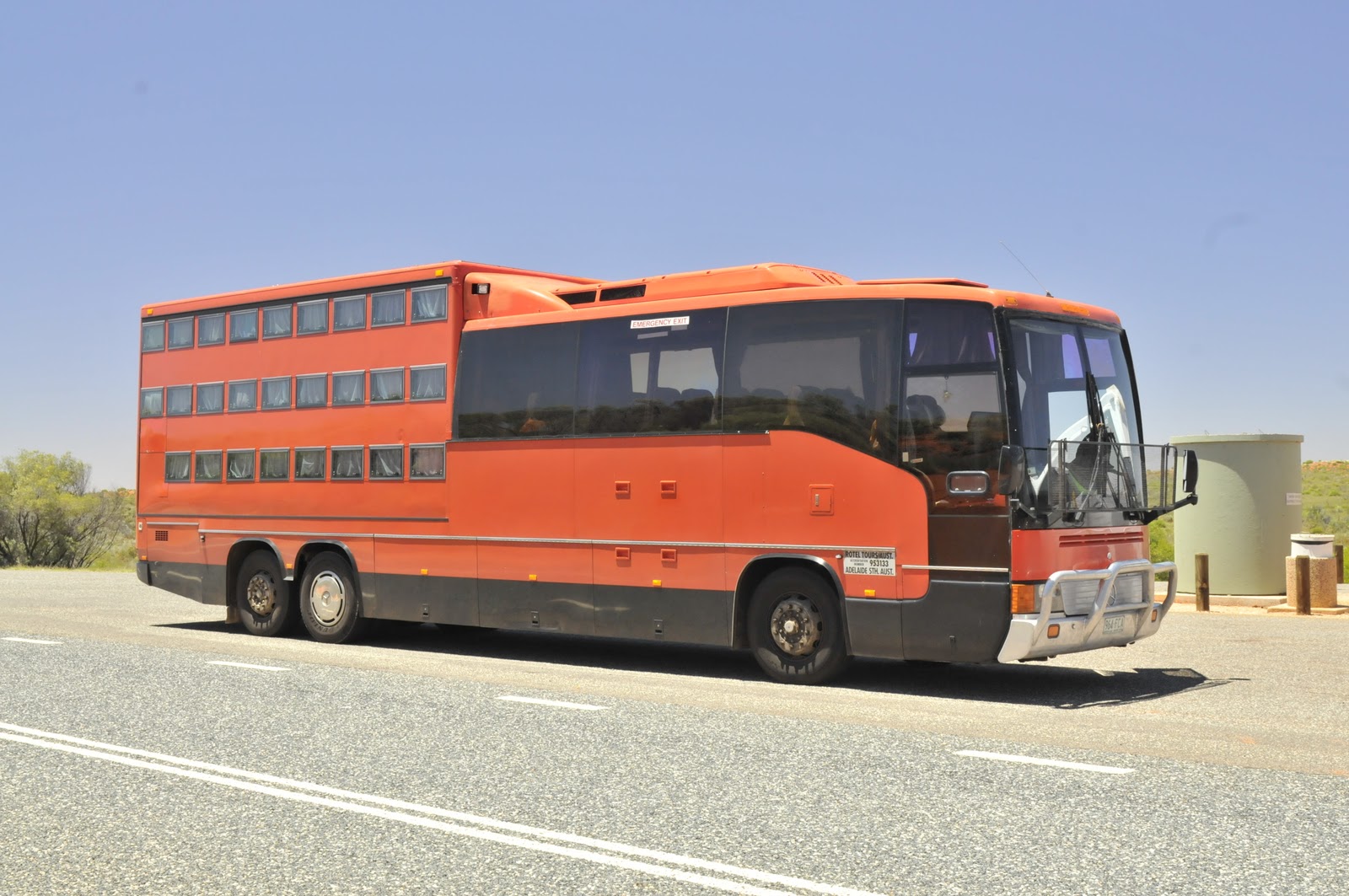
Below is the “coffin bus”. There is a German company that takes you around and you sleep in the pullout trays that are represented by the 26 small windows in the back half of the coach. It is actually crowded in the day time as well as there is seating for only 26. If I were the driver I’d rent a room each night. 

Alice Springs, Australia’s Outback Town

The Great Red Center of Australia has one town. Alice Springs is 1000 miles in any direction from the next town. There are long long dirt roads to Darwin, Perth, and Adelaide and a blacktop (bitumen here) road that goes about 200 miles to Uluru (Ayers Rock). The rainiest month on record was last month and Alice is a bit more than ten times its annual rainfall average already this year. The “rainy” months are yet to come. It was a nice surprise to have the desert green and flowering. There were places where the bunch grasses were so thick they looked like pasture. Everyone is amazed by the bounty this year – but it may not rain again for years (that has happened). 

The plane to Alice was delayed and we were almost three hours off schedule when we arrived. The really bad news is that I didn’t get a chance to assess the Desert Museum. I have wanted to look this museum over for quite a while. It seems to be like the Desert Museum outside Tucson and might offer a great opportunity to visitors. 

This trip we have lots of nature/bird people and I’m sure that 5-7 or maybe even more would stop off at the watery pools of the Alice Springs Waste-Water plant for a quick look at ducks, swan, grebes, and shorebirds in the desert center. We always go to the Flying Doctors and the School of the Air; both interesting but indoors. Here in this remote part of the world the aboriginal history, natural history, and geologic formations are the draws. I would really like to feature the natural history. I think that visiting the Desert Museum and birding in the lagoons could be made as interesting as the other options. We will do the School of the Air today and Flying Doctors tomorrow. Hopefully I can squeeze in a visit one day or the other.

The Crested Pigeon is an elegant member of this group.
The Wallaby below was grazing on the lawn of the old telegraph station.


Paul Griffin, the opal store proprietor here in our hotel, and I will do a talk on the geology of Australia with emphasis on the semi-precious stones and mining options that have been featured here for the past 150 years. However we will also talk of the booming mineral and resource market that Australia is currently taking advantage of. 
Alice is a small town of about 26,000 and is located among the ridge lines known as the McDonald Ranges. The slot (gap) that lets you in and out of town is the Heavitree Gap and it is quite narrow; just wide enough for a good two lane roadway. The McDonalds are the last visual remnants of very old mountains (330 million years) that have eroded away. Like most of the visible hard geology here they are the bent and twisted edges of what were once horizontal sediment layers. Many of them are now approaching the vertical. As this area was sea bottom at one time the sediments are mostly sandstone. Through tectonic pressure these sandstone layers have metamorphosed into quartzite and now have the appearance of a tan glass – blocks of tan glasslike stone, not glass shards, make up the walls of the ridges and valleys. The cooler, wetter, narrow valleys in the McDonalds are vegetated with Cycads and Ghost Gums and Spinifex grass. Some of the passageways become narrow slots, like in Petra, that pass right through the narrow ranges.

This view is of the upper half of the narrow split at Standley Chasm.

The Black-fronted Dotterel was at Standley Chasm as the river bed was actually wet due to the rains.
The Black-footed wallaby is a regular resident near Standley Chasm and is often the only “kangaroo” we see.

The McDoanld ranges are small now, rarely 1000 feet tall and split with these narrow gaps. They are a bit like eskers with cuts through them; or more like a thick sandstone hawser cut shrply at the end with another drawn up close to it but not quite touching. You can see them lying there like large caterpillars in a row. They are not really mountains anymore – but they have character.
When Fran and I come back here, for a month or more, I think I’d like to drive north to Darwin from Alice Springs. We would certainly want to get to Kakadu National Park. It is arguably the best site in all of Australia for wildlife and cultural things. It is a very long way from everywhere else though. Kakadu is supposed to be just great; crocodiles, birds, wet forests, and marsupials. 

The evening we spend in the bush with Con and Kathy and John and Barry Skypse is a treat. Everyone sings along with Barry and two of our travelers get to play along (below). One plays the lager-phone (a broom stick with dozens of beer bottle caps tacked to it) and the other plays the wobble-board (masonite wobbled back and forth). That particular song is a long song and lots of fun. I bought Barry’s CD so that I can do the Gum Tree song with the kids. It has lots of hand motions and is a cute thing. It will be fun to play for and with them.

The next morning we go back into the bush with Con and we get a lesson on the Outback aboriginal people. We can also buy dot-paintings done there by the ladies. It is a very nice morning. The image below is of the lady from whom I bought the picture she is holding. It is a picture of “snake and emu traveling north”.


I did get to spend an hour and a half at the sewage lagoons with our avid nun-birder; but that was barely time to walk the perimeter of this great birding site. Also, as they have had a great deal of rain, there were no “mud” flats only very-full pools. So there were no herons, egrets, and only a few plovers, sandpipers or muddy-edge specialists. But, it was good anyway. There were about 92 Black Swans, one hundred of several kinds of ducks and grebes and a selection of Black-tailed Native-Hens, Black-winged Stilts, and Masked Plovers. There was also a Red-capped Plover and some (hard to get close to) sandpipers.
I have a key to the birder’s gate at the plant. There is a kiosk with a bird book and list of sightings. There is a birder’s pamphlet and a sign-in book. It is a very nice arrangement all-in-all. The key was mine for a $35 deposit a year ago and I have used it during my last three trips here. As I am not booked for any more outings, and if I remember, I will try to sell it to the driver or someone else who lives in or visits Alice.

I really do like Alice and the surrounding Outback. Some day this place will get a week or more of our birding time.

Pines to Palms – oops, forgot to post earlier

The 5000+ foot air in the San Jacinto Mountains was rough on our virus-addled lungs. We walked up in Humber Park and then went on to Black Mountain where we hung out at a fire tower with juncos and hummingbirds – and the forest ranger. Once you are in the mountains amidst the towering pines (Jeffrey’s, Coulter, Yellow) and the Incense Cedars the hustle and smog of Los Angeles are hard to imagine. The change is not only visual it is almost spiritual. Life here in the mountains (and the desert) is so different from city life.

While in the mountains we enjoyed the Steller’s Jays, the Acorn & White-headed Woodpeckers, the Mountain Chickadees, and the company of Pete and Suzon Caparelli. We were out all day every day and walked, looked, explored, wandered, drove, and photographed the countryside. It is a rather vertical countryside that seems a rock-climbers delight. We did not do any rock climbing but we did explore the rocky woodlands.

Of all the birds the harlequin-faced Acorn Woodpeckers were the most fun. They are gregarious and the families live in the same area generation after generation. They find a dead pine that has lost its bark and drill hundreds, thousands actually, of acorn-sized holes, each of which they then try to fill with an acorn. This larder-tree will house enough food for the family to make it through a cold and often snowy winter. They are always busy and their clown-like looks make them a treat to watch. Yes, now Google Acorn Woodpecker and check the images section.

One of the nice birds we had was Red-beasted Sapsucker. this is a high country bird that we found in the Boulder Basin Campground up on Black Mountain.

We had some good birds and lots of fun in the mountains and then we drove Route 74 down into the desert where we are going to stay in the town of Palm Desert.

Cairns is a Great Town

I have just arrived in Sydney and am in a McDonald’s as the Apple store is closed on a Sunday night. I will post one page and then do a couple more tomorrow evening at the Apple Store. I have been out of contact for a while and the wi-fi here is very slow…. so I am not going to do to much this evening. I will add reef images tomorrow and then do Alice Springs and Ayers Rock (Uluru) tomorrow. 

Cairns is what a city should be; smallish, pleasant, great weather, on the coast, vibrant, good food, great birds, and inhabited by happy people. There are mountains with rain forest nearby. The Atherton Table Lands are just an hour away and then the outback begins from there. Great variation in habitats all within easy reach. There is a cadre of birders that gathers every evening along the city’s lovely waterfront to look at Bar-tailed Godwits, Great Knots, Sharp-tailed Sandpipers, Grey-tailed Tattlers and Eastern Curlews (what a bill!). The shorebird scene is just great and draws a late afternoon crowed each day. The two Johns (Steele and ??) are there most every day along with a scattering of people from around the world. One night there were people from Michigan and the other night there were Pennsylvanians there. 
There are not many places where you can watch birds on a mudflat and have a view of a tropical forest and mangrove swamp and watch thousands of Flying Foxes head off for an evening of feeding, have a choice of 100 places to eat and enjoy a balmy evening along the shore. Late yesterday I was watching Eastern Curlews, Great Knots, Sharp-tailed Sandpipers and turned inland to have Bush Stone Curlews and thousands of Grey-faced Flying Foxes departing for the evening. All of this in a clean (well the FFoxes do make a mess every here and there) city with a great climate and nice people. Every day at every hour here is a walking group or jogging group or dance group exercising somewhere in the copious parkland around town. It gives the place a lively and vibrant feel.


The Great Barrier Reef is just a stone’s throw out to sea – or a rocket shot out to sea (it is very long). Oh, did you know that 95% of the energy and food that corals utilize is provided by algae that has become incorporated within the animals? These zoozanthelle photosynthesize using the waste products from the cell (nitrates, phosphates, and carbon dioxide) to undergo their plant life activities. thus the corals are somewhat like a closed system where everything is recycled. Our cells utilize incorporated bacteria (mictochondria) in much the same way; excepting they produce RNA and oversee most cell metabolism.

Anyway, the Great Barrier Reef is in warm shallow water and simply chock full of stuff to ogle. There are almost 3000 separate coral reefs over 1700 miles of coast line running from New Guinea down past Brisbane. We headed out on a big catamaran for Michelmas Cay, a two-hour ride from Cairns. The catamaran runs on two inboard engines and carries about 140 people and a crew of 14 or so. It puts up a sail on most trips but the engines do most of the work. We are out there for four hours and snorkel on a lovely section of reef. Once the Ocean Spirit reaches its mooring and we can depart for shore in a tender or take a ride on a semi-submersible glass-walled boat. The boat ride shows coral heads, lots of fish, and usually a Green Turtle or two. We hire on a marine biologist for the day. Dave O’Brien is very personable, charming, and great with people in the water. Once on shore (on the cay) you are in the middle of Sooty Tern and Brown Noddy colony numbering about 10,000. The people are restricted to a small section of beach and the birds are everywhere. There are also a few brown Boobies and Crested and Lesser Crested Terns on the coral island. We had a Bridled Tern and a few Ruddy Turnstones as well.

There are diving opportunities though snorkeling is really all you need to do. There are many acres of coral here with some sandy bottom. There are a hundred kinds of fish and perhaps 30 kinds of coral, both hard and soft. The key is coral sand and has some grasses. It is still growing and in the 3rd stage of development (sediment buildup, island appearance, low vegetation, shrubs and trees).

      
The coral is varied and nice, the fishes are spectacular, and the birds on shore are captivating – but the Giant Clams are the most amazing part of the reef. They boggle the mind. The one shown above is more than three feet from end to end and stands (?) almost 28 inches high. The siphon is easily large enough to insert your fist.


The first day we take the travelers up the mountains on a smallish train. It is an hour’s ride and the scenery is lovely. There are 18 bridges and 24 tunnels as you climb to Kuranda. The descent is later made in gondolas on the world’s longest cable ride. That is even more spectacular. Once up there you can shop, eat or walk the forest trails, I do the later. Last time I had a Victoria’s Riflebird and this time I had a snake. Each outing is different but there are always wet forest plants and birds. The gondola has two stops on it and you can get out and walk around a bit. One stop has a walkway and naturalists to show people the forest life. They mostly talk of plants especially the great Kauri Pine that grows at this stop.

Cairns has a rainy spell in January, February and March. They can get hurricanes (monsoons) at that time and lots of rainfall. This year there has been rain off and on all through September and October. They are saying that Alice Springs and the Great red Center has also had rain. Maybe there will be some flowers and singing birds in the Outback.
The Tjapukai aborigines were the people of this forest and coastal area. They were rather well off as they had the ocean and rivers as well as forest from which to get food. There was no unified aboriginal culture either regionally or nationwide; there were about 260 languages throughout Australia and most groups have their own history and traditions. They were not united and from most records they were not very friendly toward each other. We went to the Tjapukai cultural center and had a history play, some dance and language shows, and a display of how to make and play a diidgeredoo and what tropical forest plants were edible or useable. It is a brief intro to a people who bear no resemblance to the aboriginals we see in Alice Springs. There is a difference in look, skin color, and attitude. It is a nice presentation and he group always seems to enjoy it.

The Last Day in Southern California

Today was the fourth wet and gray morning here in Orange County. Of course everyone tells us how unusual the weather has been but that doesn’t make the sun shine. We were off early to the Newport Pier where we joined dozens of fisherman in the early morning mist. The pier was a polyglot of languages as the fisherpeople were from all over. They seemed to be casting a run of about six small hooks, about two feet apart, and then bringing in six smallish fish. we presumed they were bait fish to be sold or used for bait for larger fish; but we never found out for sure.

The surfers were active around the pier even though the waves were small. Any day surfing has to be taken advantage of I guess – like birding. There was a shark attack yesterday in which a boogey-boarder was killed. The shark attack was 250 miles north of us and was actually north of Point Concepcion, where the warm/cold water difference is usually located. The shark was on the cold north side of the state and not in the southerly and warmer waters. (Boogey-boarders are like body-surfers of the olden days. Where we rode the waves on our own bellies like porpoises, a boogey-boarder has a small board that he lies on and then rides that through the surf.)

There were lots of gulls (Western and Heermann’s mostly) and terns (Elegant, Royal, and Forster’s) out from the end of the pier. There were also a few Surf Scoters heading south and some Parasitic Jaegers chasing about. The Brown Pelicans and gulls lined up on the beach near the area where the “dory fisherman” cut and sold their morning catch. It seems there has been a surfside fish market on the beach here for the past 130 years. Fresh fish cut as you wait.

We headed down the peninsula to the West End Jetty where we watched the boogey-boarders and looked for rock-loving shorebirds. We didn’t add any species but enjoyed the older part of town with (still very crowded) lovely beach homes that often dated aback 70+ years.

We then went to a place that was established by high school biology teachers to show their students the out of doors. The Environmental Nature Center now has a building, a gift shop, and volunteers to make it a very nice Newport Beach stop. They have planted small sections with plants representative of many of California’s varied habitats. We added several species here despite it being cool and gloomy, mid-day, and the area being rather small. We found Black-headed Grosbeak, Pacific-slope Flycatcher, Western Tanager, and Hermit Thrush at this stop.

After this stop we traveled the Upper Newport Peninsula (aka the Back Bay).  This is an 3.5 mile long protected flowage set aside for protection of habitat for the light-footed Clapper Rail.  Everyone we spoke with told us that the rails were easy to see – all over the place.  We found this not to be true but had several places along the route where they were calling.  We did finally get a look at one. The water also had lots of coot and Ruddy Duck as well as Marsh Wrens, Pied-billed Grebes (see below) and many herons and egrets. It was a nice place. The road is a slow-paced one way track that is used by bikers, walkers, joggers, and birders. It is edged on the uphill side by vertical cliffs that are covered in scrub and held White-crowned Sparrows, House Finches, California Towhees and Yellow-rumped Warblers.

Tonight Fran flies overnight back to Boston and then Cape Cod. I head off to the west to Australia – where the blog-beat will continue.

Palos Verdes Peninsula

In days of yore the Palos Verdes Peninsula was an island off the mainland of what is now California. All sorts of organisms lived there and many found it inconvenient or impossible to commute to and from the mainland. These populations became suited to the island and began to differ from the source populations. Recently (2-3 million tears ago) the island has reconnected to California and is now valuable real estate in the heaving urban sprawl of Orange County. The creatures of the once-island still differ from their neighbors, though not enough (usually) to be called separate species.

The signs of ancient sea beds are evident and the twisted, tortured, pressure-packed eons since they were laid down are also implied/shown. The cliffs along the coast are not very high, maybe 200′ at the highest, but they tell a great story of time and change. This area was uplifted as the Pacific Plate crashed eastward into the North American Continental Plate and the forces were extreme and are now evident. It is pretty exciting (in a slow-motion sort of way) to picture what happened here. The rains of the past week have caused significant erosion of the surface material. Parking areas, roads, and beaches were coated with new stuff; mostly a sandy or silty layer. The action of the rain (and wind and sun) are easy to see on a day to day basis but the internal pressure of tectonic plates is hard to imagine – but the results are laid out for all to see.

Today we looked over the cliffs of Palos Verdes onto the shallows of the coastal kelp forests and out toward the island of Santa Catalina. The twisted layers of sediments are spectacular and the hazy views of the Pacific were pleasant. We traveled through Palos Verdes, Rancho Palos Verdes, and then on south back to Newport Beach. It was a slow-paced day with some great sights. The parks of Orange County are quite nice and there are smaller parks in most towns. It is a nice counterpoint to the very impressive residential and corporate landscape.

The Heerman’s Gull (above) nests in the Sea of Cortez and is a California bird after its breeding season. They are small and very similar to the Dolphin Gulls of Tierra del Fuego.

The Black Oystercatcher is a large shorebird of the rocky coast. They pry open shells and scrape crustaceans from the rocks. This species is found (in one form or another) all the way south through the South American coast.

The squirrel is probably some color form of the Fox Squirrel – or at least that is what it looks like. For those who may care, I’ll research it and add corrected information if needed. Most of the squirrels here have been gray and red (like through most of the country) and ground squirrels of all sizes and shapes. This one was a bit of a surprise.
We have had three days of gloomy weather here on the coast. It has been in the 60s early and 70s by the end of the day. The sun has not been a regular companion. We have been out every day and have seen a lot but maybe would have enjoyed a whole day (or two) up in the Anza Borrego Mountains. There is always next time….

Orange County & The Coast

The morning was a bit gray but the rain had stopped. We started off for the San Joaquin Wildlife Sanctuary which is probably in Irvine but runs into Newport Beach. It is in fact a place with 12 miles of trails and a series of lagoons, ponds, and vegetated wetlands. And, no surprise, it is fed by treated wastewater. there is no aroma here and the trails are wide and hard-packed. We entered the office building and chatted with the staff, looked at the gift shop, and picked up a checklist. We then spent about four hours walking the trails. We had a very nice time of it – but as it was pretty gloomy still I didn’t carry the camera.

We had lunch and headed for the Bolsa Chica Ecological Reserve were we walked another four miles or so. Forty years ago there were dozens of oil pumps working this area and the surfers at Huntington Beach were just across the street. It was cold today, but I’d guess the surfers are still there; however, the oil fields have morphed into the reserve.

This is river water and tidal water. There are thousands of shorebirds, herons, egrets, terns, and gulls in this area. I did carry the camera all afternoon and the photos below are representative.

The willet is divided into two distinct populations. The Western Willet shows up in the east in September on occasion but out here they are all Western Willets. This one if walking marsh vegetation looking for anything that moves.

The Long-billed Curlew has the longest and curliest bills of all the shorebirds. It probes deeply and finds all sorts of things at a level no other bird utilizes. 

The Green Heron, shown below, is on a floating boom that deflect flotsam that rushes down the man-made rivers when the rains come. The junk is deflected into a corner where it can be gathered. The floating boom was the nicest part of the habitat – I cropped out tons of garbage.

There are many types of terns out there – the Forster’s Tern is widespread across the southern part of the US. They lose their black caps and develop these black eyepatches after breeding season.
The California Brown Pelican is rebounding from hard times. We have seen them in several places and they seem to be doing pretty well.

The Belted Kingfisher is very widespread. The double bands on the chest marks this as a female. The male has one band.
The Say’s Phoebe is named after Say, a doctor who was assigned to western forts (so he could study birds) by a willing Chief of Staff after the Civil War. There were many such appointments and there are many western birds named after these men.

I do the blog in public libraries as we travel – and they are now closing —- more later.

Flash Flood in Anza Borrego

Our last morning in Palm Desert (the Coachella Valley) was rainy and surprisingly cool. It rained hard off and on for a couple hours as we prepared to head for the coast. Rain is not much of a problem here so there are swales along the road edges and then concrete riverways that collect water instead of sub-surface drainage like we have in the east. There is no (or very little) sub-surface drainage in areas where rainfall is limited and freezing rarely occurs. I drove in the rain to wash the car and then we headed south toward the Salton Sea and then west through the Anza Borrego State Park. This is a remote and large region with limited vegetation and great scenery. Ansel Adams did much of his photography in this area. The gray clouds and the rain followed us. It was eery to be in cactus-lands and have thunder and lightning.
We arrived at the park headquarters in the small town of Borrego Springs just as a downpour began. We stayed there quite a while despite them having lost the ability to show movies. Finally we decided to head out and see what we could see from the car’s windows. What we discovered was that the town was awash with flooding. There were places we had to detour through a parking lot or driveway. It was fun in a way. 
We headed out into the bush country where we hoped to find LeConte’s Thrasher. The rains were intermittent and when it rained we would head down the road to pass the time. We found a flash-flood of silty water coming down a dirt track and cutting across the road. At first it was just a foot of very brown water filled with old tumbleweeds. After a while the vegetation was gone and the water was a bit deeper. Then there was a wall of tumbleweed and water that raised the flood about three feet or more. It ate through the roadway and broke a 3″ pipe gate. At this point is was scary not just fun. I was watching the water to see if rattlesnakes were going to flash by – none did.

After starting rather small the water surged filling the road crossing and swelling against the gate. There was noise from this but no where near as loud as expected. The water was so brown with dirt  that it was more like a slurry of mud flowing past rather than bubbly as water would be. It was easy to see this river of sand wearing down rocks and changing landscapes. The water is the medium but the particles are the grit.

The second surge of water rose up against the gate and broke the chain and knocked half the gate down after digging out its footing. The tumbleweed acted as a dam once it lodged against the gate. 

The town landfill was the only thing further up the road and local landscapers arrived with trailers of brush – but they couldn’t get through the torrent. After the torrent abated there was a washout that was easily two feet deep and they still couldn’t cross. Rocks as large as bushel baskets were rolled downstream.

We went back up the road and met up with a British couple that was looking for the thrasher as well and we wandered the rather barren landscape for an hour or so without any luck. We then continued west toward the coast but with a couple hours of mountains, and then hills, to cross. Along the way we stopped for a look at Canyon Wrens and then had a good look at the Black-throated Sparrow (shown below). 

Sparrows have a rather drab and brown reputation. However, as you can see some of them are pretty cool looking. This bird, the Black-throated Sparrow, should be called the Desert Sparrow because it is really limited to dry areas. It is a rather common bird in the right habitat and seeing these guys in the wild makes all the sand, and cactus, and heat worthwhile.

I am attaching one more sparrow image; that of a White-crowned Sparrow. This is another of the crisp, brazen, flashy sparrows. Maybe some day I’ll stick in photos of the plain ones; Song, Swamp, Lincoln’s, and so on.
Anyway, we arrived on the coast in the dark and in the rain. We have kind of settled in for the next few days and are ready to travel the Freeways of Orange County.

Coachella Valley Preserve

This morning we started out at the Coachella Valley Preserve, an area bought (in 1984) to protect the Coachella Valley Fringe-toed Lizard. It also protects a beautiful swath of California Fan Palms that grow along a one-mile stretch of wet soil. There are eleven palm oases along a crack in the earth (part of the San Andreas Fault) that dams the flow of groundwater and brings some of it to the surface. In many impoundments in the desert algae, dust, and invasive vegetation mar a pond or puddle, but here the water is clear and crisp. The Desert Pupfish is an endangered species and is found in these pools.
The palms are the easiest things to ogle and appreciate as the lizard is reclusive and the Desert Pupfish is also hard to see. The palms are 40-50′ tall and wear their old leaves like a heavy fur coat. They are called California Fan Palm and are the only palm native to this region. Many of the palms planted as street trees that look like the CFPalm are really a Mexican palm of the same Genus and have almost the same appearance. When they are planted as street or yard trees they are sheared to expose a trunk with a cluster of leaves at the top. In the wild they are quite different. Some of the oases are so densely vegetated that they have a canopy and block out most of the sunlight. The leaves are palm-like and remind me of palmetto leaves from Florida and other southern parts of the world.
While we were here we also had a few good birds; Phainopepla, Loggerhead Shrike, White-throated Swift, and Orange-crowned Warbler were nice until the arrival of a Yellow Warbler and three Lawrence’s Goldfinches. The warbler is not rare anywhere and is found throughout the US and Central America – but we hadn’t seen one yet and they are generally out of here and on their wintering grounds by now. Lawrence’s Goldfinch is a special bird. It is very local in distribution and also happens to be beautiful. They are erratic in their movements and cannot be counted on anywhere, even during nesting season.
The history of the Coachella valley Preserve makes a nice tale. In 1903 there was a homesteader living here on 80 acres. He was known as Alkali Al Thornburg. In 1903 a fellow came by wanting to ranch the area and he thought the water would be most helpful. Alkali Al liked the two mules and buckboard that the rancher arrived with and they traded; the land for the mules and wagon. It was the sons of the rancher who recognized the rarity and special characters of the property and worked to protect it. The Nature Conservancy, the federal government (Bureau of Land Management), and the State of California (Fish & Game and Dept. of Recreation) all aided in the final acquisition. It is a very interesting place and well worth a visit. You can always blend geology, biology, and human culture…..

We continued on from The CVPreserve south on a remote road and eventually turned west into Indio where we returned to the sewage treatment wetlands and the Wild Bird rehabilitation place. We wandered the trails and climbed the towers. By now it was mid-day and the sun was hot – though we are in a lovely “cool” spell where the mid-day temperature is only about 84 degrees. There were fewer birds that during our last visit but it is always fun to watch Marsh Wrens and Ruddy Ducks.

Here are a few images from the wetlands.

As I walked the perimeter hoping for photo-ops, Fran used one of the towers that are provided for birders and other visitors. There are probably not many other visitors to a wastewater facility however.
The Mourning Dove (above) and the Eurasian Collared Dove (below) are very common in Southern California. The MODO is native and widespread across North America. The ECDO is an introduced species and is spreading rapidly around the country – from many points where escaped pets and released birds have established populations. We had one in Chatham last year.

There are two pelicans in California; a sub-species of the Brown Pelican and these White Pelicans. As seen here they often feed in a line where they scare the fish ahead of them and the ends of the line act as barriers against end runs. As they approach shallow water they scoop the fish in their large expandable bills.
The two ducks (Shoveler above and Ruddy below) are much more common in the middle of the country and the west than they are along the east coast. Ruddy Ducks belong to a group called “stiff-tails” and the Shoveler has a broad will with something like an array of baleen around the edges to help capture its food. The Ruddy Duck is a diver while the Shoveler is a surface gleaner.

The last image for this post is an American Coot. The red eye and white bill make this charcoal-black bird easy to identify. They are found across the country and are more common in the south than the north. The coot is primarily a vegetarian though it will eat whatever happens by; they make goofy noises that can hardly be referred to as a song.