Alaska – The Forest of the Southeast

Please consider all images as copyrighted – thank you. Contact me for use… DEClapp

This is the first of several pages on Alaska. I was just there (May-June 2017) for just over three weeks with a tour group** and then touring/birding with Fran. It was grand – In  the Southeast we traveled from Sitka to Petersburg to Juneau and then after the tour, I flew north to spend time out on the Seward Peninsula (Nome), then down to the Denali (Mount McKinley) area, and finally to the very beautiful and livable Kenai Peninsula. The next ten blogs or so will speak to the various areas of this great state and to the geology, birds, mammals, and scenery of the region.

DSC_2395.JPG
Sitka Spruce dominate the coastal forest along Alaska’s Southeast peninsula. There are mountains to the east which keep Alaska and western Canada quite separate. There are only three passes through the mountains and only one sort of main road. Most of the Southeast is serviced by ferry lines and float planes. But that only enhances the remote feeling that the state exudes.


Alaska is certainly a state of majesty. The superlatives are unending; 3,000 rivers, 3 million lakes, 34,000 miles of coastline*, 425 times the size of Rhode Island and with a lake as large as Connecticut. But for many it is the scenery and wildlife that compels a visit. The state encompasses about half of the west coast Canada and then runs northward with about one-third of Alaska inside the Arctic Circle. Ever drive across Texas; Alaska is twice as large. As a matter of fact it is a bit larger than Texas, California, and Montana combined. Seventeen of North America’s tallest mountains are in Alaska.

*The 34,000 includes islands; the mainland coastline is about 6,600 miles.

It is our least densely populated state – if Manhattan were populated the same way there would only be 28 people on that island. In the northern city of Barrow the longest night is 67 days and the longest (summer) day is 82 days. The temps have ranged from -80 to +100. Juneau is accessible by road. Neither is the states fourth largest town, Nome. Anchorage has just under 300,000 people, Fairbanks is next with about 31,000. No other town has 10,000 people.  There are several indigenous groups living in Alaska; about 15% of the population is either Indian or Native Alaskan.

DSC_2430.JPG
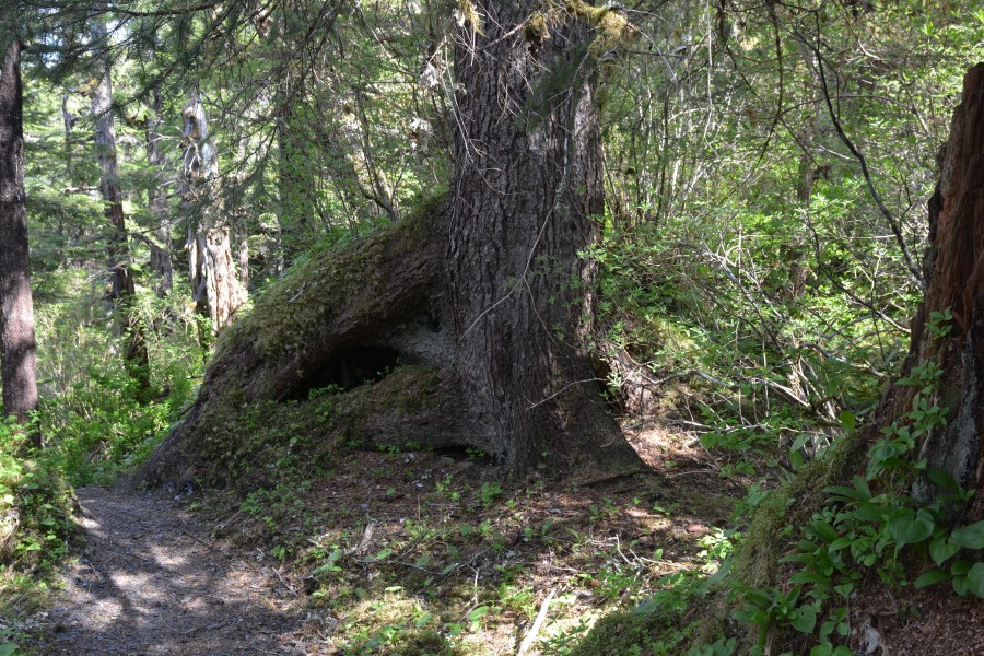
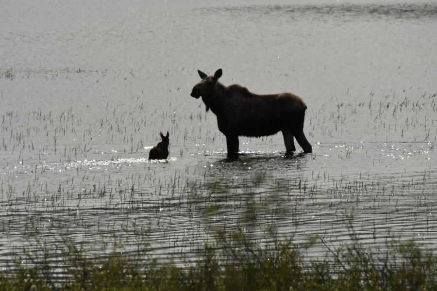
Most of the coastline is forested. When you read about bears, and there are a lot of them in these woodlands, feeding in “meadows” in the spring it usually refers to a small silt bank along the edge of the water that is growing grasses and flowers. There are very few large areas of grasslands that typically are conjured up by the world meadow. There are areas of young second-growth (regeneration) where forest clearing/harvesting has taken place.

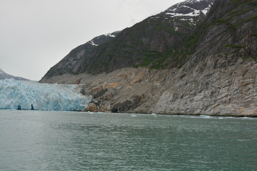
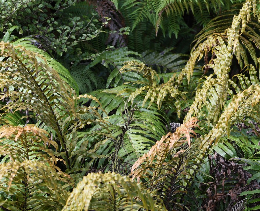
The Southeast, as the lower section is referred to, is rather mild and forested with a temperate rain forest. It is islands, mountains, and forests. It is also where the glaciers begin. The south central portion has Anchorage and the Matanuska Valley; a quite livable part of the state, though winters can be rather cold and dark. Heading north along the coast there are few towns and very few people. This area is tundra. both dry and wet, and often underlain with permafrost. There is no soil and hence no opportunity for agriculture. The huge central and northern expanse of the state was never glaciated and is almost all tundra where a tree is any woody plant and no woody plants grow waist high.

a DSC_2570.JPG
This image is looking down on Juneau from the air (note reflections) – there will be a separate blog page on Juneau. But, it helps in understanding Alaska overall, to get a look at how small the cities are and how much land there is between towns. Quite stunning.
a DSC_2408.JPG
In a wet, lush forest, built on rocks with little soil, there are a lot of trees that topple to the ground. The elevated perch that a downed tree offers is often taken by seedlings and the new sprouts grow quite literally on top of their fallen ancestor. This gives the visitor a chance to anthropomorphize the forest. The base of many trees look like legs, trees look to be moving across the landscape. As the “nurse log” rots away the younger tree will seem to have bow legs reaching down to the earth. The tree then looks like it is standing on short bowed legs. These forests are vibrant but each plant has a story of  danger, opportunity, and evolutionary luck.
DSC_2413.JPG
Tens of thousands of tons of salmon migrate up the coastal Alaskan stream to spawn. Most die after spawning. The remains of the salmon are very important, essential probably, to the health of the forest. Here I was lucky enough to snap a quick image of a mink dragging a couple of pounds of salmon into and under the roots of a Sitka Spruce. The flesh will feed them (and likely its offspring) for several days, but the remaining bits and the droppings from the mink, will fertilize this and nearby trees some 60 uphill feet from the water.

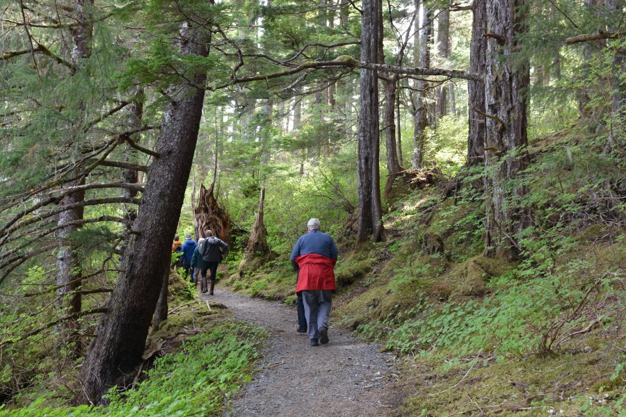
I had the good fortune to work with the National Geographic/Lindblad Expeditions boat Sea Bird in the Southeast. The naturalists on board were very energetic and excited. There were divers looking at the sea life, botanists looking at the extensive green stuff, water and ice people looking at rain/rivers/glaciers/and floating ice, and (of course) birders and geologists looking at the things that they are interested in. Most importantly, it was then shown and/or explained to our guests.

DSC_2487.JPG
Perhaps the Glacier Bay National Park & Preserve is better known than the much larger Tongass National Forest (17 million acres versus 3.3 million acres). The glaciers themselves and the dramatic decline in their size gets this area lots of press coverage. The beauty of the area and the rather easy access also help. Maybe the Orca, humpback, fur seals (fur sea lions actually), bears, and mountain goats also attract people. Marbled Murrelet, Tufted Puffin, and the delicate Black-legged Kittiwake bring a smile to everyone’s face and are easily seen in these waters. But likely it is the ferry and cruise boat service that makes a visit to the still-glaciated Southeast rather easy. There is no road access from Canada and only one ten-mile long road that gets you from Glacier Bay to the tiny town of Gustavus – but otherwise it is ferry, plane, or private boat. There are many summer-time cruise ships that enter Glacier Bay, look, and then leave. None of them dock or stay overnight in Glacier Bay.
DSC_2474.JPG
Glaciers are formed in the coastal mountains. It is the moisture from the Pacific that hits the coastal wall of mountains and then drops rain in lowlands and snow up higher that fed (or feeds) the glacial growth. These glaciers have been, and some still are, tidewater glaciers reaching to the sea. They are now receding and access is up fjords many miles in most cases. The old ice in Alaska, at the terminus of a glacier is rarely 100 years old*. The ice that calves into the sea is often devoid of air due to the weight and pressure of deepening snow as the glacier forms. The weight accumulated over the decades squeezes out the air leaving a lovely blue ice made of nothing but water molecules.                                                                                                          *Antarctica may have ice that is a million years old. In Alaska most glacial paths are short and quite downhill allowing the ice to move quickly. There is ice that may be about 30,000 years old in a basin in an older ice field and the longest glacial flow in Alaska is seen in the Bering Glacier which is about 140 miles in length. It’s ice may be almost 400 years old before it reaches the sea.
DSC_2384.JPG
The Southeast offer great vistas, wonderful oceanic wildlife, spectacular park lands, and very comfortable towns. It may not be the wilds of northern Alaska but is wonderful countryside to visit.
**I often work for Smithsonian Journeys, the Smithsonian Institution’s travel program. In the case of Alaska, we often use National Geographic and Lindblad Expeditions as a mechanism for our outings. They offer a wide range of travel opportunities and we are pleased to be able to cooperate with them in various spots around the globe.


Alaska, Nome – mammals

Please consider all images as copyrighted – thank you. Contact me for use… DEClapp

Like most places that Fran and I frequent, Nome has wildlife. Nome was sought out as a destination primarily for its birding, but high on our list was the chance to see, Musk Oxen. I had been to Nome previously and had not seen these large shaggy beasts, but we had our fingers crossed this time. They have been in the Nome area for less than 55 years. They were transported from Arctic Canada and eastern Greenland starting in the 1930s. The first lines were placed in Fairbanks and then out on Nunivak Island. They thrived and since have provided transplant animals for much of western and northern Alaska. About 300 were released on the Seward Peninsula and there are now about 3500 in this part of the state.

The first afternoon we had several almost in town, they were near the asphalt roads which means pretty close to downtown Nome. They soon became our new favorite mammal. They are pretty big, as big as a cow but so shaggy that you really can’t see how long their legs are. When they walk or run you can’t see the legs which means that they look like giant brown mops cruising across the land as if on some sort of anti-gravity floating thingamajig. DSC_1744.JPG
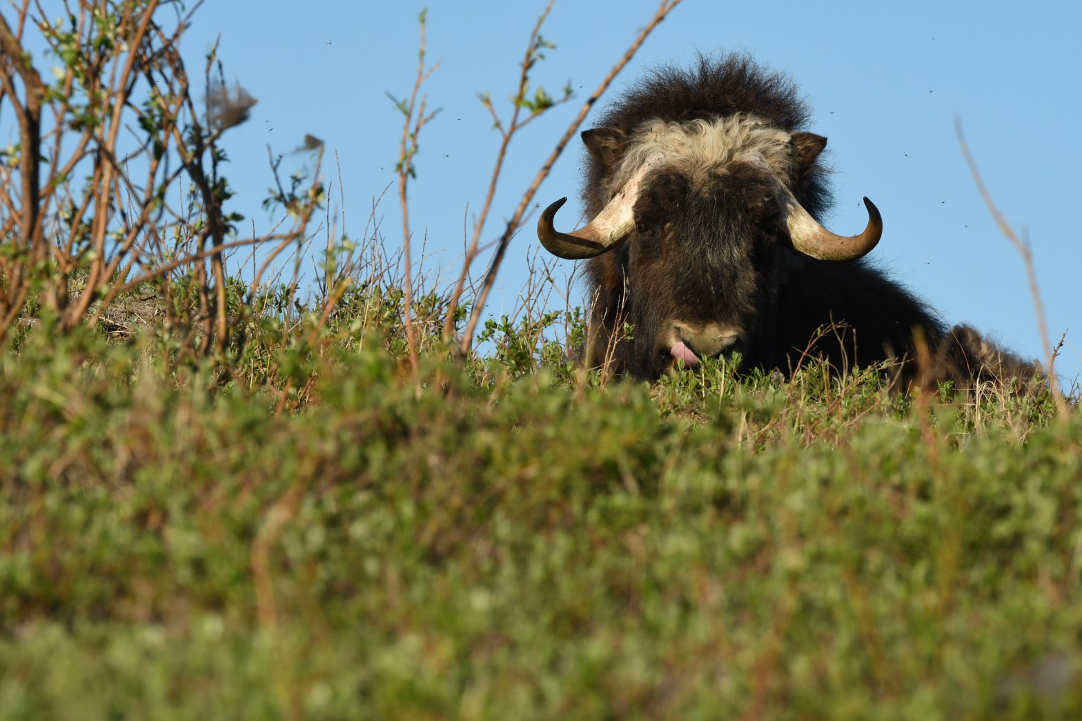
In tundra areas the Musk Oxen were eating the leaves of the small willows that dominated the wetter spots. They were shedding profusely and many of the shrubby willow were sporting Musk Oxen hair that they had combed from passing animals. The fur is, even this outer layer of winter hair, very soft. The belly fur is called qiviut and is the finest animal fiber that there is – beating out alpaca, mohair (from an Angora goat), and cashmere (wool from a goat). The fur is eight times warmer than wool and doesn’t shrink or felt (mat). I don’t know how it compares to spider silk or silkworm cocoon silk.DSC_1788.JPG
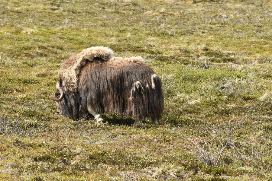
As you can see from the images they were rather placid. When we left our hotel, one morning at about 4:30 a.m., there was a young fellow chatting up the night desk guy. We stopped to talk before heading out to get specifics on the lay of the land and this young man offered us that old bit of sage north country advice, “don’t pet the bovines”. We didn’t; but they were languid enough to pose when they were sleeping or lying about chewing their cud. On their feet they were quite a bit more shy and moved away from us whenever we approached.Version 2
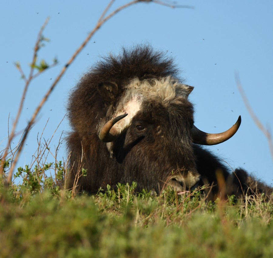
Though the temps were quite warm, hot actually, we rarely had any number of mosquitoes. But if you look closely at the image above there are lots of insects around the head of the Musk Ox. We had intense and dynamic hatches of Chironomids (midges) drifting along the road near Safety Lagoon and occasionally a few mossies, but bugs were not a feature during our visit.DSC_2070

DSC_2091I had one image of a baby Musk Ox taken through the windshield as the mother herded it rapidly out of the track heading up to Anvil Mountain. It wasn’t great picture, as a matter of fact it is pretty lousy and I deleted it. I wish I had it now simply to show how small and cute the youngsters are. We saw several females with young ones. The groups were often of mixed sexes and mixed age. We ended seeing 30-40 Musk Oxen each day and in some places 20-30 in one group.

DSC_2016
We saw Moose in many places; most commonly down by Denali and out on the Kenai. But up near Nome we came on this female with a youngster of the year. She was more intent on chasing away last years youngster than in taking care of the smaller one. She chased the yearling over and over; splashing through the water, and creating quite a stir and lots of mist and an occasional rainbow. However they never got into good light and all the images are backlit and stark. Better Moose images will follow for other locations.
DSC_2611All I’m showing of Seward Peninsula Caribou is this set of shed antlers that I came across way out on the Kougarok Road way off the road in the rolling tundra hills. There will be other images of Caribou in the page about Denali – along with the better Moose and a Wolf as well.

Caribou are widespread in Alaska and the range extends all across Canada to the Atlantic Ocean. There are many sub-species (populations, groups) within this range. In Europe and Russia they are called Reindeer but our forms are all called Caribou. In Alaska there have been attempts to import domesticated reindeer from Siberia and northern Scandinavia. As a matter of fact there are a couple places near Nome where Reindeer are being raised. The image below is of a Reindeer that slipped out of its fenced enclosure.

DSC_2754.JPG
Reindeer are really European or Siberian Caribou, and, after being imported, are being raised in a few places near Nome.
DSC_2130
Red Foxes are here as well. They are widespread and live on ground squirrels, lemmings, birds eggs, birds, insects, and various bit of vegetation. The Arctic Fox is in the Nome area as well – though we never saw one. Arctic Foxes tend to eat lots of mammals (lemmings and voles) but will raid bird nesting colonies in the early summer.
DSC_2694
The Arctic Ground Squirrel is the largest of our North American ground squirrels. They hibernate, the males are larger than the females and their weight varies greatly throughout the year. They are mostly vegetarian but will eat eggs and carrion when they find it. They hibernate for about 7-8 months and allow their internal body temperature to drop below freezing. Every two to three weeks they will wake up, shiver, and allow their body to reheat. They probably metabolize fats at these points and then drop off into a deep torpor for the next three weeks or so. Males start hibernation after the females and reenter the outside world before the females.


Franz Joseph Glacier – New Zealand

Please consider all images as copyrighted – thank you. Contact me for use… DEClapp

This is another version of a May 2017 posting – enjoy again.

z NZ FJG long view.jpg
The west side of the Southern Alps pours rivers of ice (and water and rock) down to the narrow shelf of coastal land before draining into the Tasman Sea. It is the old dust to dust scenario, only with water. The Tasman provides the moisture that hits the mountains, climbs uphill, becomes cooler and ultimately condenses, and this process provides the moisture for the snow that eventually accumulates and becomes the ice that forms the glaciers that run back to the sea. Whew. The two glaciers that are easily reached along the South Island’s western edge are the Fox and Franz Joseph. Both of the glaciers have grown and retreated in the recent decades. Like most glaciers, they are now retreating which allows the rock debris the glaciers have gathered or that has fallen from above onto the glaciers to pretty much hide the ice itself under a layer of fractured greywacke* rock.
z NZ FJG walk vista.JPG
At Franz Jospeh you can walk for an hour or so (each way) to the toe of the glacier. The scope of the area and the walk can be understood by finding the people just a bit right of center in this image. The glacier itself is the gray stuff near the top center, not the light colored material, that’s rock. The stream bed has been filled over the recent years with broken stone washed down by the melt waters of the glacier. The surface of the glacier is now strewn with stones and there is precious little ice showing.
z NZ FJG river bed.JPG
The river fills with stone and gravels and eventually fine silts fill in the spaces between the rocks. This makes a deep rocky river course that is surprisingly watertight on top. In Alaska it would become rich with alders but in New Zealand there are a variety of shrubs, ferns, and young Nothofagus (southern beech – though certainly not a beech). The thread of the stream will divert back and forth across the strewn rock stream bed as each channel gets blocked or when flood waters create a surge that forces the flow to deviate from the original channel. These streams are common in all glaciated terrains worldwide.
z NZ FJG glacial river.JPG
The water running out from under a glacier is not clear and certainly not blue. It is a milky gray. This color is derived from ground stone, a powder called glacial flour, the flour is created as the glacier rubs stone against stone under thousands and thousands of tons of ice as it moves downhill. The flour is very fine but will eventually settle out if the river is drained into a lake or other quiet body of water. The flour will make a soft, slippery, clay-like sediment at the bottom of the lake. This is a slow process but time pretty much runs forever does’t it.
z NZ FJG eroded sidewall.JPG
There are times and places along the edge of a glacier where the mountain resists. The glacier is abrading, grinding the edges of the valley with the material that will (or would) become a lateral moraine; this is essentially a slurry of ground stone and ice that act like a powerful sandpaper. In other places large boulders are carried by the glacier and these boulders scrape the sides of the valley leaving lines, patterns, and shapes. These curves and grooves were carved into the rock by the movement of material contained in the edge of the glacier. The depicted area is about fifteen feet tall.
z NZ FJG ferns.jpg
Once the glacier recedes and the surface is sealed with fine sediments vegetation moves in. In damp western South Island ferns are one of the dominant plant types. They occur quickly in recently exposed areas and are also found in the wet forest that develops on the lower mountain slopes. The non-flowering plants are well represented in this habitat with ferns, liverworts, mosses, and algae all commonly found.
NZ FJG tomtit.jpg
Many New Zealand bird populations have been decimated by a variety of environmental intrusions; people, rodents, cats, rats, brush-tailed possums, stoats, and so on (and on and on). One of the native species that breeds well enough to maintain a population with some stability is the little Tomtit. This may look a bit like a North American chickadee or a European tit but it is a member of the Australian robin group. There are five races/sub-species/ forms/populations of the Tomtit scattered over the islands. This one was frequenting the new growth along the route of the river draining the Franz Joseph Glacier. They are birds of undeveloped areas and seem to be doing rather well in a habitat now rich in small mammals – something New Zealand never had until recently.

 *Greywacke is a solidified clay, an ooze-stone of sorts. It is fine grained, gray, and reasonably homogeneous. It is sedimentary in origin and has been lifted from the Tasman Sea by the (on-going) movement of the Australian plate as it slowly crashes into the Pacific Plate. It form stone most like shale; a fragile rock that shatters and splinters easily. (The glaciation that persists in NZ is mainly along the west coast of the South Island; earth tremors can occur most anywhere.)

New Zealand sits with an island on each tectonic plate and a fracture line between the two islands. Precarious? Yes.

Surprisingly the great Alpine fault has little to do with what we have read about during the past ten years as the Christchurch area of the South Island has had several damaging earthquakes. The earthquakes that impacted Christchurch are seemingly well away from the most likely earthquake region.

unnamed.jpg
this image is from Global Rumblings

Milford Sound New Zealand

Please consider all images as copyrighted – thank you. Contact me for use… DEClapp

NZ milford eggleton valley.JPGNZ milford eggleton valley2.JPG
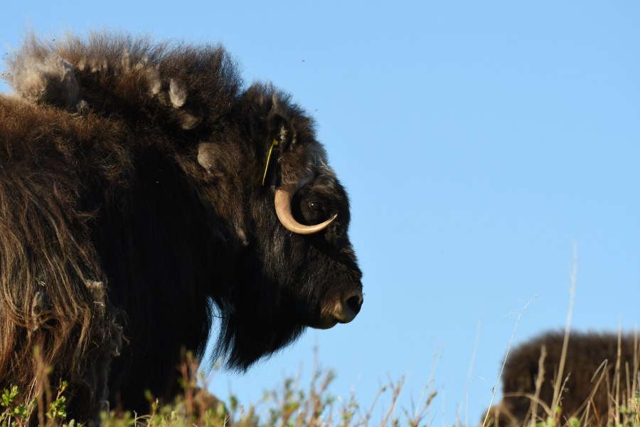
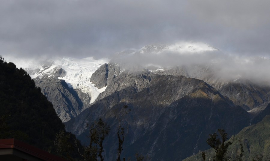
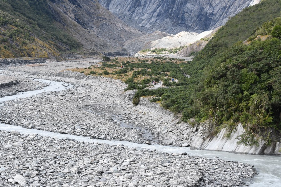
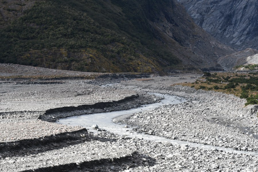
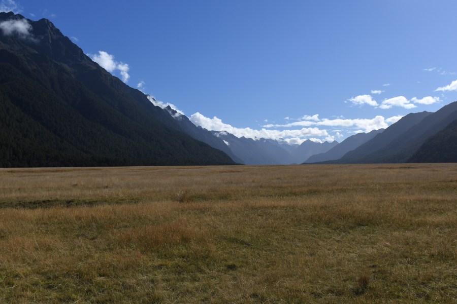
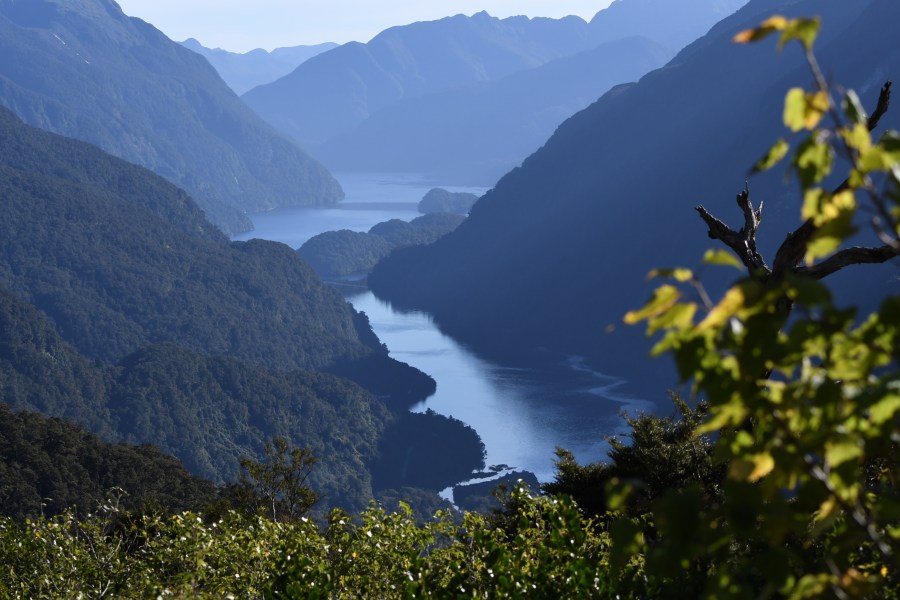
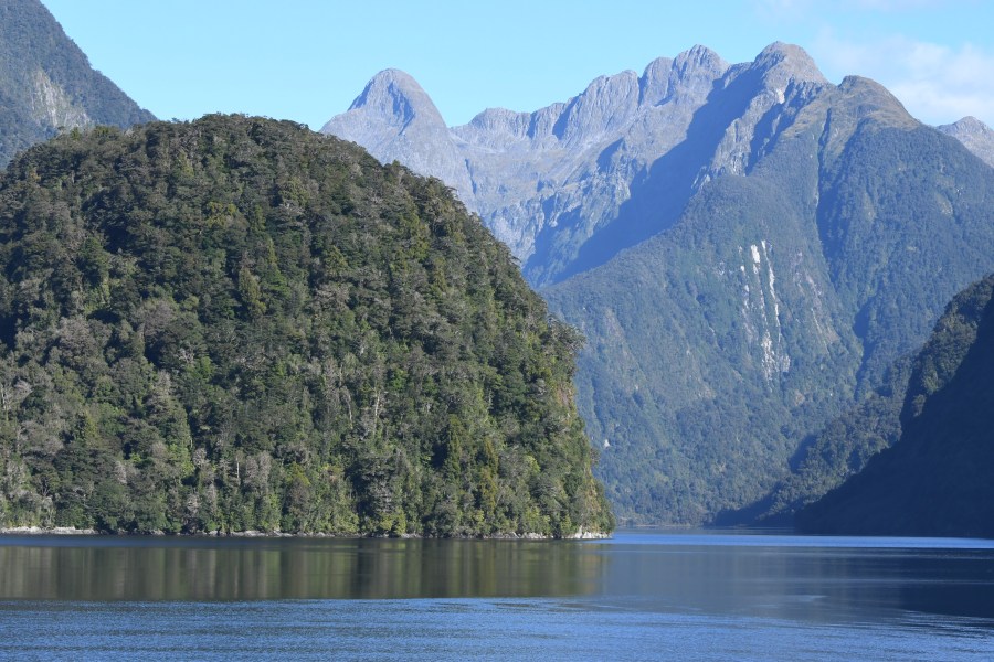
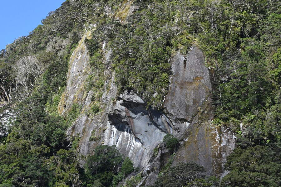
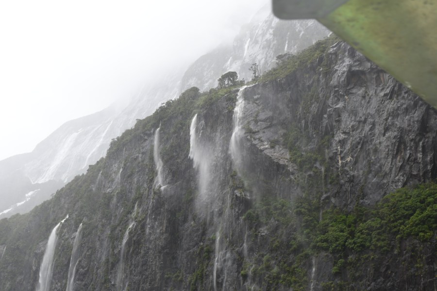
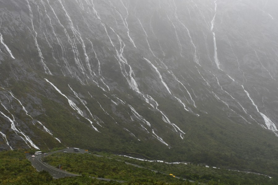
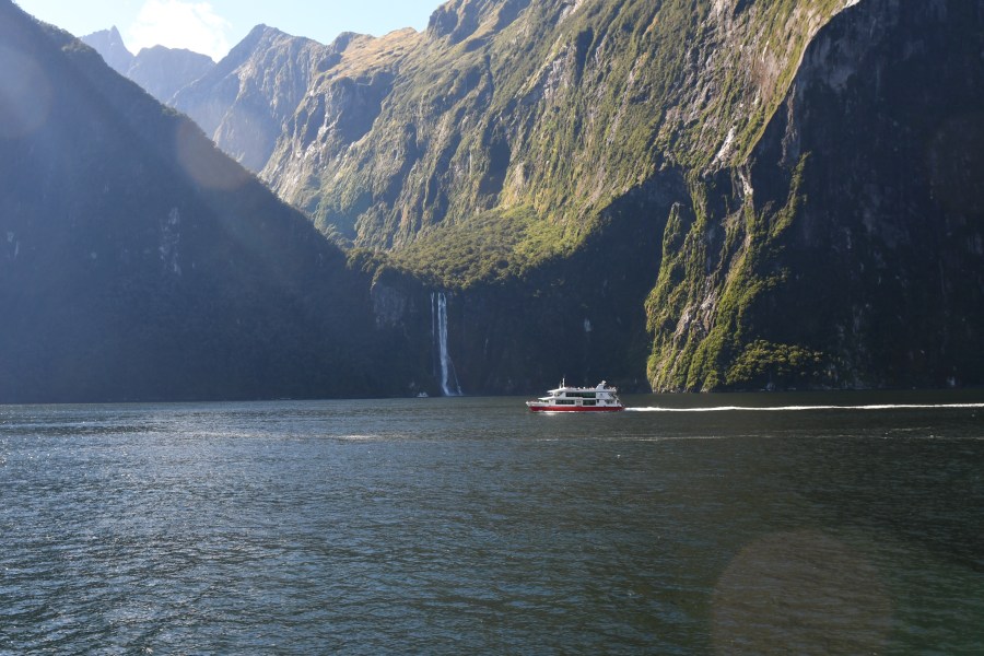
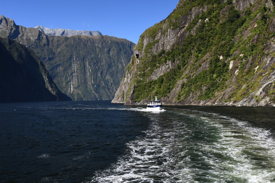
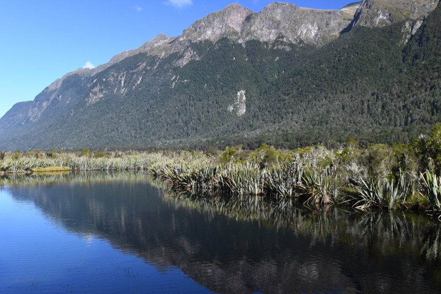
Milford Sound is the best known of New Zealand’s fjords. Relatively easy access through the Murchison Mountains makes for a memorable ride and delivers you to a spectacular fjord that reaches several miles to the Tasman Sea. Milford Sound and Doubtful Sound are the two fjords that are accessible along the western coast of New Zealand’s South Island. In both cases there is no north-south road in or out of the sounds (actually fjords or in New Zealand fiords). In visiting Milford you drive from Queenstown (where most people stay) through Te Anau (where some people stay) and into the Fiordland National Park (3 million acres+). The road is a glacial geology lesson with hanging valleys, glaciers, braided streams, and lots of sheer rock walls.

The image at the top of the page show the Eglinton Valley, an old glacially carved pathway in the mountains now filled with, mountain rubble, stone, sands, and silts. It has a layer of soil deep enough to grow grasses and its contrast with the forested mountainside is simply breathtaking. The lower picture (above) is Mirror Lake where standing water, New Zealand flax (Phorium), and the surrounding mountains offer unending photographic opportunities.

NZ milford road.JPG
Driving on the road amazes and awes (and scares) the traveler as it passes through Nothofagus Forest, along rocky gorges, and through a rather narrow tunnel. Descending to sea level on the western side you will be simply agog at the beauty of these rather young and still growing mountains.
NZ milford chasm erosion.JPG
One of the pull-offs that shouldn’t be missed on the way to Milford Sound is the short walk to The Chasm. It is here that you can see the results of persistence and the underestimated power of water. The rocks have been smoothed by water and shaped by smaller stones that have been agitated and swirled by the running stream.  There may be a rather large green parrot (Kea) in the parking area – don’t feed it (or them) but do take a picture of this endemic New Zealand bird.
milford sound hanging valley.jpg
Hanging valleys give you a sense of the glacial tributaries that once flowed into the main glacier that was gouging out the fjord. Picture this from the air – there are small glaciers flowing down hill  using and creating their own valleys and eventually running into another glacier coming from another valley; then these two run together downhill. Sooner or later the largest glacier (really an amalgamation of smaller glaciers) reaches the sea and begins to decay in the ocean waters.
z NZ miford sound in rain.jpg
We often hope for a blue-sky day so that the greens are greens and the rocks are velvety gray – but rainy days offer a great deal in Fiordland. The ride in to Milford Sound will have hundreds of waterfalls and cascades on a rainy day – the air will be rich in moisture coming in off the ocean and being captured momentarily by the rocky mountains. On a sunny day there are fewer than ten waterfalls along the road or Milford Sound waterway, but in the rain it is alive with water as the images above and below depict. Note the hairpin turn and tourist buses in the lower part of the picture below. The scope is impossible to capture…but this gives you an idea of the majesty of the surroundings.

NZ milford road rain.jpg

NZ milford tunnel.JPG
The Homer Tunnel takes you through as mile or so of very hard rock. It is an area of steep rock cliffs and mountain cirques that hold snow until mid-summer. The tunnel was pretty much hand dug and took decades to build. New Zealand’s South Island is a small rocky place where manpower and money are not abundant. Many of the “projects to nowhere” were often back-burnered and took years and years to complete. There was really no compelling reason to create a road through these mountains to Milford Sound so it was kind of slow-motion construction project. Perhaps if gold had been discovered along the coast things would have been different.
NZ milford hanging valley.JPG
The ride outward toward the sea continues the glacial geology lesson. Here one of the boats passes a waterfall draining a hanging valley – a remnant carved by a long-gone glacier from the Ice Age.
z NZ milford passage.JPG
One of the nice things about fjords is that they are often narrow, making the steep walls that much more impressive. Milford weaves a bit as the fresh water end of the valley runs toward the saltier end.
NZ milford dolphin.jpg
Many of the fjords are rather sterile as far as sea life goes. Fur seals found in the fjords are almost always youngsters unable to hold space in the competitive haul-outs along the outer coast. Dolphins can be present but the fresh water and the layered water of the fjord are less productive than the sea water outside. There is also an off chance that the boat will enter the edge of the Tasman Sea and an albatross or two might be encountered. There are two species of penguins that use the fiords (Little/Blue/Fairy and Fiordland Crested). The crested penguins are seasonal nesters in the area but Little Blues can be seen throughout the year.
NZ milford passage2.jpg
Nice views once on the water. Nice views on the ride in and out. Different views if you take a small plane out from the sound. Overall – an experience that you will remember, rain or shine.


Miranda Shore-birding

Please consider all images as copyrighted – thank you. Contact me for use… DEClapp

Miranda is a place not a person. It is a wonderful place to observe waders/shorebirds in their non-breeding moments. The highlight species here is the very odd little shorebird called Wrybill. It certainly does have a bill that has gone awry. NZ miranda vista.jpg
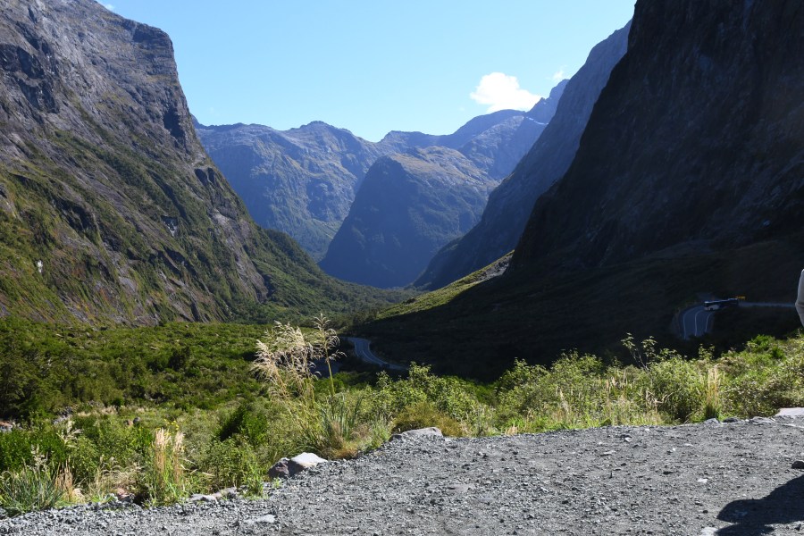
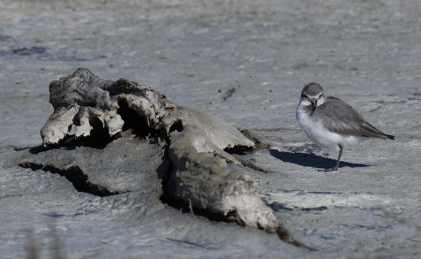
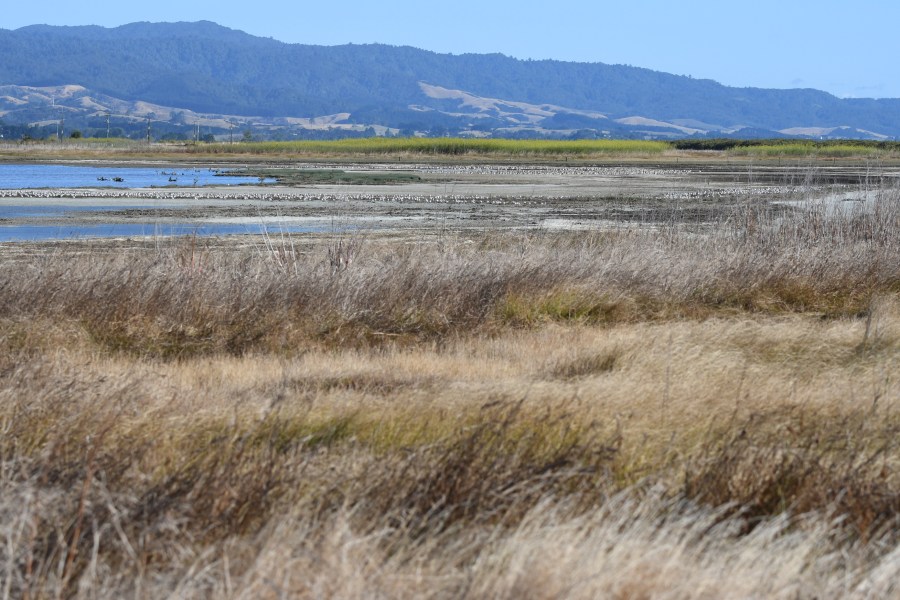
The site is coastal as you might imagine and quite low. it was agricultural and now a refuge, but will succumb slowly too increasing ocean levels over the next century or less. It is partly low dunes, vegetated salt marsh, cobble beach and adjacent grassy wetlands. Most plants are appropriate but there is a great deal of fennel growing here. As an outsider unfamiliar with fennel I found it to be very attractive and it seemed a bit of a local speciality.NZ miranda fennel.jpg

Please consider all images as copyrighted – thank you. Contact me for use… DEClapp


NZ miranda vista2.jpg
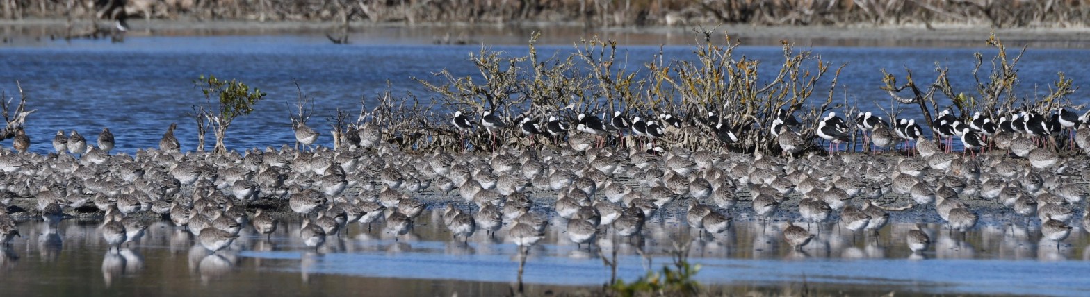
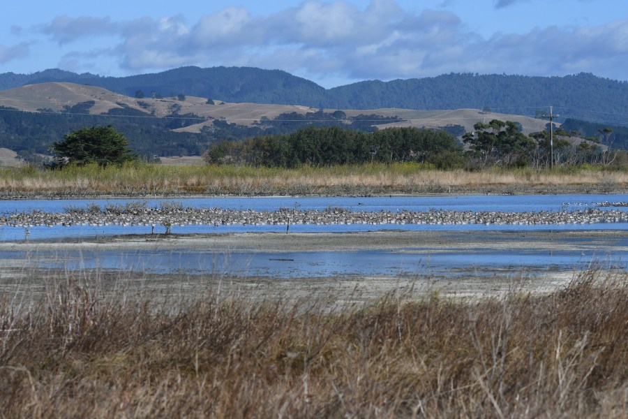
But, back to the birds. As these overview images show there are sweeps of loafing sandpipers on the flats in the middle of the refuge. there are also other birds, oystercatchers for example, that rest in large numbers closer to the salt water. The image below shows winter-plumaged Bar-tailed Godwits and Pied Stilts

NZ 2017 miranda birds
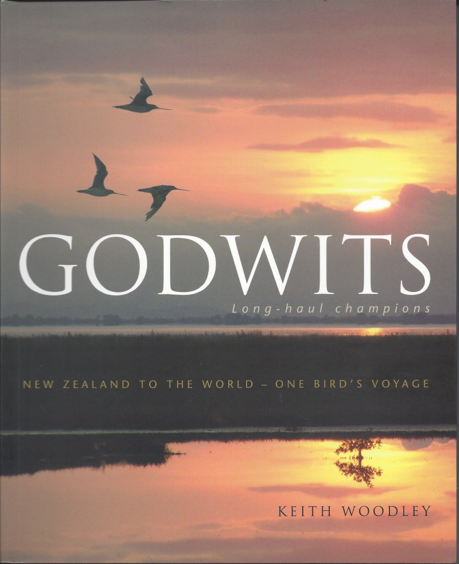
Though the Bar-tailed Godwits have the most amazing migration of almost any bird and they are worthy of their own excellent book ( Godwits; Long-haul Champions by Keith Woodley; ISBN978-0-14-301193-4) it is the funny little Wrybill that I was hoping to see. I have seen lots of godwits in both Australia and North America. In wintering plumage around Cairns and in Alaska where they are in beautiful warm amber/honey colored feathers. I heartily recommend the Godwits book but will finish this blog with the Wrybill.NZ 2017 miranda birds
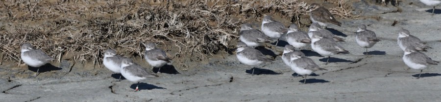
They are pretty plain looking, just kind of a gray and white in winter plumage and maybe a richer gray in breeding season. It also develops a black neck band and always has a white forehead. It attracted my attention because it is an endemic to New Zealand and a threatened species. It winters in as few spots only and breeds locally on the gravel banks of braided glacial river courses. NZ miranda showing bill.jpg

NZ miranda wrybill close.jpgWrybills have a bill that bends to the right. They all do. There are birds with upturned bills and downturned bill and even birds where the upper and lower parts of the bill cross over each other. There are pointy beaks and spatulate beaks…but this is the only bird with a bend to the right (or left for that matter).NZ miranda wrybill2.jpg 
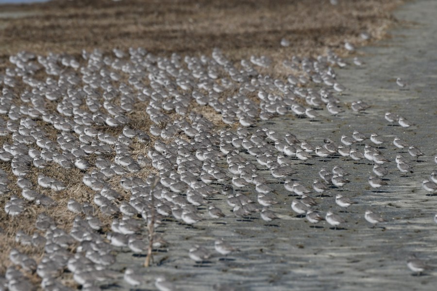
There is something fulfilling about seeing a new bird. It completes a circle of information. Things that have been read about, travels that have been mapped, species that have evolved to survive in specific manners become part of a new whole once they are observed. The world have been spinning away for millions upon millions of years but most life is rather new and constantly honing itself to a world that changes daily. Low sea levels, high sea levels, glacial periods and volcanic explosions are but mere blips on the time scale of the planet but they have been part of what has required godwits to migrate thousands of miles each way each year and for Wrybills to have a bill that turns stuff over only to the right. Very cool. Very humbling.NZ miranda book godwits.jpegThis book is very nice – it is a good story, well written, with a strong plot, and with main characters you can hardly believe, and it comes with with great pictures. But the real story is the simply Bar-tailed Godwit. Certainly, you should look for the book, read it and marvel; but most importantly you should see a godwit and simply appreciate it as a creature of great stamina, ability, tenacity, and beauty.

Doubtful Sound (Fjord) New Zealand


Please consider all images as copyrighted – thank you. Contact me for use… DEClapp

There are a dozen or so fjords on the southern half the western side New Zealand’s South Island. Coming from Christchurch you would cross the Southern Alps via Arthur’s Pass and descending to the Tasman Sea which forms the western boundary of the island. There are a couple glaciers that can be visited as you head south (Franz Joseph and Fox) with the mountains to your left and the sea to the right. It is a very nice drive.

NZ DS long view.JPG

The fjords are pretty much all referred to as “sounds” due to the naming used by early visitors to the region. Sound usually referred to a safe harbor where today it usually means a harbor separated from the sea by a barrier beach or islands. A fjord is more of a glacial name and refers to a narrow passage from the land to the sea that was carved by a glacier. Sounds are often flooded areas where the sea has entered a low lying area.

Milford is the most widely known of New Zealand’s sounds and will soon get its own blog page. For tourists, and most New Zealanders as well, there are only two sounds that can be reached without your own boat or helicopter; these are Milford and Doubtful. Milford has a walking track that allows visitors to arrive on foot after a 33.2 mile (53.5km) walk that usually takes five days and four nights. Visiting Doubtful Sound requires a boat ride across the fresh water Lake Manapouri and then a bus ride down to the shore where the salt water (mostly) adventure starts.

NZ DS down fjord.JPG

The boats that take people out into the fjord, and perhaps to the Tasman, are large and comfortable. Lunch can be purchased and the captain and a naturalist narrate along the way. If the winds are light the boats will enter the Tasman and perhaps give passengers a chance to see Buller’s Albatross (mollymawk). This is the most commonly seen albatross but Southern Royal, one of the Wandering complex and perhaps Shy can also be encountered. There are about 25 pairs of Northern Royal Albatrosses nesting across the island on the Otago Peninsula at Taiaroa Head. It is thought that these birds move east toward South America after nesting.

NZ DS fur seals.jpg

It is never guaranteed but it is quite likely that you will see Fur Sea Lions (erroneously and routinely called Fur Seals) loafing on rocks along the way. There may be Bottlenose Dolphins as well; but probably no other mammals. The birders will see Red-billed and Southern Black-backed Gull, White-fronted Tern and perhaps see New Zealand Pigeon, Kaka, or Bellbird in the trees along side.

NZ DS blue penguins.jpg

There are two penguins that frequent both Doubtful and Milford Sounds – the Fiordland Crested and the Blue Penguins can both be seen. The small Blues are possible year round and the Crested are in the fjords for nesting starting September and running for a few months. They nest in fallen rocks or under rough vegetation and are not easy too see even when they are around.

NZ DS side walls.JPG

NZ DS rock & trees.JPG

The sides of a fjord are steep. this holds true in Alaska, Norway, Chile, and New Zealand. In many place the vegetation seems totally inappropriate. How can tress grow on sheer rock walls with no soil? The can and do – mostly in mats of roots that layer over the rock rather than penetrate into the rock. This results in tree-slides on occasion where sheets of vegetation simply slide down into the water.

NZ DS bullers albatross.jpg

In New Zealand as on e approached the Tasman Sea at the salt water end of the glacier it is likely that you will see Sooty Shearwaters or Buller’s Albatrosses. There are many varieties of ocean birds in and around New Zealand but these two are the most usual.

The Franz Joseph Glacier, New Zealand

Please consider all images as copyrighted – thank you. Contact me for use… DEClapp

The Southern Alps are a bit of a surprise. The country of New Zealand consists of a couple medium sized islands and lots of smaller ones. It has been submerged and lifted by tectonic plates for tens of millions of years. It is known for kiwi birds and Maori people. The giant Moa once lived here; sailors and whalers visited in the 18th and 19th centuries. Captain Cook and Charles Darwin dropped in. It is a smallish sort of place and to have an active mountain range with glaciers, rivers, and earthquakes is a bit of a surprise. Getting to the glaciers is a bit of a challenge as well. There are few roads that cross the mountains and allow access to the western side of the South Island. There are only three passes.

NZ FJG long view

Cook, along with Joseph Banks and Daniel Solander, arrived off the coast of New Zealand in October of 1769. This was an extension of the trip that took the Endeavour and its crew to Tahiti to observe and document the Transit of Venus in an attempt to create a reliable method to determine longitude. Darwin was in New Zealand for only nine days very late in 1835; however the Captain of the Beagle Robert FitzRoy was later the second governor of New Zealand. The Beagle anchored in a harbor that was not much more than a swarm of bars and brothels. FitzRoy and Darwin did spend a day inland in what they referred to as an oasis of English civilization.

Anyway, the Southern Alps are a surprising mountain range along the western side of the South Island. They are easily explained in light of the plate tectonic theory. There is a plate moving from the west that is grinding its way under a plate that is to its east. This subduction event creates a buildup sea floor stuff (in this case greywacke and argillite stone) and occasionally pops a volcano or two along the way. Just onto the North Island stand a large volcano, Taranaki or Egmont, easily seen as one flies to the North Island. The North Island has many volcanoes and volcanic fields; like Auckland Volcanic Field and the Taupo Volcanic Field with Ruapehu as the largest peak and highest peak on the North Island of any kind.

NZ FJG eroded sidewall.JPG
Eroded Sidewall

The Southern Alps are high enough to still have permanent glaciers and evidence of expensive glacial activities over the past eons. There are a couple glaciers that one can visit by driving all day from Christchurch and spending the night before driving back. There are only three roads that cross the mountain range and get you to the west coast, so ease of access is not part of these outings. The Fox Glacier is rapidly receding in our modern climate and is largely buried under its own load of mountain debris. The Franz Joseph Glacier is also receding but is reachable and viewable from many vantages. The braided river stream is ample evidence that the glaciers have carried countless millions of tons of rock down from the mountain over time. The greywacke is riddled with quartz intrusions and the rock is falling to pieces right in front of you.

NZ FJG walk vista.JPG
Glacial Outwash Riverbed

NZ FJG river bed.JPG

NZ FJG glacial river.JPG
Glacial River with water colored by “flour” (ground rock). The grinding of a gacier over stone wears the rock, usually into small bits that are suspended in the flowing water. The river bed shows stones of all sizes and sands and gravel as well. The gray-blue of the water is further evidence of the power and weight of a glacier.

It is a lovely walk to and from the Franz Joseph Glacier with many kinds of tree fern and regular ferns and the Nothofagus (Beech) trees along with Bellbirds and Tomtits to brighten the passage. The vistas are grand, the stream bed complex and compelling, and the glacier itself is a snowy treat slipping down the mountain. I like geology more that I ever thought I would and it seems that geology allows for so many explanations and ideas to fall into place. New Zealand is rich in earthquakes, volcanoes, mountain building, mountain eroding, coastal plains and shelves, and much more – all easily seen.

NZ FJG ferns
Ferns
NZ FJG tomtit
Tomtit

Milford Sound, So. Island, New Zealand

Please consider all images as copyrighted – thank you. Contact me for use… DEClapp

There are several glacier-formed fjords (Norwegian spelling) along the New Zealand’s South Island’s western side. Few can be reached without great difficulty. Those of you who have a fear of heights or twisting roads may think that none of them can be reached with ease. The rides to Milford Sound (and Doubtful Sound – see separate blog page) are spectacular and the geology is raw and personal. In the rain there are hundreds of waterfalls; sometimes hundreds in view at once. In the sunshine it is breathtakingly beautiful to drive to and then ride on the sound.

NZ miford sound in rain.jpg

NZ milford road rain.jpg

The ride to Milford Sound is not short. You have to pass through farm and pasture land where sheep, dairy cows, and red deer are grazing before reaching the edges of the native Nothofagus forests. Then it is onward and upward to the tunnel that takes you through the last part of the greywhacke* mountain range and dropping you downward, steeply, to the coastal edge. The tunnel, the Homer Tunnel, is about 0.75 miles long (1.2km) dropping about 400′ before opening on the western side of the mountains.  It was opened in 1953 after being started in 1935. It was conceived in 1889 by the founders of the saddle that served as a pass through this region.

NZ milford tunnel.JPG


NZ milford road.JPG

The two valleys in the area of the tunnel, The Hollyford and the Cleddeau are about 2500 feet wide at the bottom and have nearly sheer walls rising nearly 3000′ vertically. This creates a marvelous bowl as the tunnel begins and a grand visit as you exit on the western side. Snow slides in this area, or the blast of compressed air from the descending slides, are good reason to keep this road closed in the winter. There are vast snowfields in the mountains above the tunnel and roadway.

milford sound hanging valley.jpg

Milford Sound itself is a steep sided passage carved out of argillite and greywhacke (and some granite as well) by glaciers. The fjord is about 9.3 miles long (15km) and quite narrow. It is the most famous tourist attraction in New Zealand with at least 550,000 people visiting each year. In some years it is nearly a million. The surprise to most Americans and Europeans is that there are almost no overnight accommodations in Milford. Almost everyone is bussed in and then bussed out each day. It is not really a playground but rather a treasure that is pretty well guarded.

NZ milford eggleton valley.JPG

The ride in and out provides a lesson in glaciation and its impacts. There are bare rock, steep-sided mountains, hanging valleys where glaciers once flowed, and valleys more than a thousand feet deep filled with glacial debris. The mountains, as they fall apart, present stone, sand, silt, and clay to be washed downhill. Much of this debris is created by the grinding of today’s glaciers on the mountain tops and some is from temperature changes that expand and contract either/or both water or stone. Expanding ice cracks the already fissured rock throughout the winter.

NZ milford chasm erosion.JPG

You can fly in and out – or just out – and get a chance to see the grandeur of the Southern Alps. These young mountains are still growing as the Indo-Australian Plate inches under the Pacific tectonic plate. The mountain grow and erode at about the same rate. The stone being raised from the ocean floor is quite fragile and the layers and schists break apart and erode away easily and quickly.

*Greywhacke is an old sandstone mostly formed as part of very ancient sea floors and now uplifted by tectonic actions to form the bulk of the Southern Alps. Some of the greywhacke found in New Zealand ages out at more than 300 million years. It is very much fractured and deformed and is just riddled with fine lines of white quartz that has intruded into the fractures. It is a rather hard rock which is a dark gray or black. It is often mixed with or in conjunction with ancient mudstone (argillite) as well.

Miranda and It’s Weird Little Bird New Zealand near Auckland


Please consider all images as copyrighted – thank you. Contact me for use… DEClapp

There’s a guy named Keith Woodley. He has a passionate relationship with a very special kind of bird. He lives and breathes godwits, Bar-tailed Godwits. There are several kinds of godwits found around the world and there are three that can be found in New Zealand when not breeding half a planet away. Keith follows the one that frequents New Zealand in pretty good numbers; the Bar-tailed Godwit. And why not! It’s life is a series of miraculous passages. If it lives a year it is likely to live for maybe fifteen more. In that time it will fly a minimum of 29,500 km a year just in migration. That comes to more than 440,000 kilometers. Oh, in miles that is a staggering minimum of 273,000 miles or about 18,300 miles a year. No wonder Woodley finds them enchanting and engaging.

One other note on these flights; they are non-stop and take more than eight days. That is 45 miles an hour for eight and a half days, without eating or stopping to rest! Triathalon participants certainly have a new goal to shoot for.

Keith Woodley has written the penultimate book on Godwits, called quite fittingly Godwits: long-haul champions. If you ever thought “gee-whizz, how about that!” when faced with one of the thousands of remarkable adaptations or evolutionary behaviors of a wild creature, this book will bring you to that sense of wonder again and again.

NZ miranda book godwits.jpeg

The Miranda Shorebird Centre (I think it is officially the Pukorokoro Miranda Shorebird Centre) is located in Pokeno, New Zealand about an hour drive from Auckland. It is on the Firth of Thames – which means little to you and me but is fun to say. The coast here is quite convoluted and this creates a mess of tidal reaches and an array of tidal floods. The tide may be high at your house but where I live over the hill it may still be two or three hours until flood. This birds know this and travel around feeding throughout the day; one spot after another. Miranda itself has about 21,000 acres (8500 hectares) of intertidal mudflats; or buffet tables as the godwits call them.

NZ miranda stilts godwits.jpg
Godwits and Stilts

In addition to Bar-tailed Godwits Miranda is best know for the oddly constructed Wrybill. This bird is an endemic plover of New Zealand. It is about the size of a North American Semi-palmated Plover, smaller than a Killdeer. Like most birds they are surprisingly light; the Wrybill averages about two ounces. But it is the beak that takes a right-hand turn that catches the bird-watchers eye. Yes, the beak does bend and yes it always bends to the right.

NZ miranda showing bill.jpg
Wrybill

NZ miranda wrybill close.jpg

NZ miranda wrybill2.jpg

NZ miranda wrybill.jpg

The Miranda Shorebird Centre has an interpretive building with a great deal of educational and surprising depictions. The migrations are one thing but the birds that winter here come from many places and have many specific, often unique, behaviors. There are overnight accommodations, a gift shop, and educational opportunities for schools and bird groups. Membership will help all facets of the operation. You can find them via their web site to learn about accommodations, activities, and how to order the godwit book at http://www.miranda-shorebird.org.nz

NZ miranda vista.jpg
Miranda vista

NZ miranda vista2.jpg

If you look at the blog pages on the glaciers of the Southern Alps or on the fjords along the South Island’s south coast you will see what are called braided rivers. These are South Island streams that are filled with stone, cobble, silt, gravels, and other stone debris from the fractured mountains – it is these cobble-filled stream that provide nesting sites for the Wrybill.

*There are three species of godwits that arrive in NZ each year. The Bar-tailed and Black-tailed both can be found at Miranda during the austral summer and northern winter. The Hudsonian also drops in to the NZ mud flats but in very small numbers and in a less predictable way. These birds all nest in northeastern Russia or in the western corners of North America, mostly in Alaska.