Please consider all images as copyrighted – thank you. Contact me for use… DEClapp
Alaska is huge and most of it is what we would call remote – empty – wild – even unexplored. It is a land of forest, tundra, and rock. Much of it is wet. Lakes and rivers abound. There are fewer than 740,000 people in the state with about 40% living in the one city of Anchorage (about 292,000 residents). Fairbanks and Juneau each have about 31,000 and there are only three other towns with more than 10,000 residents. Nome has just about 3,500 people. In Nome the native population is just a hair over half the residents and about 38% are caucasian. Most of the native people are Inupiat Eskimos.
In 1898 gold was found in a creek draining Anvil Mountain (really a hill right in town) and within a year there was a town of 10,000 looking to get rich; eventually the town reached 20,000. Gold is still sought, the old dredges lie in the tundra, new dredges lift sands from the underwater edges of the shoreline and sluice the sands for gold. Large operations brag that they are still getting about an ounce of gold a day. However, before you buy a floating dredge and head north, be advised that most of the land and beach access is in the ownership and management hands of the native peoples. You can’t just drop in and start mining.
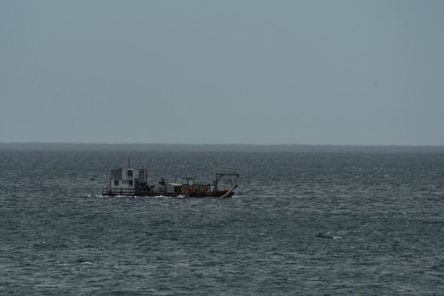
Nome is a very small city – a town by most standards. Of the many gold dredges that still lie in the old water courses this one is right in town and easily approached. There is a boardwalk and interpretive materials to help you understand how the dredges worked. They crawled along the river course scooping up large buckets (on a big conveyor belt) of stone and sand at the front end and then ran it through a huge (very noisy) water-washed sluice inside the sluice’s body. The gold (hopefully) settled to the bottom of the sluice and the washed stone was conveyed out the back by a second conveyer belt. This one was built well into the 20th century and wasn’t abandoned until the mid-1950’s.This image shows The Lovely Frances sitting in one of the scoop buckets that used to loop around, like a giant chain saw, scooping potentially gold-bearing material from the creek bottom to be washed by the sluice.When a large storm roils the sands of Nome’s beachfront people rush down to see if a new gold-bearing strata has been exposed. In the real sense of exploration and mining a new toy/machine has appeared. The small floating sluice pump allows its owner to float along on the surface of the calm waterfront (it is not always calm – or warm) and suck up sand that has run into the ocean over the centuries. Perhaps there is gold in those sands – more and more people are trying this method. It helps to have a cold-water diver move the suction hose around exploring and investigating likely spots for sand and gold to have accumulated. The image below shows an optimistic operation under way.
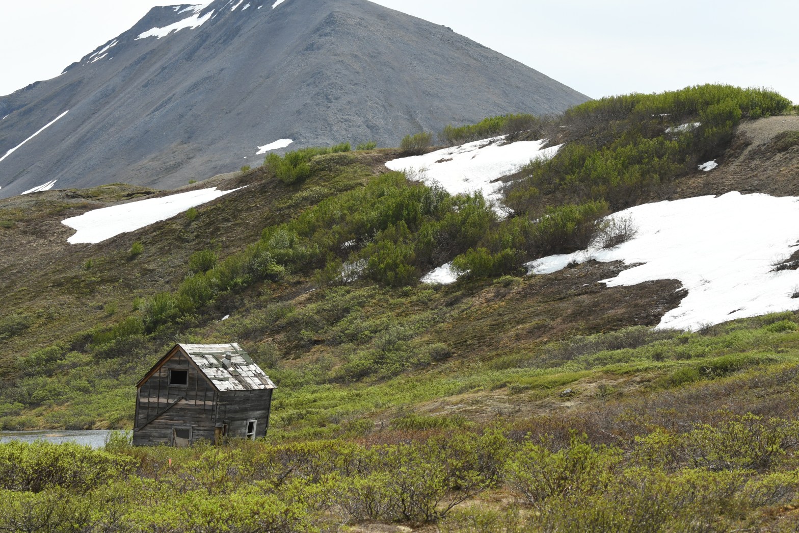
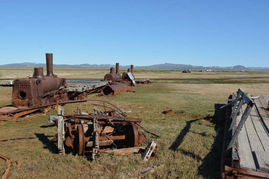
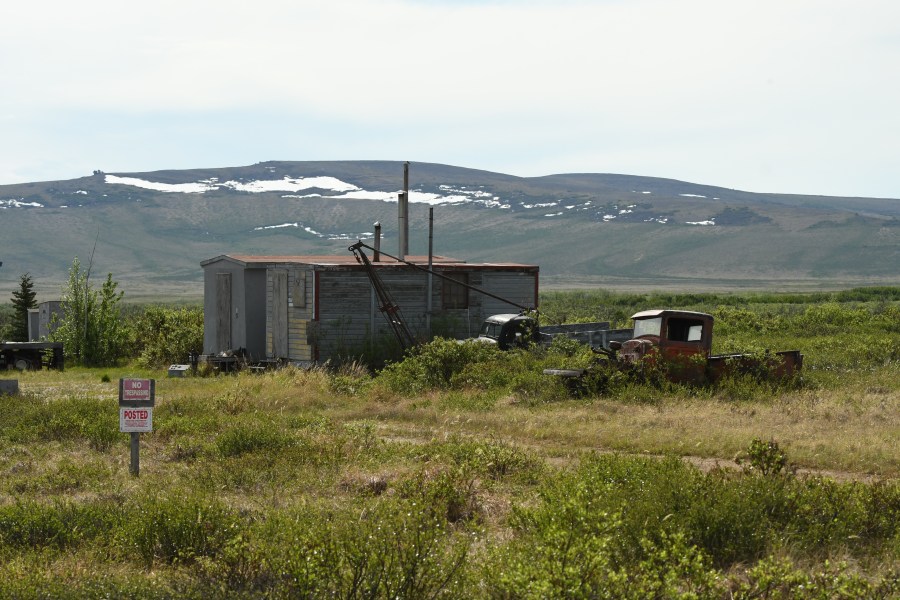
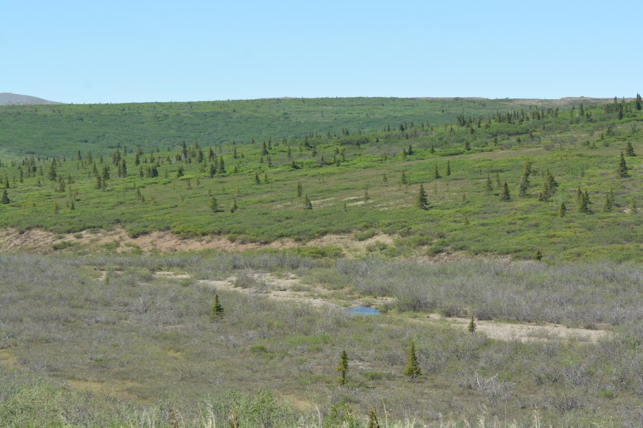
Nome is very remote – but a railroad line from New York City was brought here to move mining materials into Nome from the hinterlands. Can you believe it? It wasn’t a great success as you might imagine; building on the tundra hundreds of miles from any resources was not something easily accomplished and when the economy went bust the miners headed for New Zealand and Australia. Gold was truly a boom and bust operation. Mostly bust from what you see in this area. In the tundra there is not much in the way of bacterial or fungal life to begin to break things down. Wood lasts for decades and metal for centuries.Modern mining still persists here on the Seward Peninsula. This is a stone and gravel operation right outside Nome at Nome Point. Additionally a new lease has been granted for a very large graphite mine just 37 miles outside of town. The graphite is of good quality and is probably destined for the world’s increasing use of batteries. As a strong and stable form of carbon, graphite is one of the best non-metal conductors and is used as one terminal of lithium-ion batteries. The Canadian company (Graphite One Resources) has 165 mineral claims covering about 15,000 acres just outside Nome.In the countryside camps and abandoned camps are seen. There are only three roads in Nome, each just about 70-80 miles long. Two roads head toward smaller towns (Taylor, Teller and Council). The Kougarok Road (also called the Nome-Taylor Road or the Beam Road) ends at the Kougarok Bridge leaving about 25 miles to get to Taylor. This distance can be done on foot, by snow machine, or by a rugged ATV. Birders use this road to reach the one accessible place in North America where the rare Bristle-thighed Curlew nests. The Council Road is about 72 miles long and reaches the small village of Council. Council had 15,000 people during the gold rush and now has no one living there in the winter and maybe a hundred or so in the summer. This road has trees as you reach the far end – trees are pretty rare in the Nome area. The Council Road has two locations that are worth a stop. Both the Safety Lagoon and the Safety Roadhouse are featured on the Iditarod Dogsled Race itinerary and the lagoon is good for birds and icebergs. The Road House is a good stop for food and drink. Very nice home-made breads are a feature. The third road is the Teller Road which runs about 73 miles north toward the Bering Sea. Teller is a small, 300 people, mostly Inupiat, village at the end of the road. Like other towns or locations in the area it was heavily populated during the gold rush days (with about 5000 people).And there are few roads; often old camps and machinery to be seen. This picture, from June 6th, 2017 shows patches of snow. The temperature on this day was between 75 and 80!Heading out of Nome on the Council Road you have tundra and willow-lined streams for the first 60 miles or so. Then you can see the march of the spruces begin. Adventurous trees have begun to move into the tundra. The boreal forest is looking to take over the north lands. With warming temperatures inroads will certainly be made.In North America we often refer to the area where trees reach into the tundra as taiga. In most of the northern hemisphere the word taiga refers directly to the boreal forest. I like the two meanings as we use them. It allows for a coniferous forest (boreal) and an area of intrusion or blending (taiga). Here on the Council Road in Nome we have more than a simple soil-based in-road. We have a huge habitat expanding into the domain of another huge habitat. Of course the understory plants come along as do forest specific insects, birds, and mammals.