|
| Uluru or Ayer’s Rock sits in the great red center, the outback. It is a remnant from millions of years ago and millions of years of erosional forces. Australia, like the rest of the earth’s surface has been through a lot. |
This page will recapitulate the last 200,000,000 years – no problem. Please don’t change the channel, put the remote down – this will be quite painless and very superficial. Bear with me…. I promise not to go back to the Big Bang or the first life forms or the development of an atmosphere.
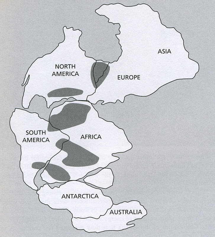
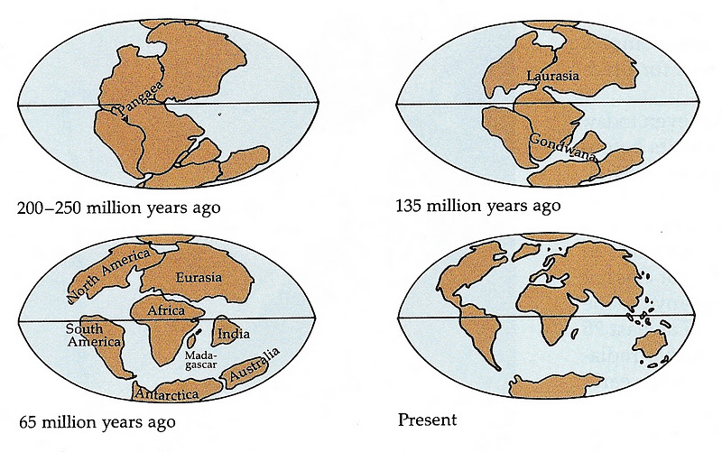
Once upon a time all the continents were clustered together. This was a mass of land called Pangea or “all land” About 180,000,000 years ago the top and bottom halves began to drift apart. The result (eventually) was Laurasia in the north and Gondwana in the south.
Incidentally, India is that little unlabeled triangle between Africa and Antarctica. It was to be sent out from there like a spit-out watermelon seed to eventually crash (only 10,000,000 years ago) into southern Asia; bulldozing debris into what is now earth’s youngest mountain range.
Over the last 150,000,000 years the earth’s crust has been ever-morphing into new configurations. The way it is now is what we call “the world”. But it is only the world for the moment because things are still moving, always changing. India is still riding into Asia and the Himalayas are getting taller. The mid-Atlantic ridge grows about an inch a year and Iceland is being split in half by volcanic activity. In the southern part of the world New Zealand is getting the Icelandic treatment via earthquakes from moving plates.
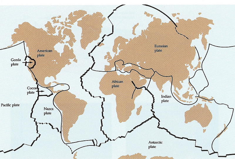
The earth is cracked and crazed into a few major crustal plates and a few small ones as well. The edges are pretty well marked on the surface by volcanoes, earthquakes, and disharmonious features.
The Pacific Basin is a very active area. Australia sits in the middle of the huge Indian Plate (now being referred to as the Australian Plate by many) and has no volcanoes and few earthquakes of any sort on the continent itself. It is merely along for the ride. But look below to poor New Zealand. It is right on the edge of the plate. It is riding on the blade of the bulldozer that is rubbing against the huge pacific Plate and has been plowed and buried more than once. The Pacific Basin is very active but Australia is very quiet, very flat, very hot, and will likely move north over the next few million years.

The land forms in Australia have been weathered/abraded/eroded due to wind and rains during the passage of immense blocks of time. Today Australia’s rivers run brown and the annual (or occasional) floods carry away millions of tons of mineral earth. The heaviest rains are in the north and the northeast. Flooding elsewhere is irregular. Visitors may see rain in Cairns or Brisbane or Sydney. Melbourne had rain during the President’s Cup golf tournament in November of 2011. But once you get inland from the Great Dividing Range it is dry – often very dry.
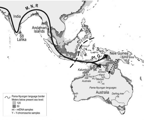
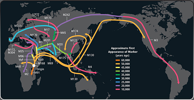
The first peoples of Australia are referred to as Aboriginals and they arrived well before the Europeans. The first people of Australia were certainly here 40,000 years ago and there are some who think they arrived as much as 100,000 years ago. The out-of-Africa route that they followed probably crossed India and then traversed Sri Lanka before crossing the water and land to northern Australia. The Genome Project by National Geographic has linked Australian Aboriginals to the people of Sri Lanka.
One thing to keep in mind is that 40,000 years ago (and back more than 100,000 years) the oceans were much lower and much more land was exposed. Any place where the water is now less than 400′ deep was land when the ice of the glaciers collected and held water. So back when the people were first arriving in Australia much of the oceanic area now surrounding the Philippines, Sumatra, Malaysia, New Guinea, and the Sundas was dry land. There were places where ocean water remained but there were not wide expanses as we now see when we look at a world map.
It was first thought that the first Aboriginal peoples arrived in northern Australia in the manner the map below implies. It was thought that they followed the coast from India to Bangladesh, to Myanamar (Burma), to Thailand, to Malaysia, to Sumatra and so on settling both New Guinea and Australia. But the DNA evidence seems to have them doing more what is shown at the bottom – crossing India to Sri Lanka and down from there. The lower map shows the pathways of genetic markers and is more of a life-flow chart.
Lastly, for those who have made it this far, let me offer a few images of the Australian countryside. Much of the interior of the continent is arid. There are great deserts and rock formations. there are skeletal remains of mountain ranges and lots of dry land.
. |
| The outback is characterized by mulga and acacia shrubs, shallow panes that hold water in the occasional rains, and vast expanses of what appears to be inhospitable land. The image does not show Uluru (formerly Ater’s Rock) but an area between Alice Springs and Uluru on the Curtain St. |
 |
| The Olgas are a cluster of less-eroded conglomerate rock in the area of Uluru. The vegetation is seasonal and rain-dependant. However the vegetation at the base of the rocks is more permanent in the same manner that roadside vegetation often does better than plants well off a road. The rocks shed water into the immediate area. |
 |
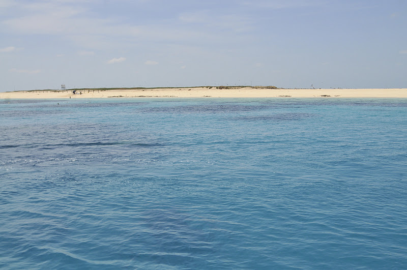
| The Great Barrier Reef is off Australia’s northeast coast and contains hundreds and hundreds of islets and reefs each different from the last. As oceans have risen during the past 40,000 years (due to glacial melting) millions of square miles of land has been inundated. In some places conditions were right for reef-building corals to get started. As water rises several things can happen to a reef; it will be submerged, shaded and die or it can grow upward or if the water is from freshwater land source it can die from lack of essential aquatic minerals. |
 |
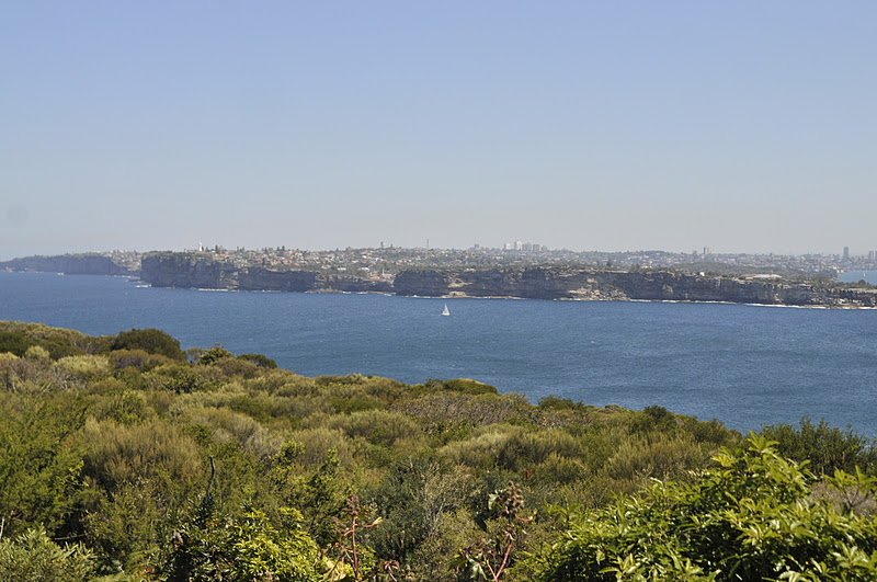
| We often think of Sydney as a bustling city with lovely parks, spectacular bays and coves and vistas, and as the home of the Sydney Bridge and Opera House. But the east coast, and this east coast city, is much more than that. |
 |
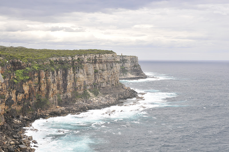
| The substrate that makes up the Sydney area is a hard sandstone that has been used for building and for building on. In many areas the coast consists of cliffs, rocks, and small sand beaches. |
 |
| The famous beaches of the Sydney area (like Manly and Bondi) are within an hours drive of the Central Business District. Sydney Harbor has a small mouth opening to the sea that is protected by these cliffs. Once inside you will find a convoluted maze of points and bays. The sandy beaches are area that trap littoral sand on the ocean side of the cliffs. The city provides a complex ferry system to move citizens from home to work and all around the harbor. |
Each place you visit is but a function of the geology. Look at the overall structure of an area; marvel at earthquakes and honor volcanoes.